
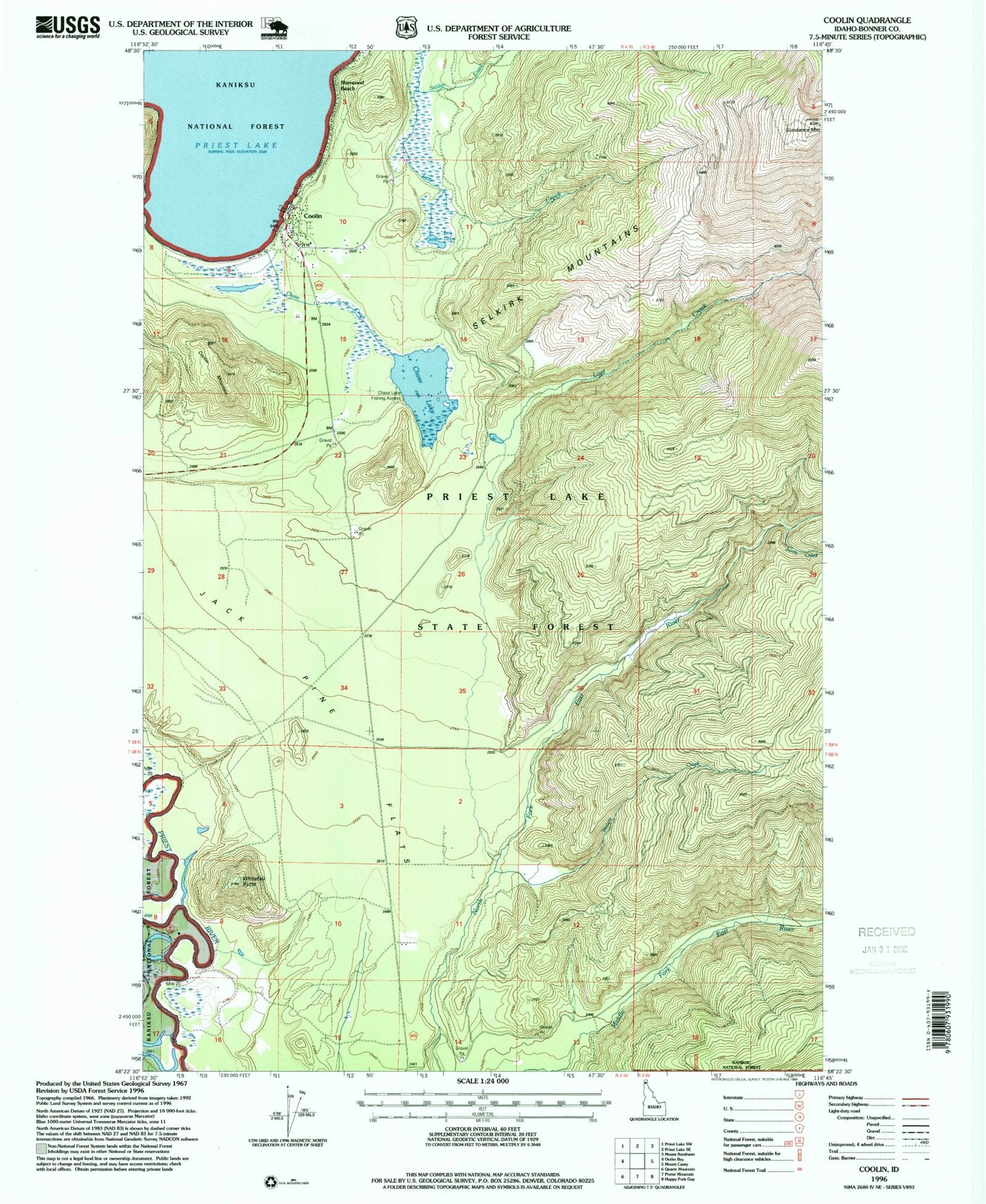
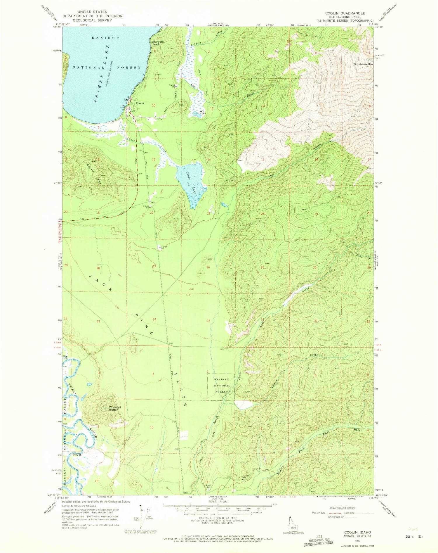
MyTopo
Classic USGS Coolin Idaho 7.5'x7.5' Topo Map
Couldn't load pickup availability
Historical USGS topographic quad map of Coolin in the state of Idaho. Map scale may vary for some years, but is generally around 1:24,000. Print size is approximately 24" x 27"
This quadrangle is in the following counties: Bonner.
The map contains contour lines, roads, rivers, towns, and lakes. Printed on high-quality waterproof paper with UV fade-resistant inks, and shipped rolled.
Contains the following named places: Chase Creek, Chase Lake, Chase Lake Access Area, Coolin, Coolin Cavanaugh Bay Fire District, Coolin Census Designated Place, Coolin Mountain, Coolin Post Office, Jack Pine Flats, Junta Creek, Lee Creek, Lee Lake, Lost Creek, Plumbago Point, Sherwood Beach, Sundance Lookout Station, Sundance Mountain, Waters Creek, Whitetail Butte


