
MyTopo
Classic USGS Cooney Reservoir Montana 7.5'x7.5' Topo Map
Couldn't load pickup availability
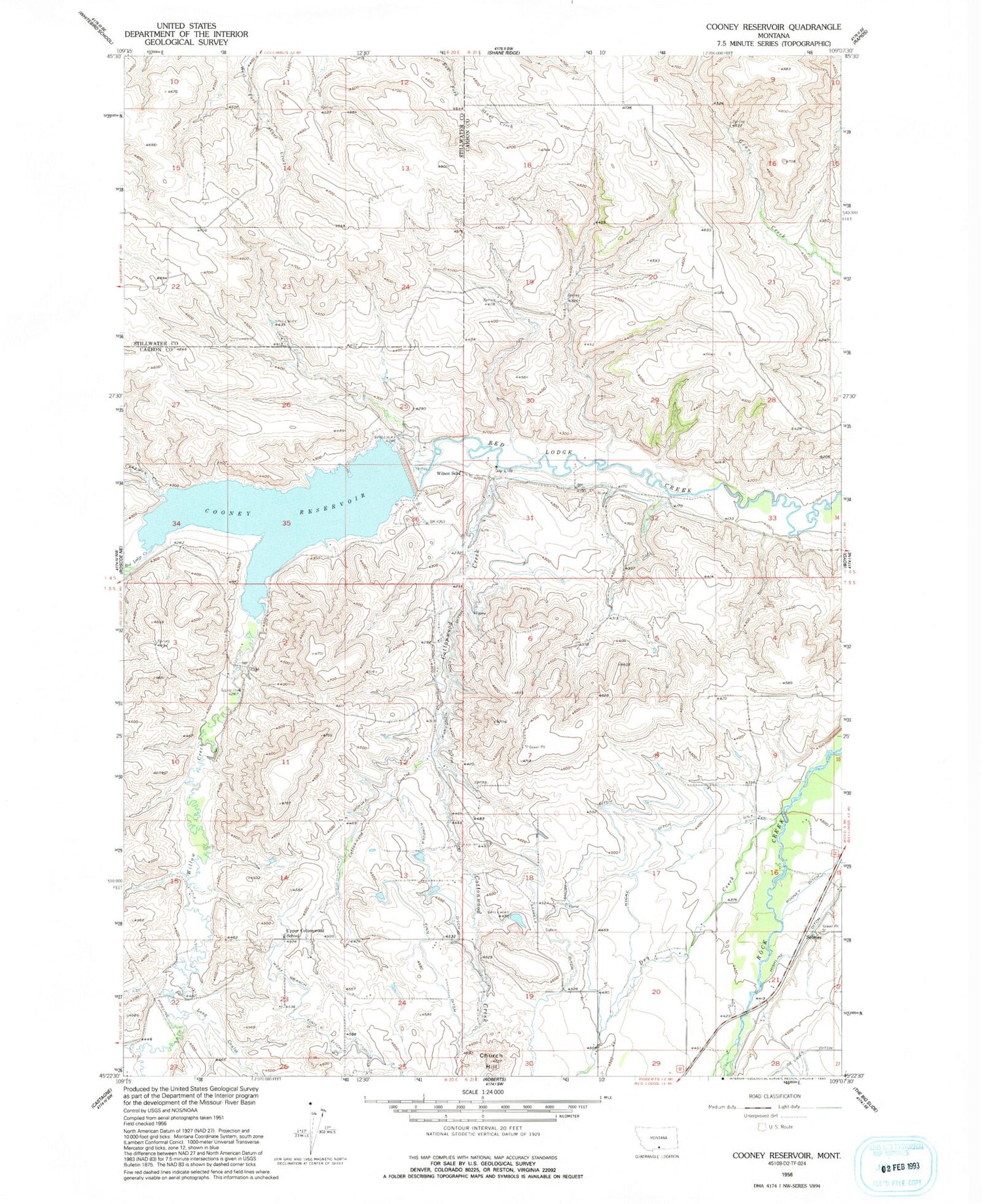
Historical USGS topographic quad map of Cooney Reservoir in the state of Montana. Map scale may vary for some years, but is generally around 1:24,000. Print size is approximately 24" x 27"
This quadrangle is in the following counties: Carbon, Stillwater.
The map contains contour lines, roads, rivers, towns, and lakes. Printed on high-quality waterproof paper with UV fade-resistant inks, and shipped rolled.
Contains the following named places: 04S20E26CDDC01 Well, 04S20E36BBBB01 Well, 05S21E05BDDC01 Well, 59070, Bangart Field, Bertoline Number 1 Dam, Chapman Creek, Church Hill, Clear Creek, Cook Ditch, Cooney Campground, Cooney Dam, Cooney Reservoir, Cooney Reservoir State Park, Cottonwood Coulee, Cottonwood Creek, Dry Creek, Finn Ditch, Hokola Ditch, Hycke Ditch, Karvonen Ditch, Korpola Ditch, Long Coulee, North Willow Creek School, Roberts Rest Area, Saarela Ditch, Selmes, Shorey Ditch, Sunny Nook School, Upper Cottonwood School, West Branch Finn Ditch, Willow Creek, Wilson School


