MyTopo
Classic USGS Cooper Ridge Arizona 7.5'x7.5' Topo Map
Couldn't load pickup availability
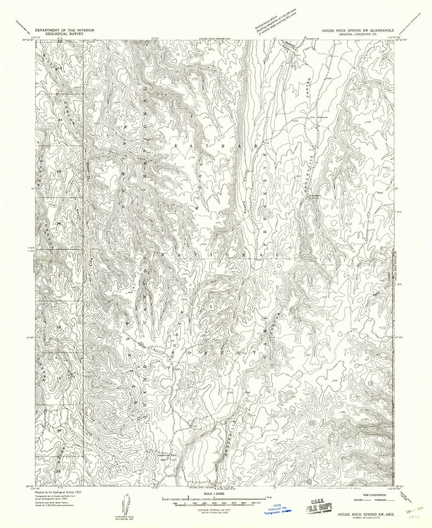
Historical USGS topographic quad map of Cooper Ridge in the state of Arizona. Map scale may vary for some years, but is generally around 1:24,000. Print size is approximately 24" x 27"
This quadrangle is in the following counties: Coconino.
The map contains contour lines, roads, rivers, towns, and lakes. Printed on high-quality waterproof paper with UV fade-resistant inks, and shipped rolled.
Contains the following named places: Basin Tank, Burro Apron, Cooper Ridge Tank, Cooper Trick Tank, Government Reservoir, Joes Reservoir, Le Fevre Tank, Lobo Tank, Middle Fork Willis Canyon, North Fork Willis Canyon, Orderville Canyon, Orderville Tank, Orderville Trick Tank, Ponderosa Trick Tank, Round Valley, Round Valley Tank, South Fork Willis Canyon, Stipa Tank, Summit Tank, Summit Trick Tank, Wet Weather Seep, Wildhorse Park