MyTopo
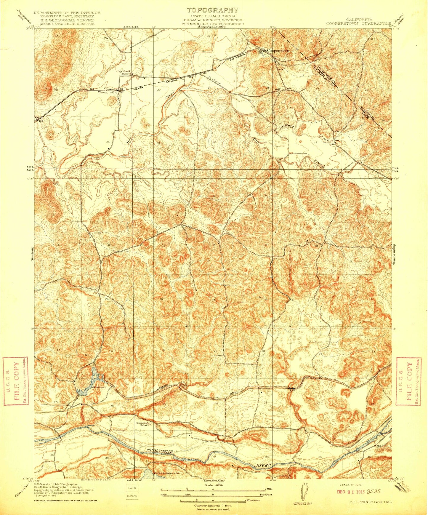
Classic USGS Cooperstown California 7.5'x7.5' Topo Map
Couldn't load pickup availability
Historical USGS topographic quad map of Cooperstown in the state of California. Map scale may vary for some years, but is generally around 1:24,000. Print size is approximately 24" x 27"
This quadrangle is in the following counties: Stanislaus, Tuolumne.
The map contains contour lines, roads, rivers, towns, and lakes. Printed on high-quality waterproof paper with UV fade-resistant inks, and shipped rolled.
Contains the following named places: Cooperstown, Diamond S Ranch, Dry Creek School, Gallup Creek, Hermitage School, Johnson Creek, Lateral A, Lateral B, North Fork Dry Creek, Peaslee Creek, Rairden Gulch, Roberts Ferry Union Elementary School, Rushing Lake, Rydberg Creek, Salter Gulch, Turlock Lake State Recreation Area, Upper Main Canal, Warner Gulch, Warnerville, Warnerville Cemetery