
MyTopo
Classic USGS Cooperstown Illinois 7.5'x7.5' Topo Map
Couldn't load pickup availability
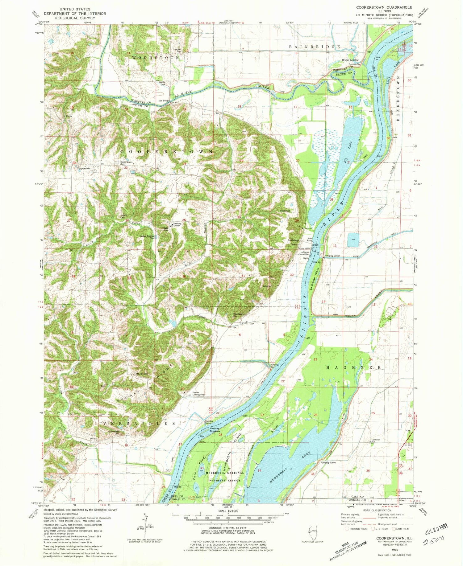
Historical USGS topographic quad map of Cooperstown in the state of Illinois. Map scale may vary for some years, but is generally around 1:24,000. Print size is approximately 24" x 27"
This quadrangle is in the following counties: Brown, Cass, Morgan, Schuyler.
The map contains contour lines, roads, rivers, towns, and lakes. Printed on high-quality waterproof paper with UV fade-resistant inks, and shipped rolled.
Contains the following named places: Adams Cemetery, Adams School, Arnold Cemetery, Baehr Branch, Big Lake, Bond School, Briggs Landing Post Light, Bush Cemetery, Camp Creek, Cooperstown, Cooperstown Cemetery, De Witt Cemetery, De Witts School, Elbow Lake, Hancock Slough, Hulett Cemetery, Immanuel Church, Immanuel Lutheran Cemetery, Indian Creek, Island School, Kloker Airport, La Grange, La Grange Island, La Grange Lock and Dam, La Grange Locks, La Grange Pool, La Grange School, La Moine River, Langford Cemetery, Lavina Henry Cemetery, Little Creek, Long Lake, Lydia School, Meredosia Island, Moores Towhead, Mount Zion Cemetery, Mount Zion Church, Perkins Lake, Petri School, Reich Landing, Richland School, Sneider Landing Strip, South Beardstown Pumping Station, Spunky Ridge, Star Bridge, Township of Cooperstown, Township of Versailles, Twin Ponds, Vandeventer Cemetery, Vandeventer School


