MyTopo
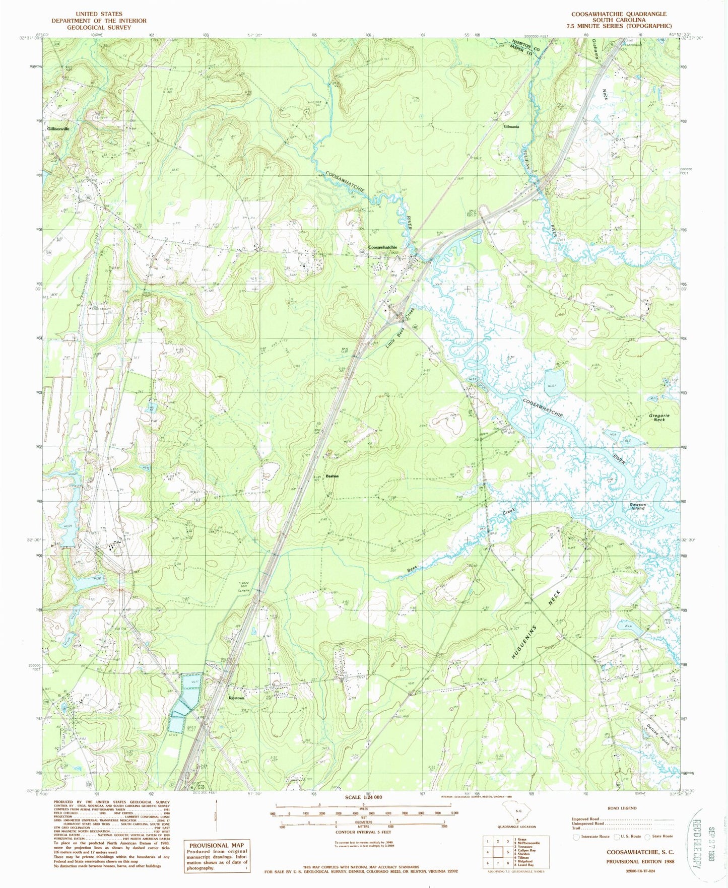
Classic USGS Coosawhatchie South Carolina 7.5'x7.5' Topo Map
Couldn't load pickup availability
Historical USGS topographic quad map of Coosawhatchie in the state of South Carolina. Map scale may vary for some years, but is generally around 1:24,000. Print size is approximately 24" x 27"
This quadrangle is in the following counties: Hampton, Jasper.
The map contains contour lines, roads, rivers, towns, and lakes. Printed on high-quality waterproof paper with UV fade-resistant inks, and shipped rolled.
Contains the following named places: Bashan, Bees Creek, Captain Bill Creek, Coosawhatchie, Coosawhatchie Census Designated Place, Coosawhatchie Church, Coosawhatchie School, Dawson Island, Deloss Point, Gillisonville Baptist Church, Gillisonville School, Gilmania, Grahams Neck, Gregorie Neck, Huguenins Neck, Jasper Fire Department Station 31, Jasper Fire Department Station 32, Little Bees Creek, Ricetown, Saint Pauls Church, Sandy Hill School, South Carolina Noname 27006 D-2581 Dam, Tallahassee School, Tallihassee Church, Walker School, Zion Church, ZIP Code: 29912