MyTopo
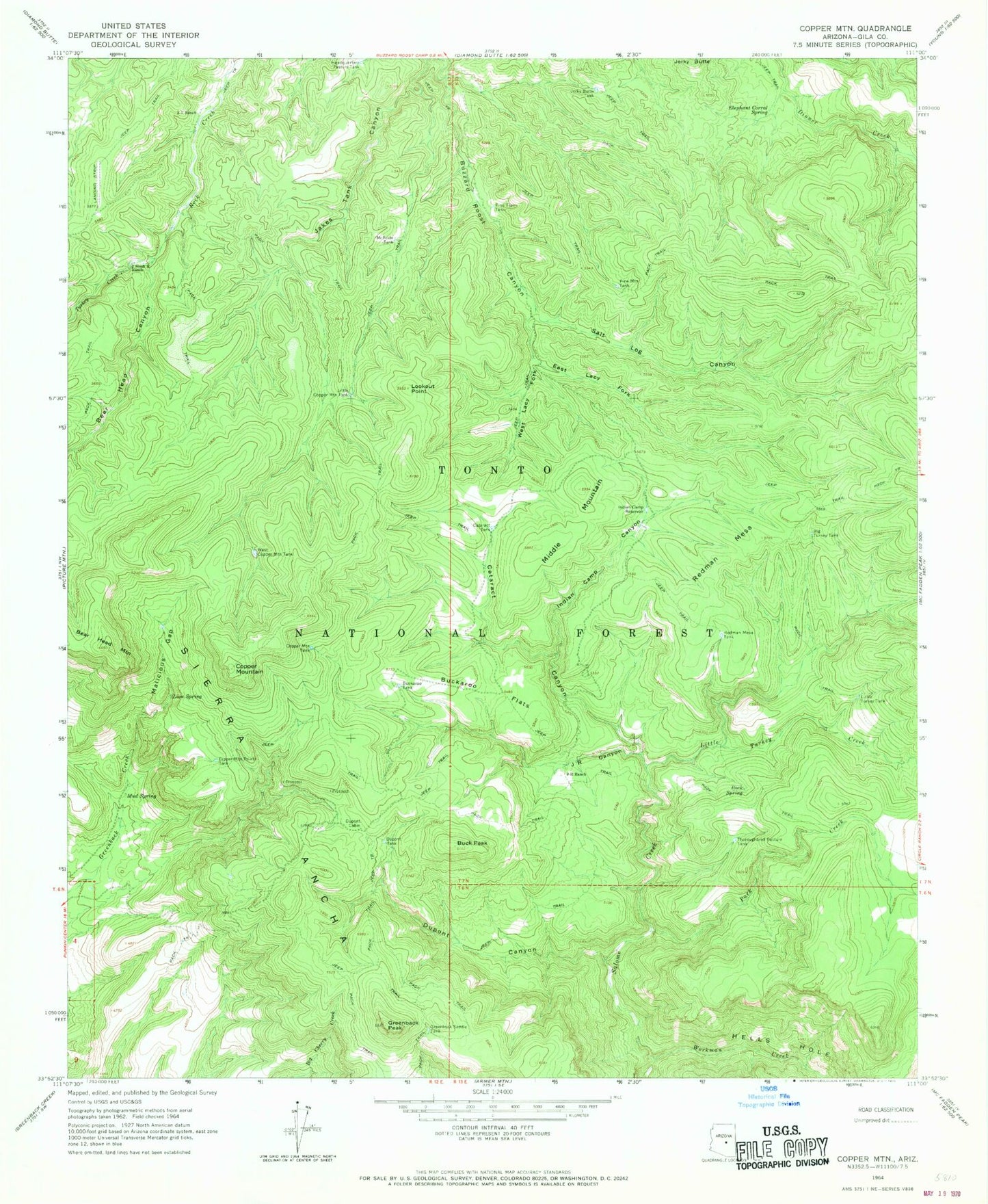
Classic USGS Copper Mountain Arizona 7.5'x7.5' Topo Map
Couldn't load pickup availability
Historical USGS topographic quad map of Copper Mountain in the state of Arizona. Typical map scale is 1:24,000, but may vary for certain years, if available. Print size: 24" x 27"
This quadrangle is in the following counties: Gila.
The map contains contour lines, roads, rivers, towns, and lakes. Printed on high-quality waterproof paper with UV fade-resistant inks, and shipped rolled.
Contains the following named places: Bear Head Canyon, Big Turkey Tank, Buck Peak, Buckaroo Flats, Buckaroo Tank, Cataract Canyon, Cataract Tank, Copper Mountain, Copper Mountain Points Tank, Copper Mountain Tank, Dupont Cabin, Dupont Canyon, Dupont Tank, East Lacy Fork, Elephant Corral Spring, Greenback Peak, Greenback Saddle Tank, Headquarters Pasture Tank, Hells Hole, Indian Camp Canyon, Indian Camp Reservoir, J R Canyon, J R Ranch, J Slash X Ranch, Jakes Tank Canyon, Jerky Butte Tank, Lion Spring, Little Copper Mountain Tank, Little Turkey Creek, Little Turkey Tank, Lookout Point, Malicious Gap, McBride Tank, Middle Mountain, Mud Spring, Park Creek, Pine Flat Tank, Pine Mountain Tank, Redman Mesa, Redman Mesa Tank, Rock Spring, Salome Creek, Salt Log Canyon, Thoroughbred Pasture Tank, Turkey Creek, West Copper Mountain Tank, West Lacy Fork, Workman Creek, Z T Ranch, Long Mesa Tank, Peach Hollow Tank, Turkey Creek, Tonto Basin Division