MyTopo
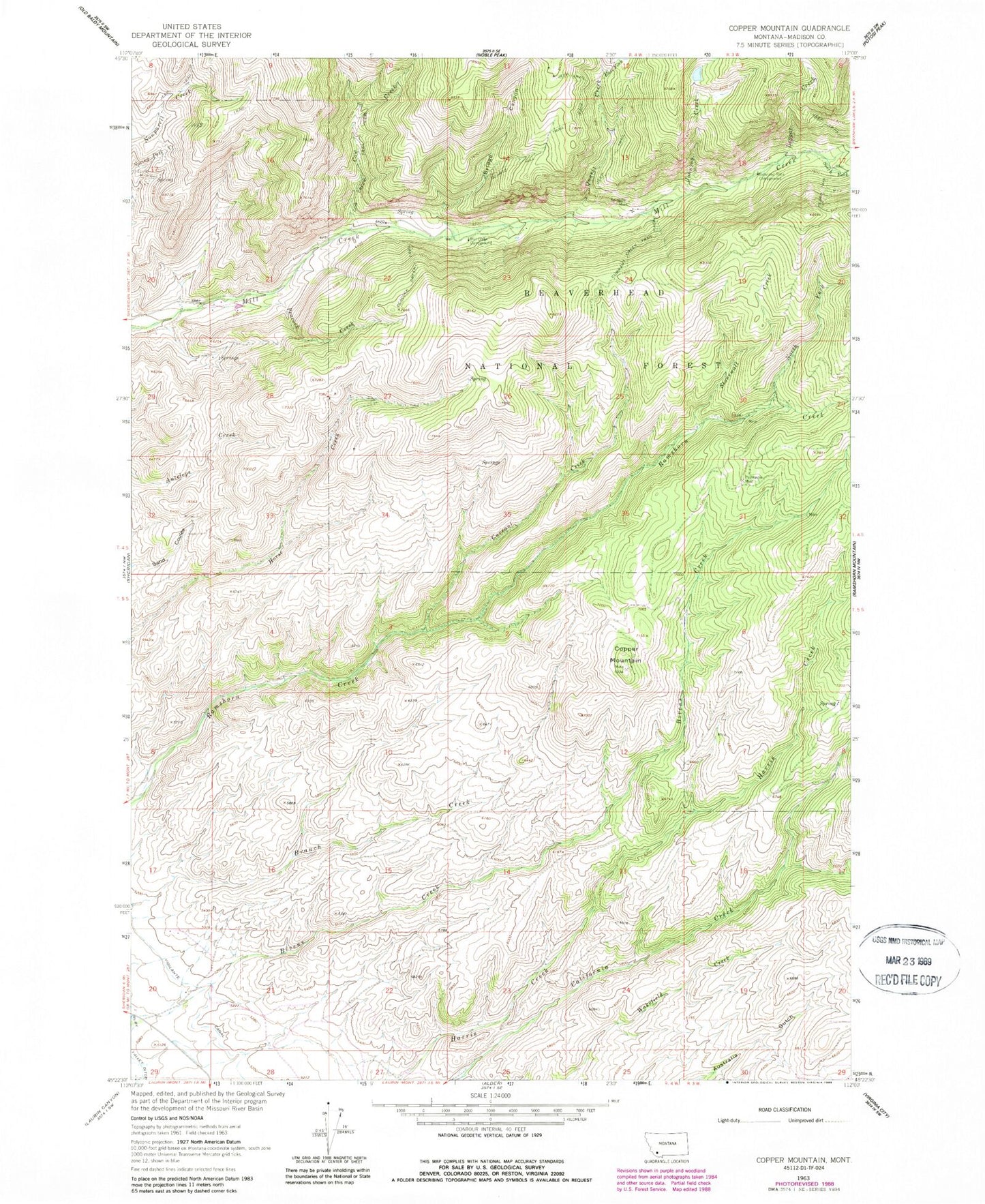
Classic USGS Copper Mountain Montana 7.5'x7.5' Topo Map
Couldn't load pickup availability
Historical USGS topographic quad map of Copper Mountain in the state of Montana. Map scale may vary for some years, but is generally around 1:24,000. Print size is approximately 24" x 27"
This quadrangle is in the following counties: Madison.
The map contains contour lines, roads, rivers, towns, and lakes. Printed on high-quality waterproof paper with UV fade-resistant inks, and shipped rolled.
Contains the following named places: 05S04W28BBAB01 Well, 05S04W28BBAB02 Well, 59749, Agitator/Concentrator Mine, Balanced Rock Campground, Betsy Baker Mine, Bridge Canyon, Cherry Gulch, Copper Mountain, Copper Mountain Mine, Cow Creek, Cow Creek Trail, Currant Creek, Currant Creek Trail, Donegan Gulch, East Fork Quartz Creek, Eclipse Creek, Freida Mine, Goldschmidt-Steiner Mine, Grandview Mine, Harris Creek Talc Mine, Horse Creek Quartz Mine, Hunts Claim Mine, J and J Mine, Jane and Nash Mine, Johnson Creek, Latest Out Mine, Leggat Creek, Mill Creek Campground, Nash Group Mine, NE NE Section 20 Mine, NE SW Section 30 Mine, Non Pareil Park, North Fork Antelope Creek Mine, North Fork Ramshorn Creek, NW NE Section 30 Mine, Paymaster Mine, Peacock Creek, Peacock Creek Trail, Pedro Mine, Pedro Trail, Pot Rustler Mine, Quartz Creek, Quartz Hill Trail, Reese Gulch, Sage Hen Mine, Sandstrom Mine, SE NW Section 36 Mine, SE SE Section 11 Mine, Silver Bar Mine, Silver Bullion Mine, Smuggler Mine, South Fork Mill Creek, Stonewall, Stonewall Creek, Studhorse Creek, SW NW Section 7 Mine, SW SW Section 12 Mine, Toledo Mine, Upper Pot Rustler Mine, Wakefield Creek, Wrights Mine