MyTopo
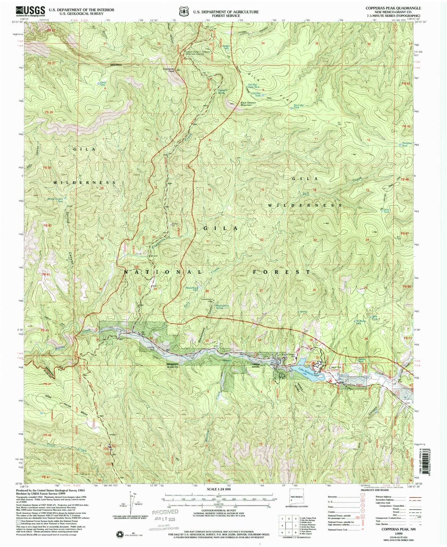
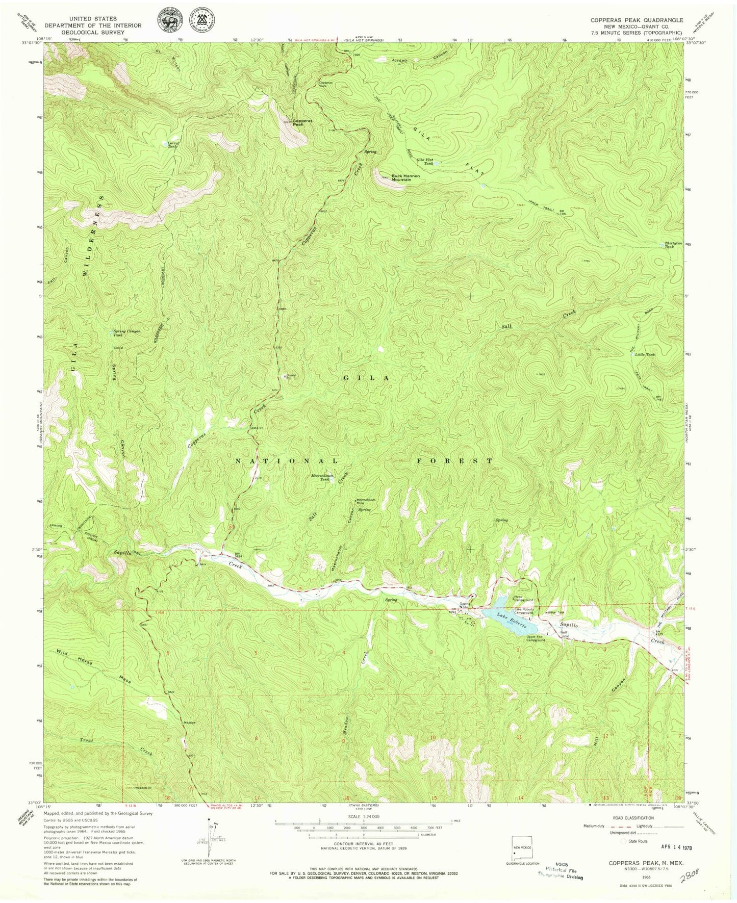
Classic USGS Copperas Peak New Mexico 7.5'x7.5' Topo Map
Couldn't load pickup availability
Historical USGS topographic quad map of Copperas Peak in the state of New Mexico. Typical map scale is 1:24,000, but may vary for certain years, if available. Print size: 24" x 27"
This quadrangle is in the following counties: Grant.
The map contains contour lines, roads, rivers, towns, and lakes. Printed on high-quality waterproof paper with UV fade-resistant inks, and shipped rolled.
Contains the following named places: Biddle Tank, Seep Tank, Meerschaum Spring, Salt Creek Spring, Dry Lake Tank, Gila Flat Tank Number Two, Jordon Tank, Copperas Spring, No Name Tank, Buck Hannen Mountain, Copperas Creek, Copperas Peak, Corral Tank, Gila Flat, Gila Flat Tank, Hill Canyon, Lake Roberts Campground, Little Tank, Meadow Creek, Meerschaum Canyon, Meerschaum Tank, Mesa Campground, Salt Creek, Spring Canyon, Spring Canyon Tank, The Military Road, Thirtytwo Tank, Upper End Campground, Wild Horse Mesa, Senator Clinton P Anderson Wilderness Overlook, Little Victor Tunnel, Lake Roberts Dam, Lake Roberts, Austin Roberts Vista/Point of Interest, Alum Spring, Meerschaum Mine, Copperas Vista, Lake Roberts Census Designated Place, Lake Roberts Heights Census Designated Place, Trout Valley Census Designated Place, Sapillo Creek Volunteer Fire Department and Rescue