MyTopo
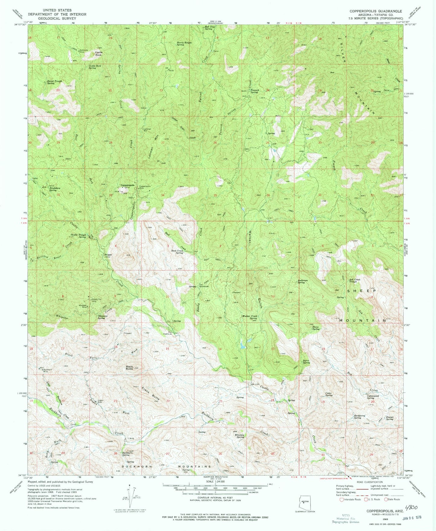
Classic USGS Copperopolis Arizona 7.5'x7.5' Topo Map
Couldn't load pickup availability
Historical USGS topographic quad map of Copperopolis in the state of Arizona. Typical map scale is 1:24,000, but may vary for certain years, if available. Print size: 24" x 27"
This quadrangle is in the following counties: Yavapai.
The map contains contour lines, roads, rivers, towns, and lakes. Printed on high-quality waterproof paper with UV fade-resistant inks, and shipped rolled.
Contains the following named places: Anderson Spring, Ash Creek Trough, Banty Creek, Black Butte, Black Butte Wash, Bradshaw Spring, Buckhorn Creek, Buckhorn Mine, Buckhorn Spring, Burnt Trough Spring, Burro Spring, Buzzard Roost Creek, Castle Rock, Castle Rock Spring, Cedar Spring, Copperopolis Creek, Copperopolis Mine, Cottonwood Spring, Double Trough Spring, Dugan Mine, Dugan Wash, East Fork Castle Creek, Ensign Spring, Evans Butte, Golden Aster Creek, Hackberry Spring, Harry Knight Spring, Horse Spring, Lehman Mountain, Little Buckhorn Creek, McKinzie Mine, Red Clay Spring, Rock Creek, Rock Creek Spring, Ruby Wash, Sheep Mountain, Spring Creek, The Box, The Doghouse, The Rockhouse, Tussock Spring, Tussock Spring Creek, Walker Creek Spring, Walker Gulch, Whipsaw Creek, Whipsaw Mine, Whipsaw Spring, Whiskey Spring, Thoma Butte, Briggs, Copperopolis, Lehman Mill, Ryland Creek