MyTopo
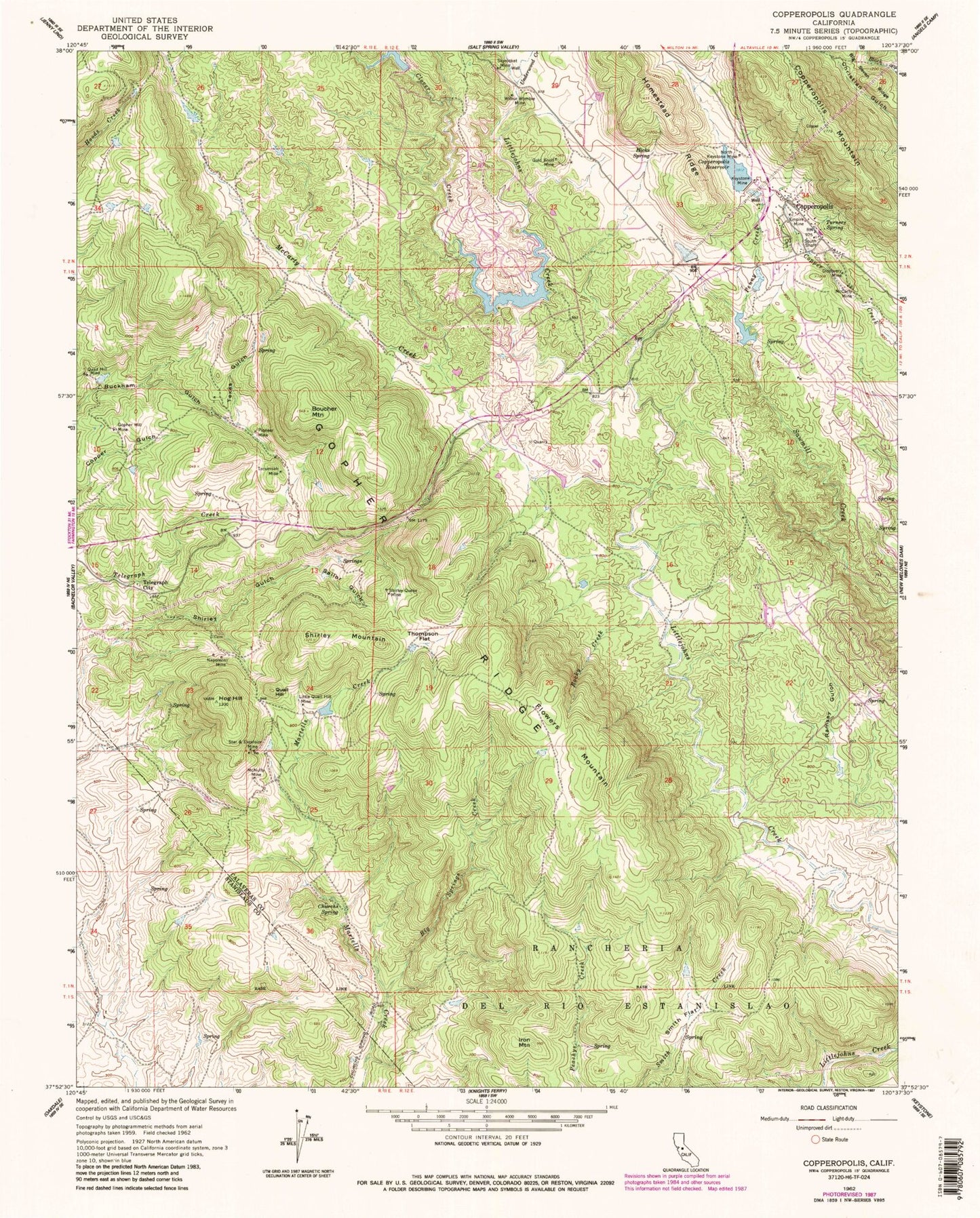
Classic USGS Copperopolis California 7.5'x7.5' Topo Map
Couldn't load pickup availability
Historical USGS topographic quad map of Copperopolis in the state of California. Map scale may vary for some years, but is generally around 1:24,000. Print size is approximately 24" x 27"
This quadrangle is in the following counties: Calaveras, Stanislaus.
The map contains contour lines, roads, rivers, towns, and lakes. Printed on high-quality waterproof paper with UV fade-resistant inks, and shipped rolled.
Contains the following named places: Big Springs Creek, Boucher Mountain, Churchs Spring, Clover Creek, Collier Mine, Copper Cove Village, Copperopolis, Copperopolis 1024 Dam, Copperopolis Cemetery, Copperopolis Census Designated Place, Copperopolis Elementary School, Copperopolis Fire Protection District Station 1 Headquarters, Copperopolis Fire Protection District Station 2, Copperopolis Mountain, Copperopolis Post Office, Copperopolis Reservoir, Department of Forestry and Fire Protection Copperopolis, Discovery Mine, Empire Mine, Flowers Mountain, Gold Knoll Mine, Gopher Hill Mine, Hicks Spring, Hodson, Hog Hill, Homestead Ridge, Iron Mountain, Keystone Mine, Little Quail Hill Mine, McCarty Creek, McCarty Mine, McNulty Mine, Mountain King 501 Dam, Napoleon Mine, North Keystone Mine, Penny Creek, Pioneer Mine, Quail Hill, Quail Hill Mine, R N Flower 507 Dam, Ramsey Gulch, Rocky Creek, Sailor Gulch, Shirley Mountain, Shirley Queen Mine, Skyrocket Mine, Smith Flat, South Shaft, Star, Tecumseh Mine, Telegraph City, Texas Gulch, Thompson Flat, Turners Spring, Underwood Creek, Union Mine, Wilbur Womble Mine, ZIP Code: 95228