MyTopo
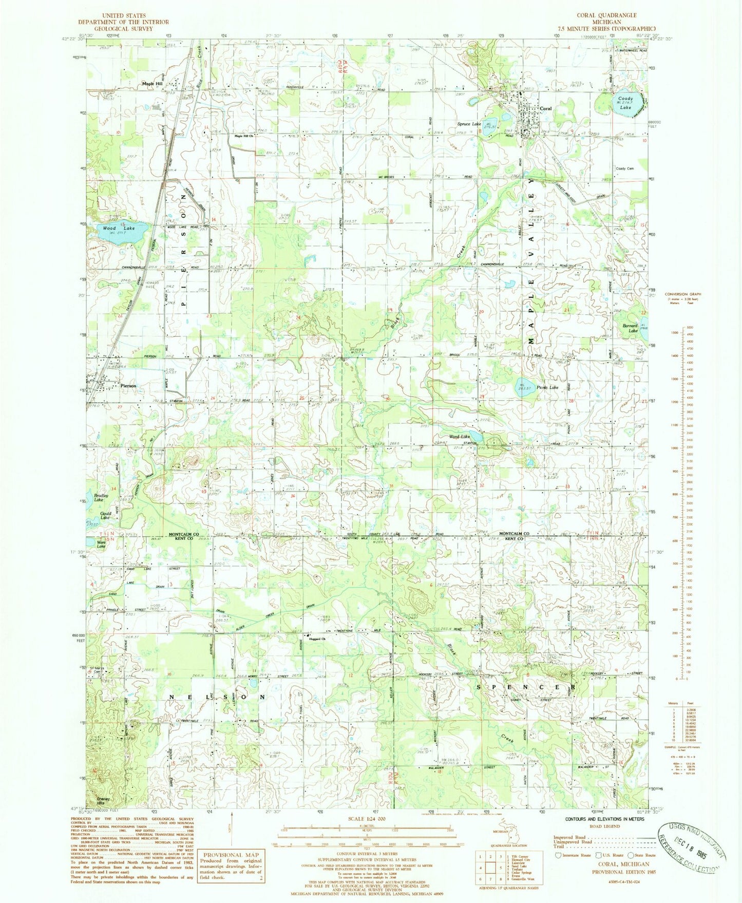
Classic USGS Coral Michigan 7.5'x7.5' Topo Map
Couldn't load pickup availability
Historical USGS topographic quad map of Coral in the state of Michigan. Map scale may vary for some years, but is generally around 1:24,000. Print size is approximately 24" x 27"
This quadrangle is in the following counties: Kent, Montcalm.
The map contains contour lines, roads, rivers, towns, and lakes. Printed on high-quality waterproof paper with UV fade-resistant inks, and shipped rolled.
Contains the following named places: Alder Creek Drain, Coady Cemetery, Coady Lake, Coral, Coral Airport, Coral Cemetery, Coral Post Office, Coral Station, County Line Drain, Emmanuel Baptist Church, Gould Lake, Heritage United Methodist Church, Herron Drain Number One, Hiram, Huggard Church, Huggard School, Lovett and Cody Drain, Maple Hill, Maple Hill Church, Maple Hill Post Office, Maple Valley Fire Department Station 1, Maple Valley Post Office, Nelson Center School, Phillips School, Picnic Lake, Pierson, Pierson Bible Church, Pierson Post Office, Pierson Station, Saint Marys Cemetery, Sand Lake Drain, Spruce Lake, Township of Maple Valley, Township of Nelson, Victory School, Village of Pierson, Ward Lake, Wood Lake, Wood Lake Station, Woodlake Post Office, ZIP Code: 49339