MyTopo
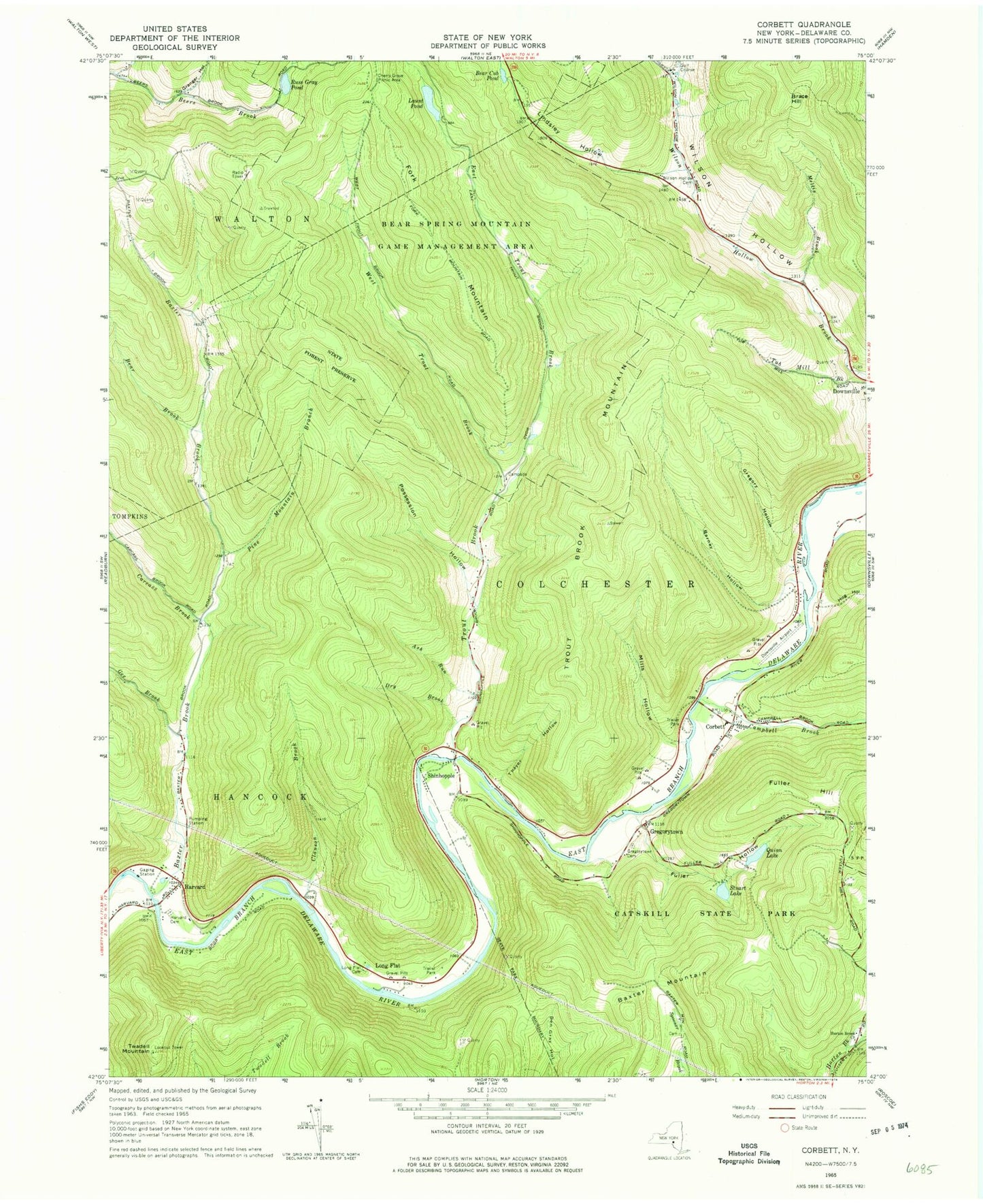
Classic USGS Corbett New York 7.5'x7.5' Topo Map
Couldn't load pickup availability
Historical USGS topographic quad map of Corbett in the state of New York. Typical map scale is 1:24,000, but may vary for certain years, if available. Print size: 24" x 27"
This quadrangle is in the following counties: Delaware.
The map contains contour lines, roads, rivers, towns, and lakes. Printed on high-quality waterproof paper with UV fade-resistant inks, and shipped rolled.
Contains the following named places: Ash Run, Barney Hollow, Baxter Brook, Baxter Mountain, Bear Brook, Bear Cub Pond, Brace Hill, Campbell Brook, Carcass Brook, Cherry Grove Picnic Area, Clauson Brook, Corbett, Dry Brook, East Trout Brook, Fork Mountain, Fuller Hollow, Gee Brook, Granger Hollow, Gregory Hollow, Gregorytown, Gregorytown Cemetery, Harvard, Harvard Cemetery, Hog Hollow, Horton Brook Church, Launt Pond, Lindsley Hollow, Little Fuller Brook, Long Flat, Long Flat Cemetery, Mellis Brook, Mills Hollow, Notch Hollow, Pine Mountain Branch, Possession Hollow, Quinn Lake, Russ Gray Pond, Shinhopple, Stuart Lake, Thayer Hollow, Trout Brook, Trout Brook Mountain, Tub Mill Brook, Twadell Mountain, Bear Spring Mountain Game Management Area, West Trout Brook, Wilson Hollow Cemetery, Downsville Airport (historical), Mahoney Quarry, Corbett Road Bridge