MyTopo
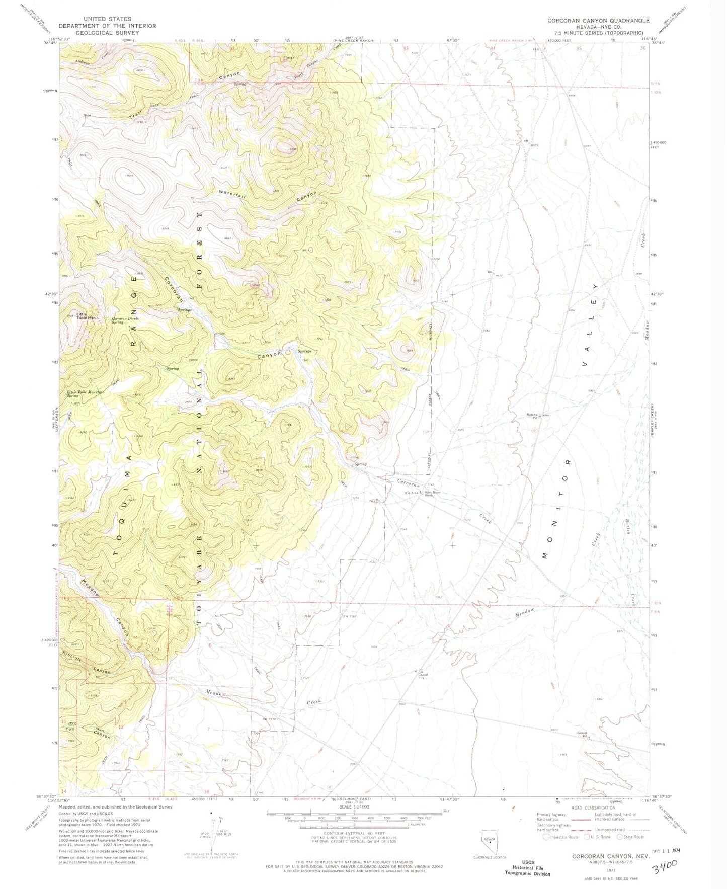
Classic USGS Corcoran Canyon Nevada 7.5'x7.5' Topo Map
Couldn't load pickup availability
Historical USGS topographic quad map of Corcoran Canyon in the state of Nevada. Map scale may vary for some years, but is generally around 1:24,000. Print size is approximately 24" x 27"
This quadrangle is in the following counties: Nye.
The map contains contour lines, roads, rivers, towns, and lakes. Printed on high-quality waterproof paper with UV fade-resistant inks, and shipped rolled.
Contains the following named places: Barley Creek, Corcoran Canyon, Corcoran Creek, Corcoran Divide Spring, Ellsworth Ophir Barley Creek Freight Route, Haystack Ranch, Little Table Mountain, Little Table Mountain Spring, Meadow Canyon, Meadow Creek Bench, Meadow Creek Ranch, Ryecroft Canyon, Stone House, Stone House Ranch, Toll Canyon, Tooth Rock, Trail Canyon, Waterfall Canyon, Widow Smiths Creek