MyTopo
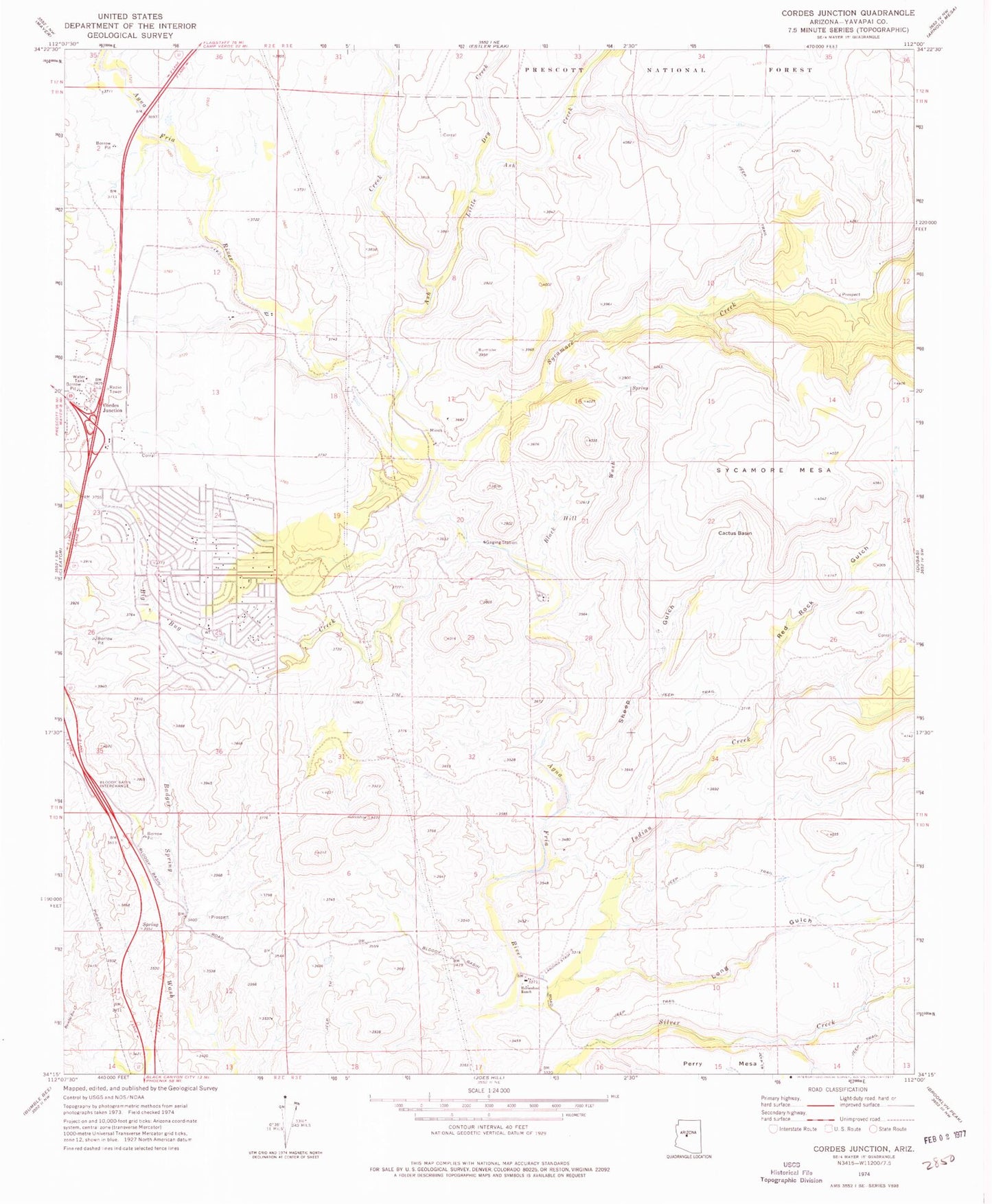
Classic USGS Cordes Junction Arizona 7.5'x7.5' Topo Map
Couldn't load pickup availability
Historical USGS topographic quad map of Cordes Junction in the state of Arizona. Map scale may vary for some years, but is generally around 1:24,000. Print size is approximately 24" x 27"
This quadrangle is in the following counties: Yavapai.
The map contains contour lines, roads, rivers, towns, and lakes. Printed on high-quality waterproof paper with UV fade-resistant inks, and shipped rolled.
Contains the following named places: Arcosanti, Arizona Highway Maintenance Yard, Ash Creek, Balmes Ranch, Big Bug Creek, Black Hill Wash, Burmister Ranch, Cactus Basin, Community Bible Church, Cordes Junction, Cordes Lakes, Cordes Lakes Census Designated Place, Cordes Lakes Public Library, Dry Creek, First Baptist Church, Horseshoe Ranch, Indian Creek, Little Ash Creek, Long Gulch, Mayer Fire Department Fire Station 23, Mountain of Faith Lutheran Church, Red Rock Gulch, Sheep Gulch, Sycamore Creek, Sycamore Mesa, ZIP Code: 86333