
MyTopo
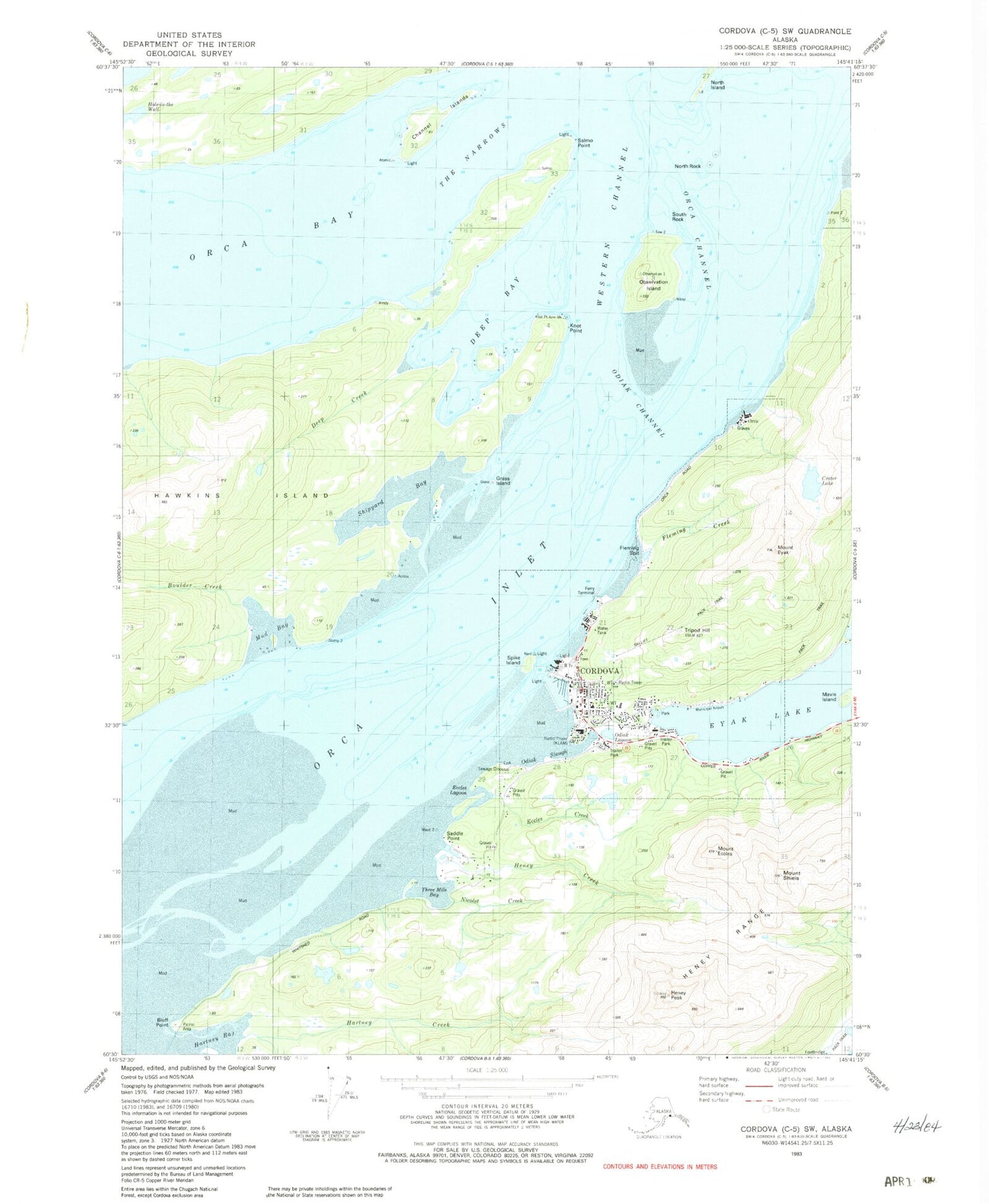
Classic USGS Cordova C-5 SW Alaska 7.5'x7.5' Topo Map
Couldn't load pickup availability
Historical USGS topographic quad map of Cordova C-5 SW in the state of Alaska. Map scale may vary for some years, but is generally around 1:24,000. Print size is approximately 24" x 27"
This quadrangle is in the following counties: Valdez-Cordova (CA).
The map contains contour lines, roads, rivers, towns, and lakes. Printed on high-quality waterproof paper with UV fade-resistant inks, and shipped rolled.
Contains the following named places: Alaska State Troopers Cordova, Apw Dam Number 1, APW Dam Number 2, APW Reservoir, Bluff Point, Boulder Creek, Channel Islands, Cordova, Cordova Cemetery, Cordova Community Medical Center, Cordova Emergency Medical Services, Cordova Municipal Airport, Cordova Police Department, Cordova Post Office, Cordova Public Health Center, Cordova Volunteer Fire Department, Crater Lake, Deep Bay, Deep Creek, Eccles Creek, Eccles Lagoon, Fleming Creek, Fleming Spit, Grass Island, Hartney Creek, Heney Creek, Heney Peak, Hole-in-the-wall, KLAM-AM (Cordova), Knot Point, Lakeview Cemetery, Mavis Island, Meals Lake, Meals Lake Dam, Mount Eccles, Mount Eyak, Mount Shiels, Mud Bay, Native Village of Eyak / Chugachmiut Tribal Organization - Ilanka Community Health Center, Nicolet Creek, North Island, North Rock, Observation Island, Odiak Channel, Odiak Lagoon, Odiak Slough, Orca, Orca Channel, Orca Inlet, Saddle Point, Salmo Point, Shipyard Bay, South Rock, Spike Island, The Narrows, Three Mile Bay, Tripod Hill, Western Channel


