MyTopo
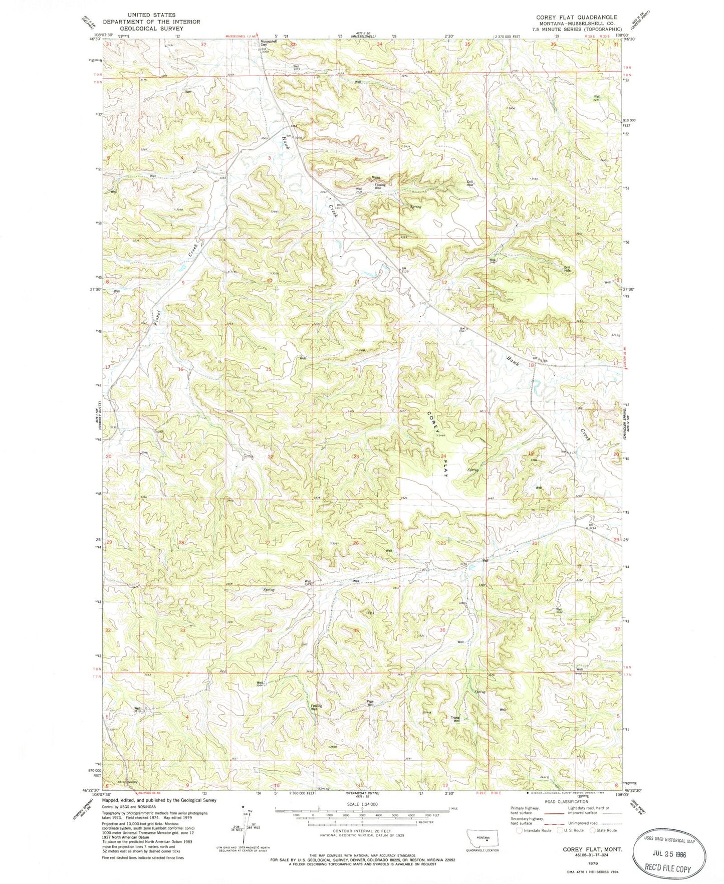
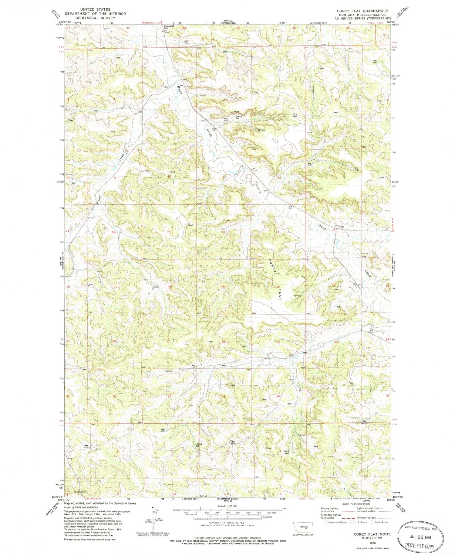
Classic USGS Corey Flat Montana 7.5'x7.5' Topo Map
Regular price
$16.95
Regular price
Sale price
$16.95
Unit price
per
Couldn't load pickup availability
Historical USGS topographic quad map of Corey Flat in the state of Montana. Map scale may vary for some years, but is generally around 1:24,000. Print size is approximately 24" x 27"
This quadrangle is in the following counties: Musselshell.
The map contains contour lines, roads, rivers, towns, and lakes. Printed on high-quality waterproof paper with UV fade-resistant inks, and shipped rolled.
Contains the following named places: 08N29E22CBAA01 Well, 08N29E23AADD01 Well, 08N29E33CAA_01 Well, 08N29E36DBDA01 Well, 08N30E06CDBD01 Well, 08N30E07BCA_01 Well, 08N30E32CCCC01 Well, 09N29E33CBBD01 Well, 59059, Cory Flat, Fishel Creek, Melstone Division, Musselshell Cemetery, Page Well, Tripod Well