
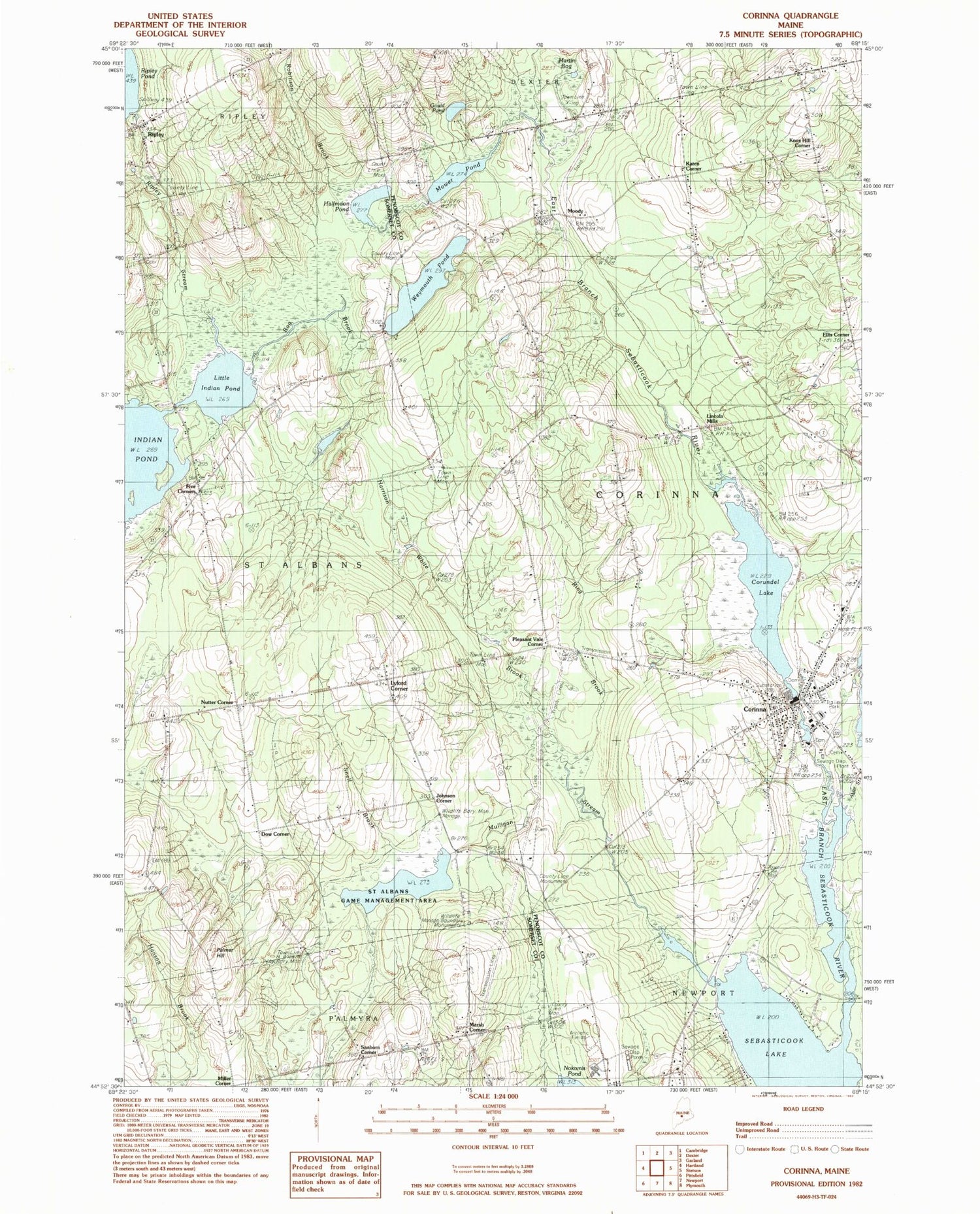
MyTopo
Classic USGS Corinna Maine 7.5'x7.5' Topo Map
Couldn't load pickup availability
Historical USGS topographic quad map of Corinna in the state of Maine. Map scale may vary for some years, but is generally around 1:24,000. Print size is approximately 24" x 27"
This quadrangle is in the following counties: Penobscot, Somerset.
The map contains contour lines, roads, rivers, towns, and lakes. Printed on high-quality waterproof paper with UV fade-resistant inks, and shipped rolled.
Contains the following named places: Addition Brook, Alder Stream, Bog Brook, Corinna, Corinna Census Designated Place, Corinna Elementary School, Corinna Junior High School, Corinna Post Office, Corinna Volunteer Fire Department, Crocker Cemetery, Dixie Corner, Dow Corner, East Branch Sebasticook River Reservoir, Ellis Corner, Fern - Dale Cemetery, Gould Pond, Halfmoon Pond, Harrison White Brook, Johnson Corner, Katen Corner, Knox Hill Corner, Lincoln Mills, Little Indian Pond, Lower Dam, Lyford Cemetery, Lyford Corner, Marsh Corner, Martin Bog, Middle Dam, Miller Corner, Mills School, Moody, Mower Pond, Mulligan Stream, Mulligan Stream Dam, Nokomis Regional High School, Nutter Cemetery, Nutter Corner, Palmer Hill, Pleasant Vale Corner, Ring Brook, Ripley, Ripley Pond Dam, Ripley Stream, Robinson Brook, Saint Albans Game Management Area, Sanborn Corner, Sebasticook Valley Elementary School, Snell Brook, Stewart Free Library, Town of Corinna, United Methodist Church, Upper Dam, Village Cemetery, Weeks Cemetery, Weymouth Pond, Weymouth Pond Dam, ZIP Code: 04928


