MyTopo
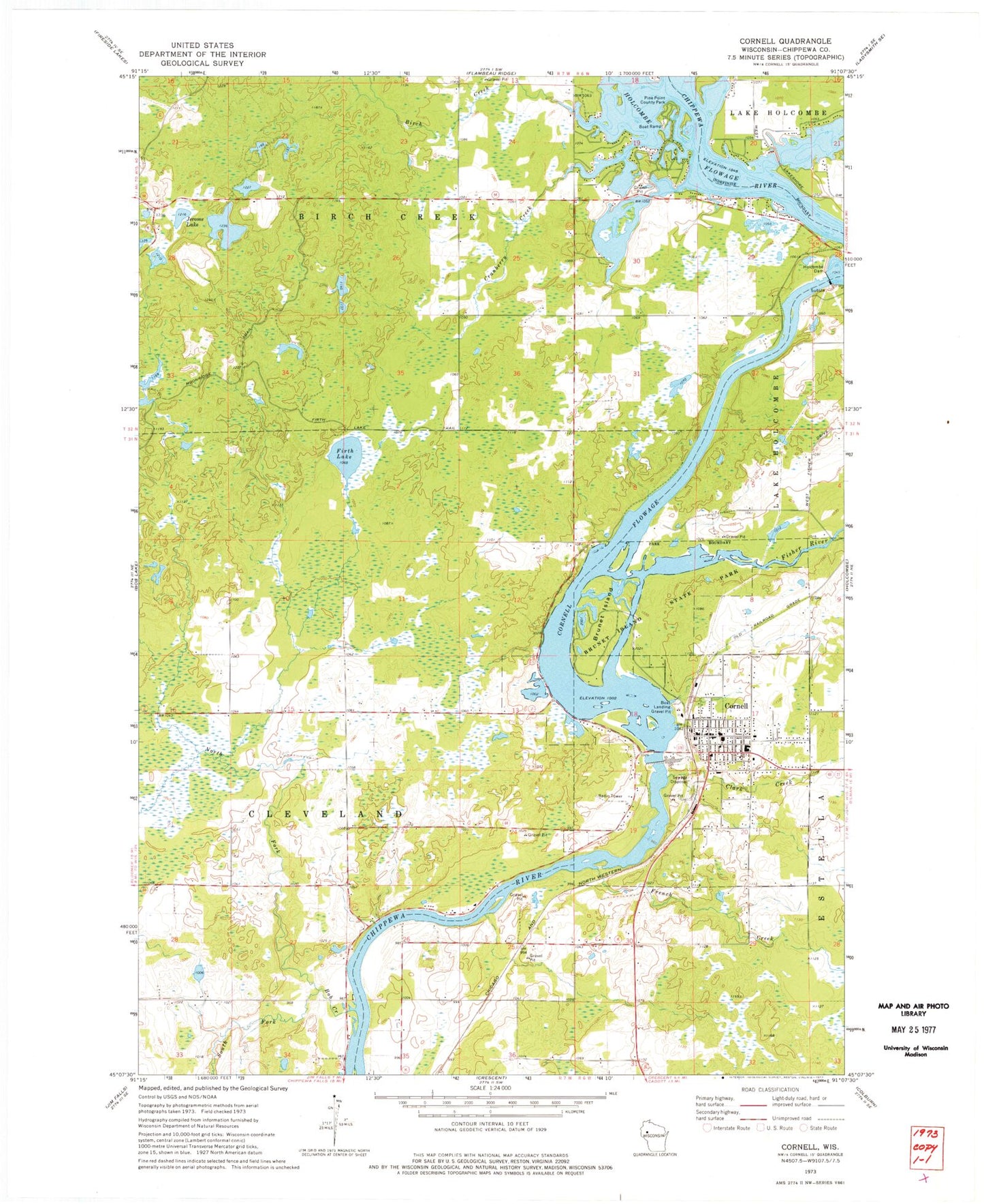
Classic USGS Cornell Wisconsin 7.5'x7.5' Topo Map
Couldn't load pickup availability
Historical USGS topographic quad map of Cornell in the state of Wisconsin. Map scale may vary for some years, but is generally around 1:24,000. Print size is approximately 24" x 27"
This quadrangle is in the following counties: Chippewa.
The map contains contour lines, roads, rivers, towns, and lakes. Printed on high-quality waterproof paper with UV fade-resistant inks, and shipped rolled.
Contains the following named places: Birch Creek, Bob Creek, Brook View Farms, Brunet Island, Brunet Island State Park, Burnt Creek Flowage Number Two, City of Cornell, Clark Creek, Cornell, Cornell 2WP7 Dam, Cornell Area Ambulance, Cornell Area Fire Department, Cornell Elementary School, Cornell Flowage, Cornell Hydro Generating Station, Cornell Middle - High School, Cornell Police Department, Cornell Post Office, County Forest Crop Land 3 D-12.210 Dam, Cranberry Creek, Fairview School, Faith Baptist Church, First Presbyterian Church, Firth Lake, Firth Lake Trail, Firth School, Fisher River, French Creek, Holcombe 2WP723 Dam, Holcombe Dam, Holcombe Flowage, Holcombe Hydro Generating Station, Holy Cross Catholic Church, Horseshoe Flowage 0.75, Jerome Lake, Kingdom Hall of Jehovahs Witnesses, Lemay Farm, Miller Lake, Moonridge Trail, New Hope Assembly of God Church, North Fork Bob Creek, Our Saviours Lutheran Church, Pine Point County Park, Pleasant Ridge School, Quinn Pit, Roberts School, Saint Johns Lutheran Church, South Fork Bob Creek, Spring Creek Flowage Number Two, Town of Birch Creek, ZIP Code: 54732