MyTopo
Classic USGS Corning Arkansas 7.5'x7.5' Topo Map
Couldn't load pickup availability
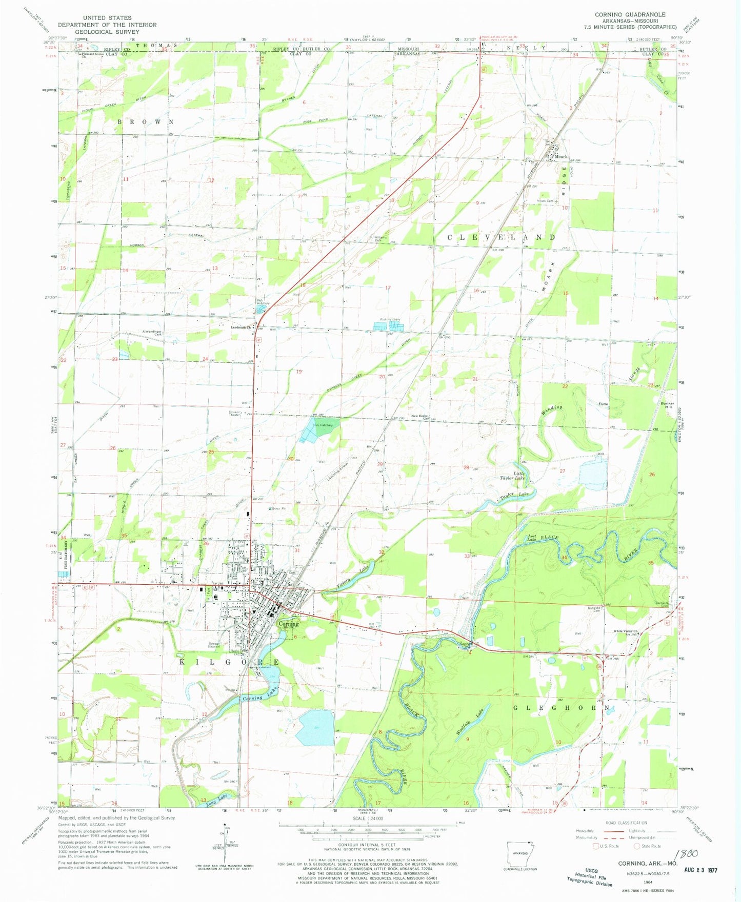
Historical USGS topographic quad map of Corning in the state of Arkansas. Map scale may vary for some years, but is generally around 1:24,000. Print size is approximately 24" x 27"
This quadrangle is in the following counties: Butler, Clay, Ripley.
The map contains contour lines, roads, rivers, towns, and lakes. Printed on high-quality waterproof paper with UV fade-resistant inks, and shipped rolled.
Contains the following named places: Allmandinger Cemetery, Bennetts Ferry Bridge, Blue School, Bunker Hill, Cantwell Cemetery, Central Elementary School, City of Corning, Clay County Courthouse, Clay County Sheriff Department, Corning, Corning Cemetery, Corning City Hall, Corning Community Hospital, Corning High School, Corning Lake, Corning Library, Corning National Fish Hatchery, Corning Police Department, Corning Post Office, Corning Volunteer Fire Department, Cypress Creek Ditch, Dell School, Hobson Lateral, Hopkinsville School, Hopson School, Huddle Plaza Shopping Center, KBKG-FM (Corning), KCCB-AM (Corning), Landmark Church, Lateral Number One, Little Taylor Lake, Long Lake, Lost Lake, Middle Creek Ditch, Moark, Moark Cemetery, Moark Ditch, Moark Ridge, New Church, New Home Church, Park Elementary School, Pleasant Grove Church, Redenbo Cemetery, Rose Pond Lateral, Sweet Clover Bend, Taylor Lake, Township of Cleveland, Township of Cleveland-North Kilgore, Township of Gleghorn, Township of Gleghorn-South Kilgore, Township of Kilgore, Victory Lake, White School, White Valley Church, Williams Cemetery, Williams School, Winding Slough, Woolfolk Lake, Wynn Park, ZIP Code: 72422