MyTopo
Classic USGS Cornish Gulch Montana 7.5'x7.5' Topo Map
Couldn't load pickup availability
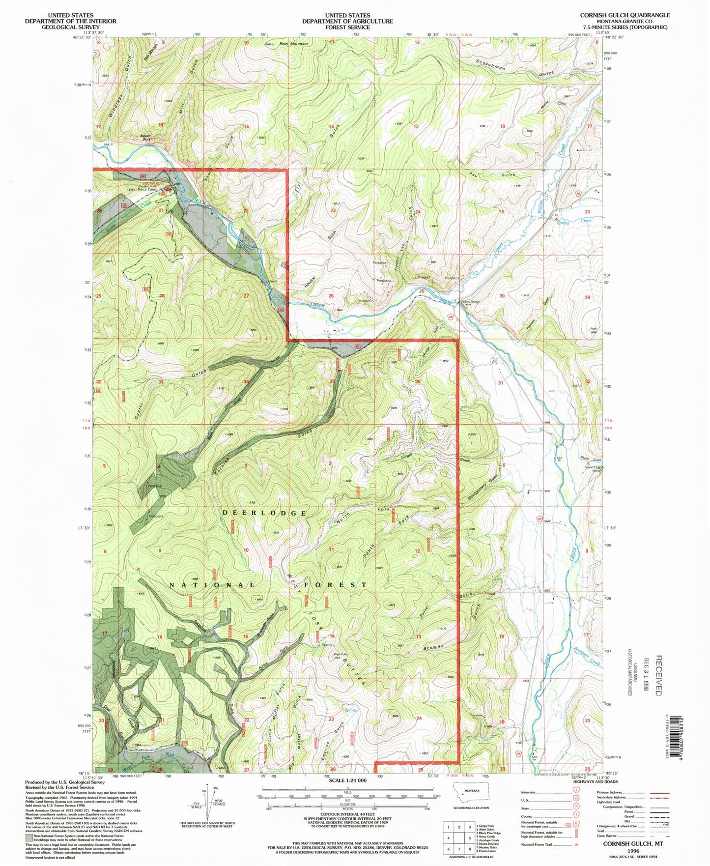
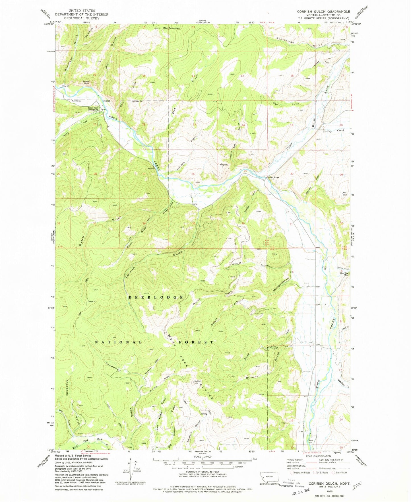
Historical USGS topographic quad map of Cornish Gulch in the state of Montana. Typical map scale is 1:24,000, but may vary for certain years, if available. Print size: 24" x 27"
This quadrangle is in the following counties: Granite.
The map contains contour lines, roads, rivers, towns, and lakes. Printed on high-quality waterproof paper with UV fade-resistant inks, and shipped rolled.
Contains the following named places: Eureka Gulch, Anaconda Gulch, Antelope Creek, Apache Gulch, Aurora Gulch, Basin Gulch, Bi-Metalic Gulch, Browns Gulch, Coal Gulch, Cornish Gulch, Ethridge Gulch, Flat Gulch, Kyle G. Bohrnsen Pfc US Army Memorial Bridge, Ginger Gulch, Hoodoo Gulch, Jimmy Lee Gulch, Little Moffat Gulch, Mill Gulch, Montgomery Gulch, North Fork Montgomery Gulch, Papoose Gulch, Puller Gulch, Quartz Gulch, Ram Mountain, Rau Gulch, Scotchman Gulch, Short Gulch, Silver King Mine, Sluice Gulch, South Fork Montgomery Gulch, Spring Creek, Wright Rock, Stony Creek Campground, Stony Creek, The Wedge, Upper Willow Creek, West Fork Buttes, Windlass Gulch, NW SW Section 25 Mine, SE NE Section 26 Mine, NW NE Section 20 Mine, WB Development Placer Mine, SW NE Section 5 Mine, Silver King Mine, Basin Gulch Placer Mine, Blue Bell Mine, Placer Post Office (historical), Bobcat Field, Squaw Rock Airstrip