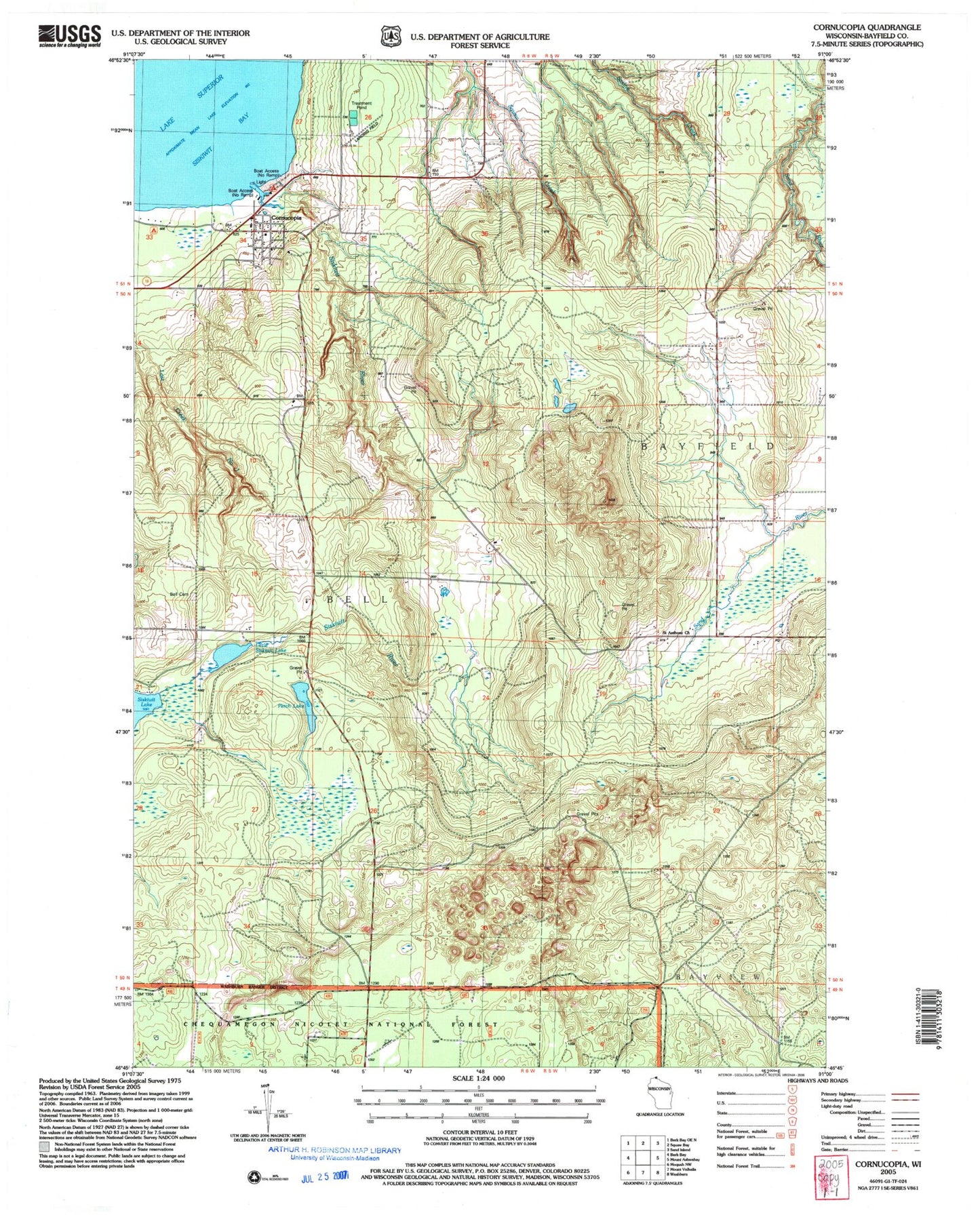
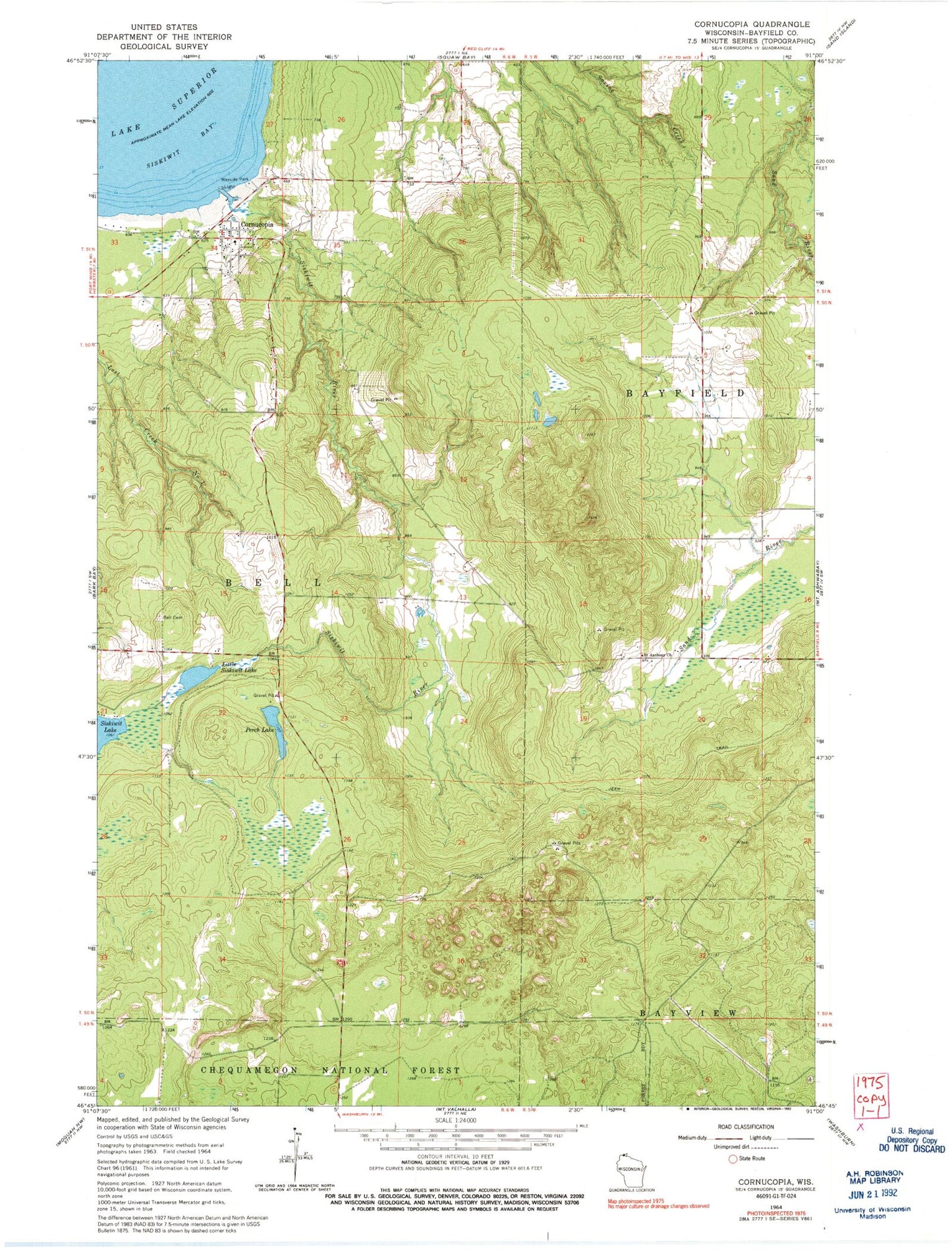
MyTopo
Classic USGS Cornucopia Wisconsin 7.5'x7.5' Topo Map
Couldn't load pickup availability
Historical USGS topographic quad map of Cornucopia in the state of Wisconsin. Map scale may vary for some years, but is generally around 1:24,000. Print size is approximately 24" x 27"
This quadrangle is in the following counties: Bayfield.
The map contains contour lines, roads, rivers, towns, and lakes. Printed on high-quality waterproof paper with UV fade-resistant inks, and shipped rolled.
Contains the following named places: Cornucopia, Cornucopia Census Designated Place, Cornucopia Field, Cornucopia Post Office, Cornucopia Volunteer Fire Department, East Pier Light, George D Jones Junior Memorial Cemetery, Little Siskiwit Lake, Perch Lake, Saint Anthony Church, Siskiwit Bay, Siskiwit Massacre Historical Site, Siskiwit River, South Shore Marina, Town of Bell, ZIP Code: 54827