MyTopo
Classic USGS Cornville Arizona 7.5'x7.5' Topo Map
Couldn't load pickup availability
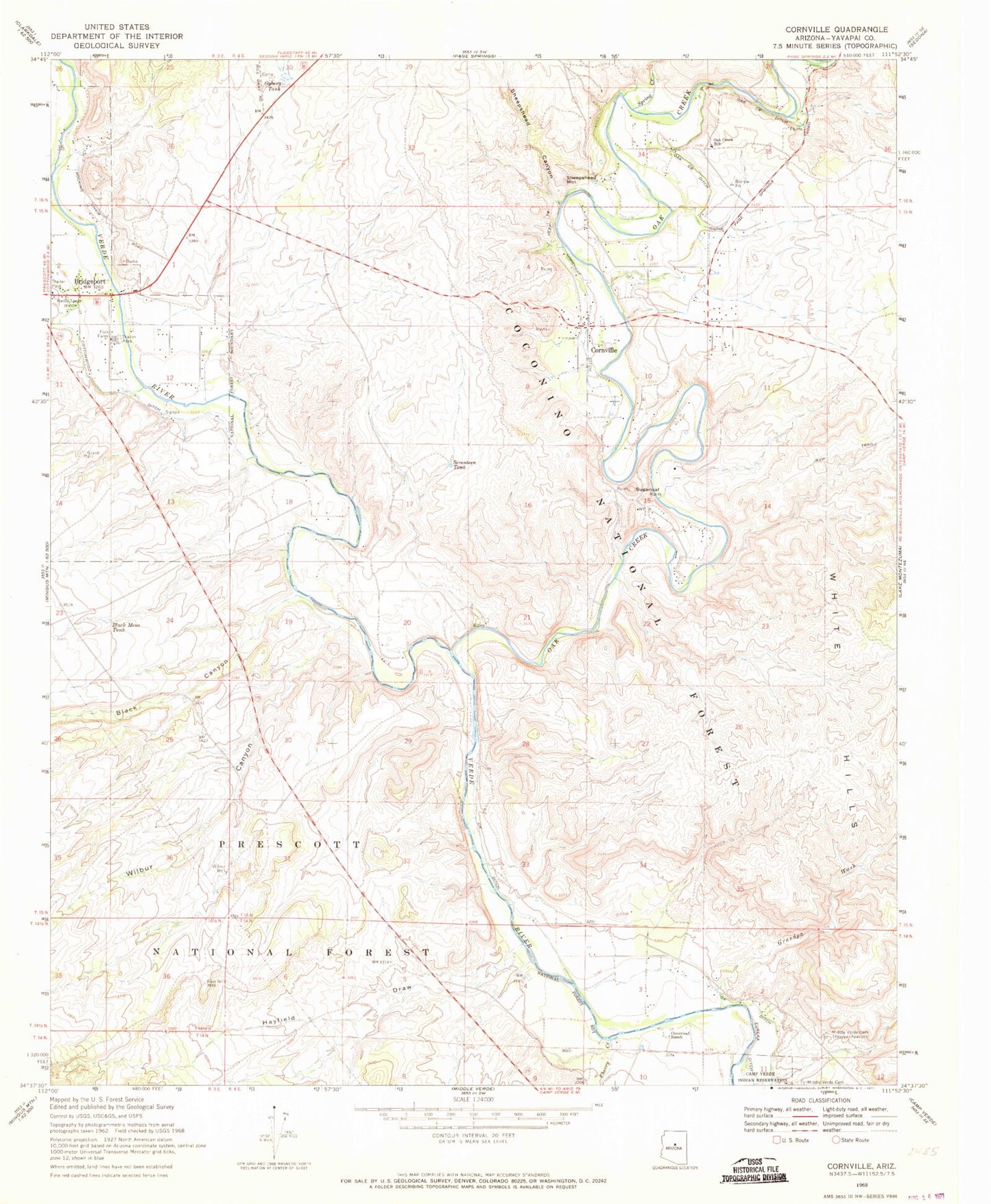
Historical USGS topographic quad map of Cornville in the state of Arizona. Typical map scale is 1:24,000, but may vary for certain years, if available. Print size: 24" x 27"
This quadrangle is in the following counties: Yavapai.
The map contains contour lines, roads, rivers, towns, and lakes. Printed on high-quality waterproof paper with UV fade-resistant inks, and shipped rolled.
Contains the following named places: Tat Momolikot Dam, Black Canyon, Black Mesa Tank, Bridgeport, Yavapai-Apache Nation Reservation, Cherry Creek, Cloverleaf Ranch, Cornville, Cornville Ditch, Grandpa Wash, Gyberg Tank, Hayfield Draw, Middle Verde Yavapai - Apache Cemetery, Oak Creek, Oak Creek Ditch, Oak Creek Elementary School, Ok Ditch, Seventeen Tank, Sheepshead Canyon, Sheepshead Mountain, Spring Creek, Sugarloaf, Wilbur Canyon, Wilbur Well, Jordan, Trick Tank, Hayfield Draw Windmill, Verde, Smelter City, Sheeps Crossing, Bignotti, KVRD-AM (Cottonwood), Cornville Post Office, KVRD-AM (Cottonwood), Solair Estates Airport (historical), Skidmore Lane Recreation Site, Prarie Lane Recreation Site, Black Canyon Recreation Site, Bignotti Recreation Site, Cornville Census Designated Place, Verde Village Census Designated Place, Tavacsi Elementary School, Cornerstone Christian Academy, Yavapai Apache Health Clinic, Turquoise Triangle Recreational Vehicle Park, Verde Santa Fe Golf Club, Cornville First Southern Baptist Church, Immaculate Conception Catholic Church, Verde Valley Church of the Nazarene, Verde Valley Reformed Chapel, One in Christ Church, Verde Valley Fire District Station 31, Verde Valley Fire District Station 32, All Souls Cemetery