MyTopo
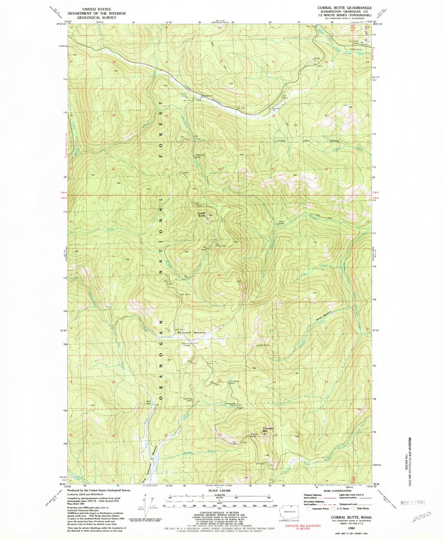
Classic USGS Corral Butte Washington 7.5'x7.5' Topo Map
Couldn't load pickup availability
Historical USGS topographic quad map of Corral Butte in the state of Washington. Map scale may vary for some years, but is generally around 1:24,000. Print size is approximately 24" x 27"
This quadrangle is in the following counties: Okanogan.
The map contains contour lines, roads, rivers, towns, and lakes. Printed on high-quality waterproof paper with UV fade-resistant inks, and shipped rolled.
Contains the following named places: Chow Creek, Corral Butte, Crosby Camp, Crosby Creek, Dill Creek, Four Point Corral, Hilltop Creek, Hunter Meadows, Inlow Camp, Irenes Camp, Lightning Camp, Long Swamp, Long Swamp Campground, Long Swamp Trail, Long Swamp Trailhead, Lost Spoon Camp, Middle Fork Twentymile Creek, North Twentymile Meadows, North Twentymile Peak Trail, Queer Creek, Skull Camp, Thirtymile Meadows, Thirtymile Trail, Thunder Camp, Thunder Mountain, Twentymile Camp, West Fork Twentymile Creek, Wildhorse Camp, Wildhorse Creek