MyTopo
Classic USGS Corral Creek Montana 7.5'x7.5' Topo Map
Regular price
$16.95
Regular price
Sale price
$16.95
Unit price
per
Couldn't load pickup availability
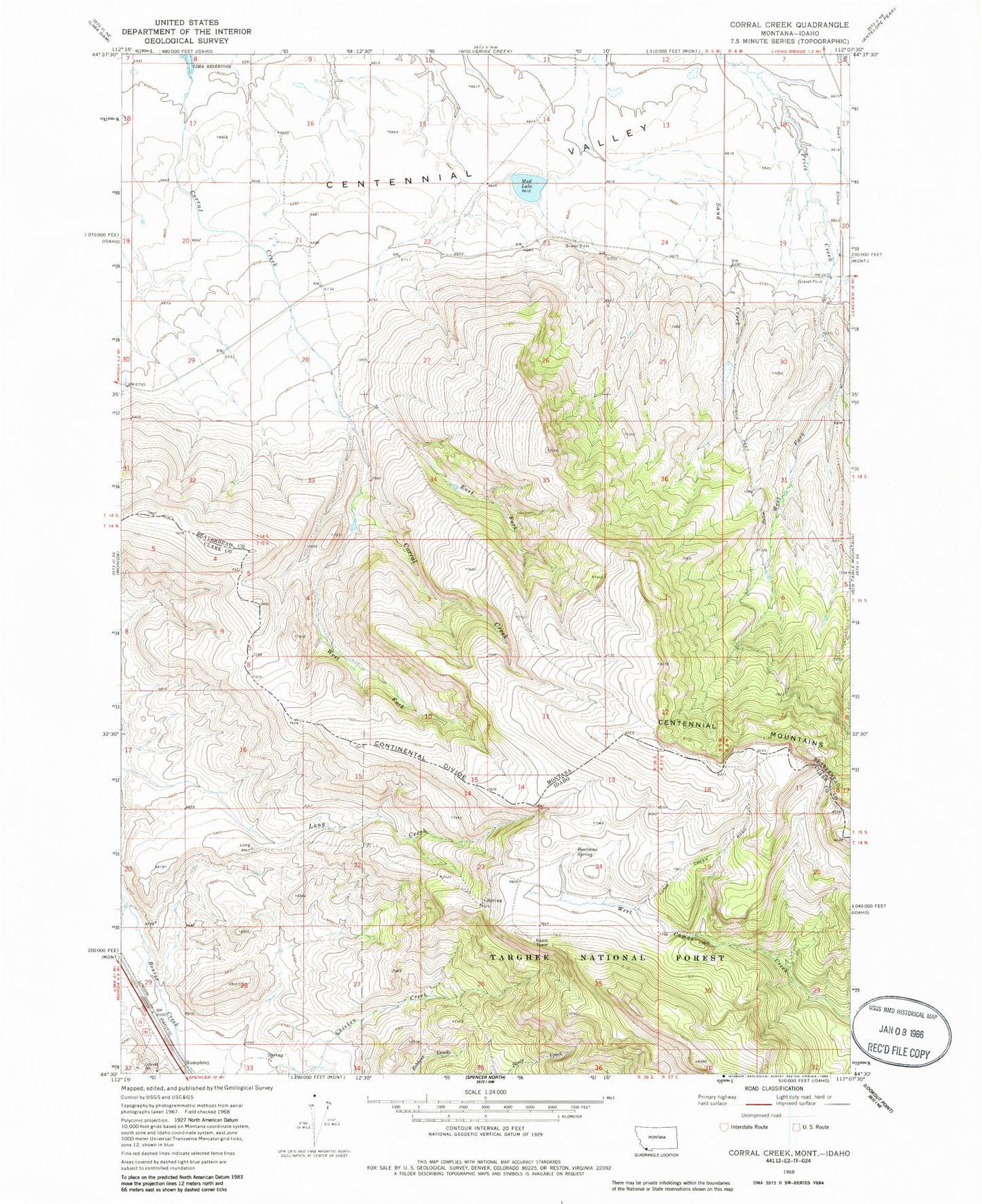
Historical USGS topographic quad map of Corral Creek in the states of Montana, Idaho. Map scale may vary for some years, but is generally around 1:24,000. Print size is approximately 24" x 27"
This quadrangle is in the following counties: Beaverhead, Clark.
The map contains contour lines, roads, rivers, towns, and lakes. Printed on high-quality waterproof paper with UV fade-resistant inks, and shipped rolled.
Contains the following named places: 14S04W19DAAD01 Well, Boatman Spring, Centennial Post Office, Corral Creek, East Fork Corral Creek, Mud Lake, Mud Lake Dam, West Fork Corral Creek, West Fork Price Creek