MyTopo
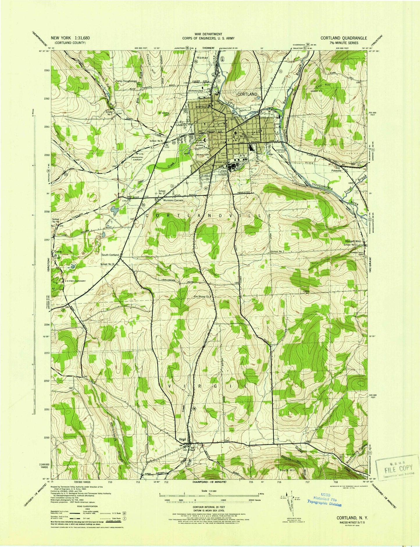
Classic USGS Cortland New York 7.5'x7.5' Topo Map
Couldn't load pickup availability
Historical USGS topographic quad map of Cortland in the state of New York. Map scale may vary for some years, but is generally around 1:24,000. Print size is approximately 24" x 27"
This quadrangle is in the following counties: Cortland.
The map contains contour lines, roads, rivers, towns, and lakes. Printed on high-quality waterproof paper with UV fade-resistant inks, and shipped rolled.
Contains the following named places: Airport Drive-In, Berean Bible Church, Bible Baptist Church, Blodgett Mills, Blodgett Mills Census Designated Place, Blue Creek, Bowers Hall, Brockway Hall, Camp Tioughnioga, Carr Hill, Central High School, Cheney Hall, Christian and Missionary Church, Christian Assembly Italian Church, City of Cortland, Clark Hall, Corey Union, Cornish Hall, Cortland, Cortland Armory, Cortland Care Center, Cortland Christian Academy, Cortland Country Club, Cortland County Airport-Chase Field, Cortland County Court House, Cortland County Jail, Cortland Fire Department Main Station, Cortland Fire Department Station 2, Cortland Free Library, Cortland Greenhouses, Cortland Junior - Senior High School, Cortland Memorial Nursing and Rehabilitation Center, Cortland Municipal Building, Cortland Post Office, Cortland Rural Cemetery, Cortland Wastewater Treatment Facility, Cortland West Census Designated Place, Cortlandville Fire Department, Cortlandville Town Hall, Davis Field, De Groat Hall, Diescher Farms, Dowd Fine Arts Center, Dry Creek, East Branch Tioughnioga River, Elm Stump Church, F E Smith Elementary School, Faith Baptist Church, First Baptist Church, First Church of Christ Scientist, First Congregational Church, First Methodist Church, First Universalist Church, Fitzgerald Hall, Forest Hill Cemetery, Franklyn S Barry School, Free Methodist Church of Cortland, Gibbs Medical Building, Grace Episcopal Church, Gracie, Groton Shopping Center, Guthrie Cortland Medical Center, Halls Hill Blueberry Farm, Hollenbeck Hollow, Holloway Field, Holy Spirit Lutheran Church, Homer Avenue United Methodist Church, Interfaith Center, Kinney Gulf, Lehigh Station, Lusk Field House, Lynch Dairy Farm, Memorial Baptist Church, Memorial Library, Miller Building, Moffett Center, Munsons Corners, Munsons Corners Census Designated Place, Neubig Hall, Newman Center, Newmark Pavilion, North Presbyterian Church, Northwoods Rehabilitation and Extended Care Facility Cortland, Old Blodgett Cemetery, Old Main, Otter Creek, Park Center, Park Side Christian School, Parker Building, Parker Elementary School, Pokeville, Pomeroy School, Randall Elementary School, Randall Hall, Robar Farms, Rubicon Ridge Farm, Saint Anthonys Roman Catholic Church, Saint Marys Cemetery, Saint Mary's Convent, Saint Mary's Parochial School, Saint Mary's Roman Catholic Church, School Number 1, School Number 11, School Number 15, School Number 16, School Number 17, School Number 2, School Number 7, School Number 8, Second Congregational Church, Seventh Day Adventist Church, Smith Tower, South Cortland, South Cortland Cemetery, South Hill, Sperry Center, Standard Building, State University of New York College at Cortland, Studio West, Tioughnioga River Bridge, TLC Emergency Medical Services, Town of Virgil, Trout Brook, Tuller Hill, Ukrainian Pentecostal Church, Van Hoesen Hall, Vandonsel Farm, Virgil, Virgil Census Designated Place, Virgil Elementary School, Virgil Fire Department, Virgil Rural Cemetery, Virgil Town Hall, Walden Oaks Country Club, Walden Place Assisted Living Center, Walker Christian School, Wallace Building, Wallace Field, West Branch Tioughnioga River, Whitney Building, Wickwire Hall, Willow Brook Golf Course, WKRT-AM (Cortland), WNYP-FM (Cortland), Woodchuck Hollow, WSUC-FM (Cortland), ZIP Code: 13045


