MyTopo
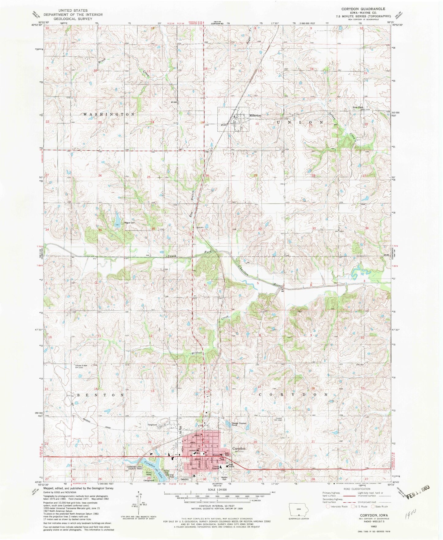
Classic USGS Corydon Iowa 7.5'x7.5' Topo Map
Couldn't load pickup availability
Historical USGS topographic quad map of Corydon in the state of Iowa. Map scale may vary for some years, but is generally around 1:24,000. Print size is approximately 24" x 27"
This quadrangle is in the following counties: Wayne.
The map contains contour lines, roads, rivers, towns, and lakes. Printed on high-quality waterproof paper with UV fade-resistant inks, and shipped rolled.
Contains the following named places: Assembly of God Church, Bentonsville, Bentonville Post Office, Christ the Servant Lutheran Church, City of Corydon, City of Millerton, Clark Eye Center, Corydon, Corydon Bible Church, Corydon Cemetery, Corydon City Hall, Corydon Dental Clinic, Corydon Fire Department, Corydon Lake, Corydon Lake County Park, Corydon Medical Clinic, Corydon Municipal Golf Course, Corydon Nursing and Rehab Center, Corydon Post Office, Corydon Vision Center, Dott Park, Fairview School, First Baptist Church, First Christian Church, Grismore Airport, Hogue Cemetery, Leanne's Place, Liberty Center School, Miles Log Cabin, Millerton, Millerton Post Office, New York, New York Post Office, Oakdale School 8, Ovia, Ovid Post Office, Peoria, Pioneer Log Cabin Historical Marker, Prairie Trails Museum, Rathbun Mentoal Health Center, Reorganized Church of Jesus Christ of Latter Day Saints, Spencer Foot and Ankle Clinic, Township of Corydon, Township of Union, United Methodist Church, Walden Park, Wayne County Courthouse, Wayne County Hospital, Wayne County Hospital Heliport, Wayne County Medical Center, Wayne County Museum Library, Wayne County Sheriff's Office, Wayne Elementary School, Wayne Junior / Senior High School, Wayne Junior High School, Wildcat Creek, ZIP Codes: 50060, 50165


