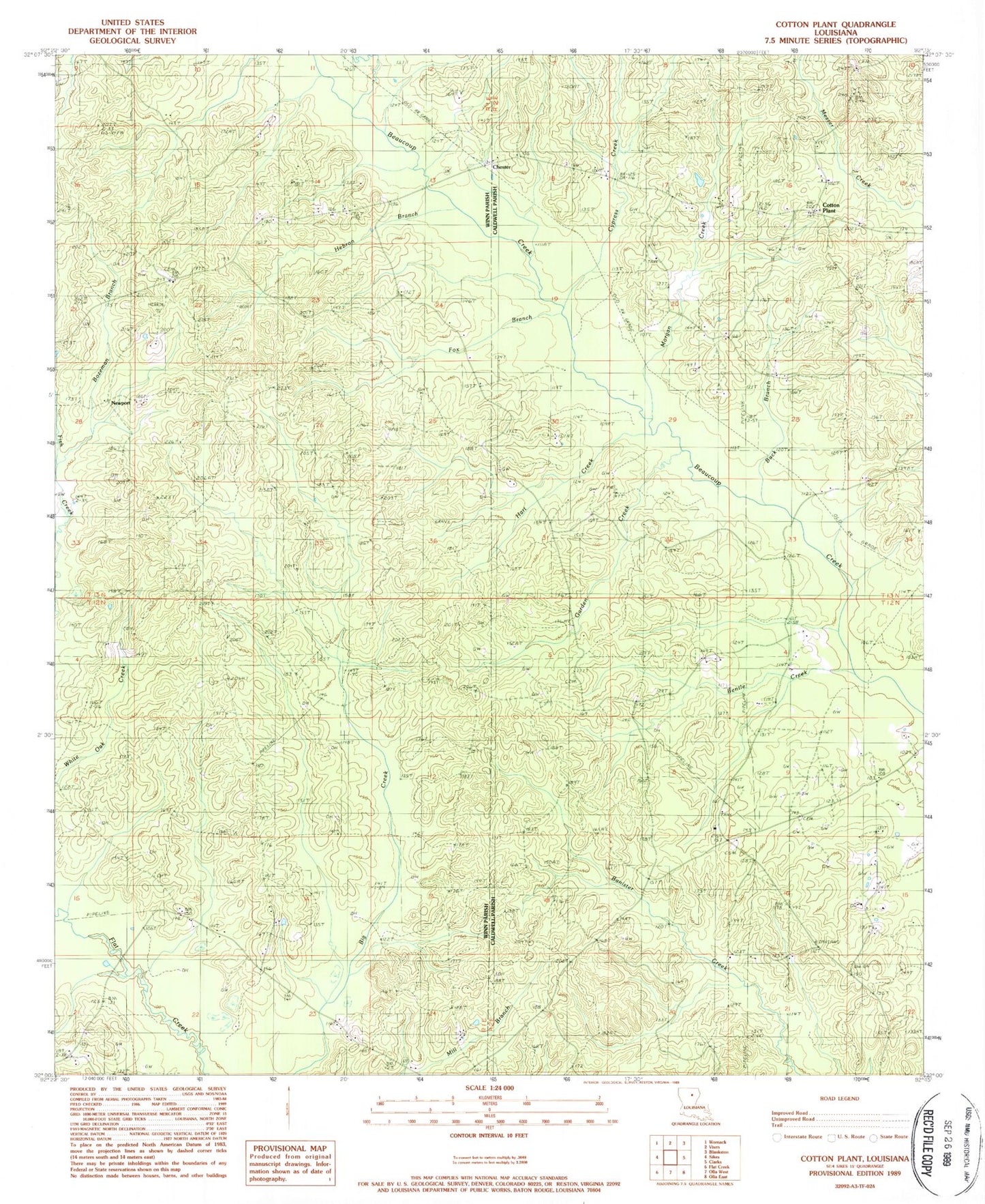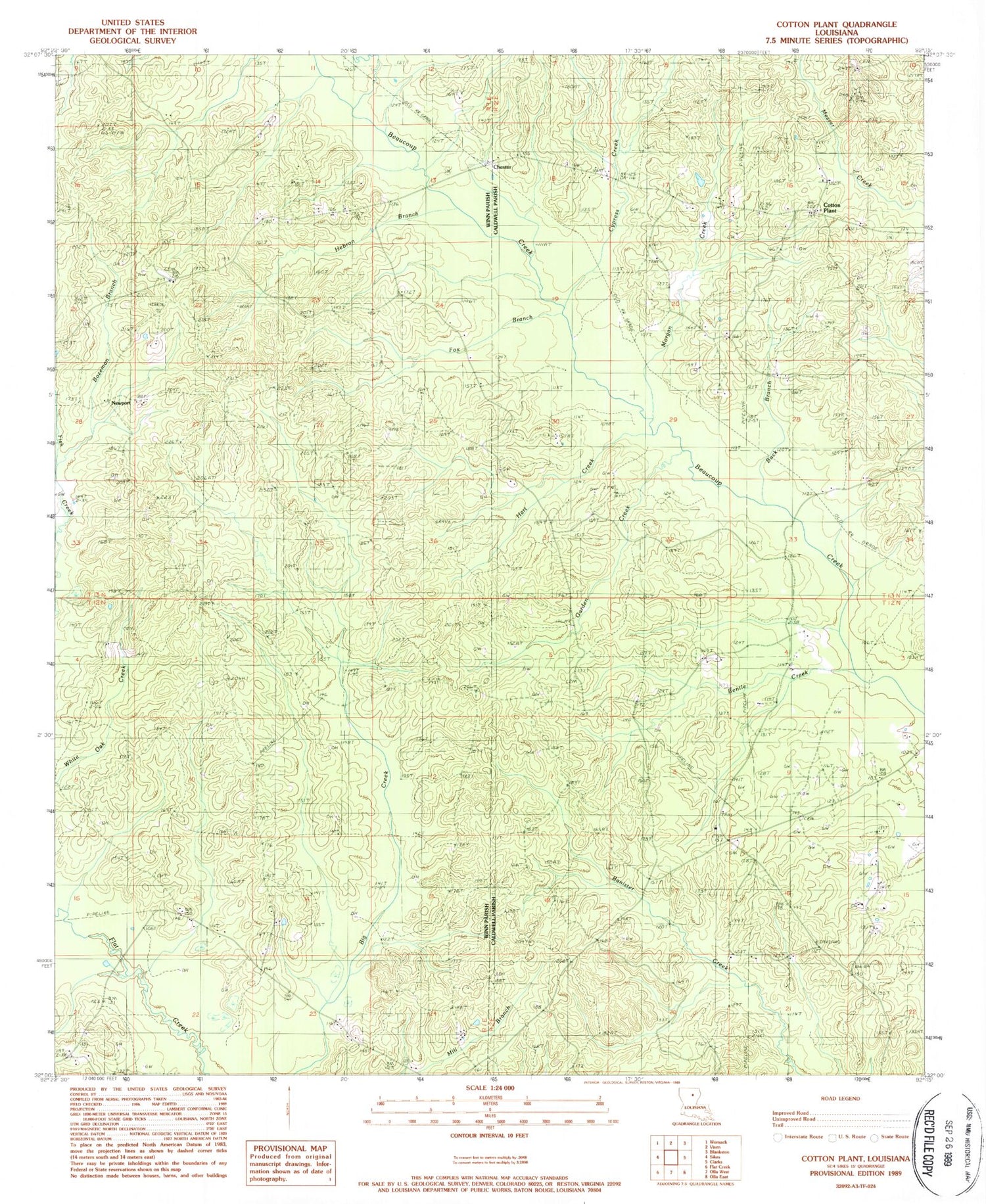
MyTopo
Classic USGS Cotton Plant Louisiana 7.5'x7.5' Topo Map
Couldn't load pickup availability
Historical USGS topographic quad map of Cotton Plant in the state of Louisiana. Map scale may vary for some years, but is generally around 1:24,000. Print size is approximately 24" x 27"
This quadrangle is in the following counties: Caldwell, Winn.
The map contains contour lines, roads, rivers, towns, and lakes. Printed on high-quality waterproof paper with UV fade-resistant inks, and shipped rolled.
Contains the following named places: Bentle Creek, Bozeman Branch, Bozeman Branch Gas Field, Buck Branch, Chester, Cotton Plant, Cotton Plant Gas Field, Cypress Creek, Fox Branch, Garden Creek, Hart Creek, Hatthaway Branch Gas Field, Hebron Baptist Church, Hebron Branch, Hebron Cemetery, Hickory Valley Gas Field, Kelly Cemetery, Lone Hill Church, McCarty Cemetery, Morgan Creek, Newport, Newport Oil and Gas Field, Newsom Cemetery, North Hickory Valley Gas Field, Northeast Hickory Valley Gas Field, Old Newport, Old Union Baptist Church, Old Union Cemetery, Piney Creek Gas Field, Powers Cemetery, Roberts Cemetery, Sardis Church, Sardis Church of Gas Field, Spring Hill Church