
MyTopo
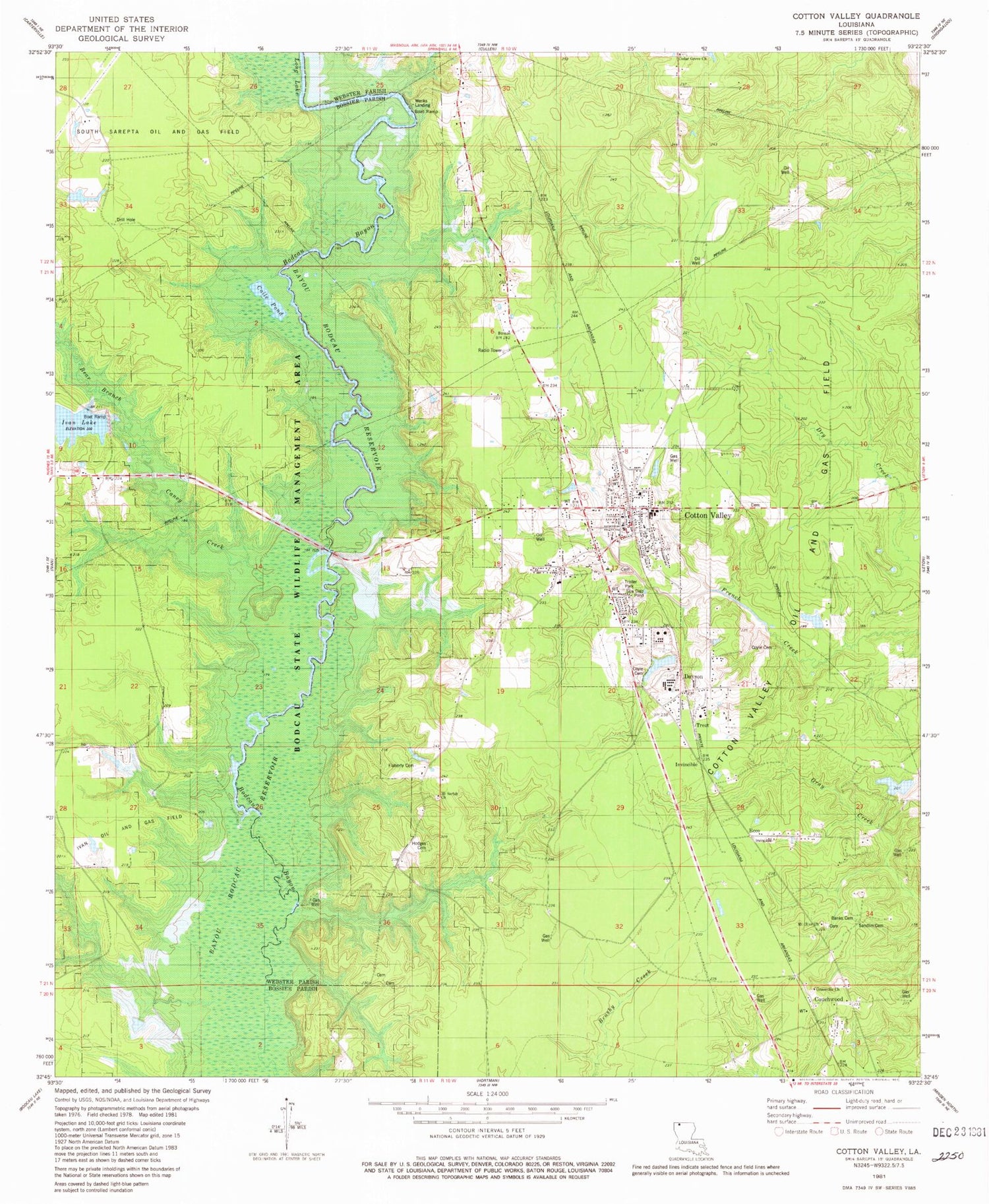
Classic USGS Cotton Valley Louisiana 7.5'x7.5' Topo Map
Couldn't load pickup availability
Historical USGS topographic quad map of Cotton Valley in the state of Louisiana. Map scale may vary for some years, but is generally around 1:24,000. Print size is approximately 24" x 27"
This quadrangle is in the following counties: Bossier, Webster.
The map contains contour lines, roads, rivers, towns, and lakes. Printed on high-quality waterproof paper with UV fade-resistant inks, and shipped rolled.
Contains the following named places: Banks Cemetery, Bear Branch, Bodcau State Wildlife Management Area, Bodeau School, Caney Creek, Cedar Grove Church, Coile Pond, Connells, Cotton Valley, Cotton Valley Police Department, Couchwood, Coyle Cemetery, Coyle Cemetery Number 2, Dayson, Ecco, Flaherty Cemetery, Greenville Church, Hodges Cemetery, Invincible, Ivan Lake Dam, Long Lake, Mount Olive Church, Mount Sariah Church, New Hortman School, North Webster Upper Elementary, Placid, Pleasant College, Sandin Cemetery, Town of Cotton Valley, Treat, Webster Parish Fire District 7 Storage Facility, Webster Parish Fire District 8 Station 1, Webster Parish Fire District 8 Station 2, Webster Parish Fire District 8 Station 3, Webster Parish Fire District 8 Station 4, Webster Parish Special Learning Center, Wenks Landing, Woodly Pond Dam, ZIP Code: 71018


