MyTopo
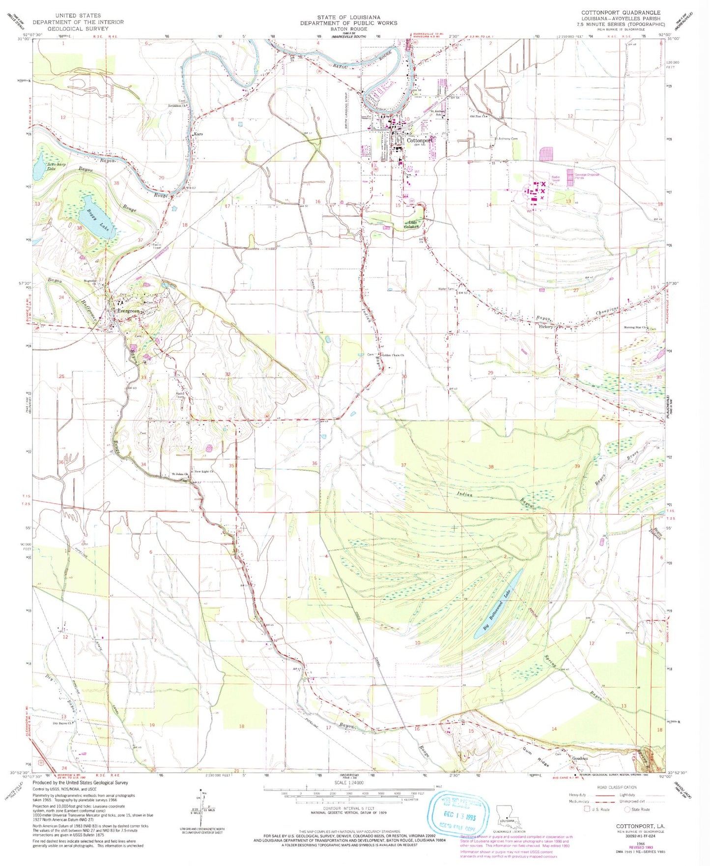
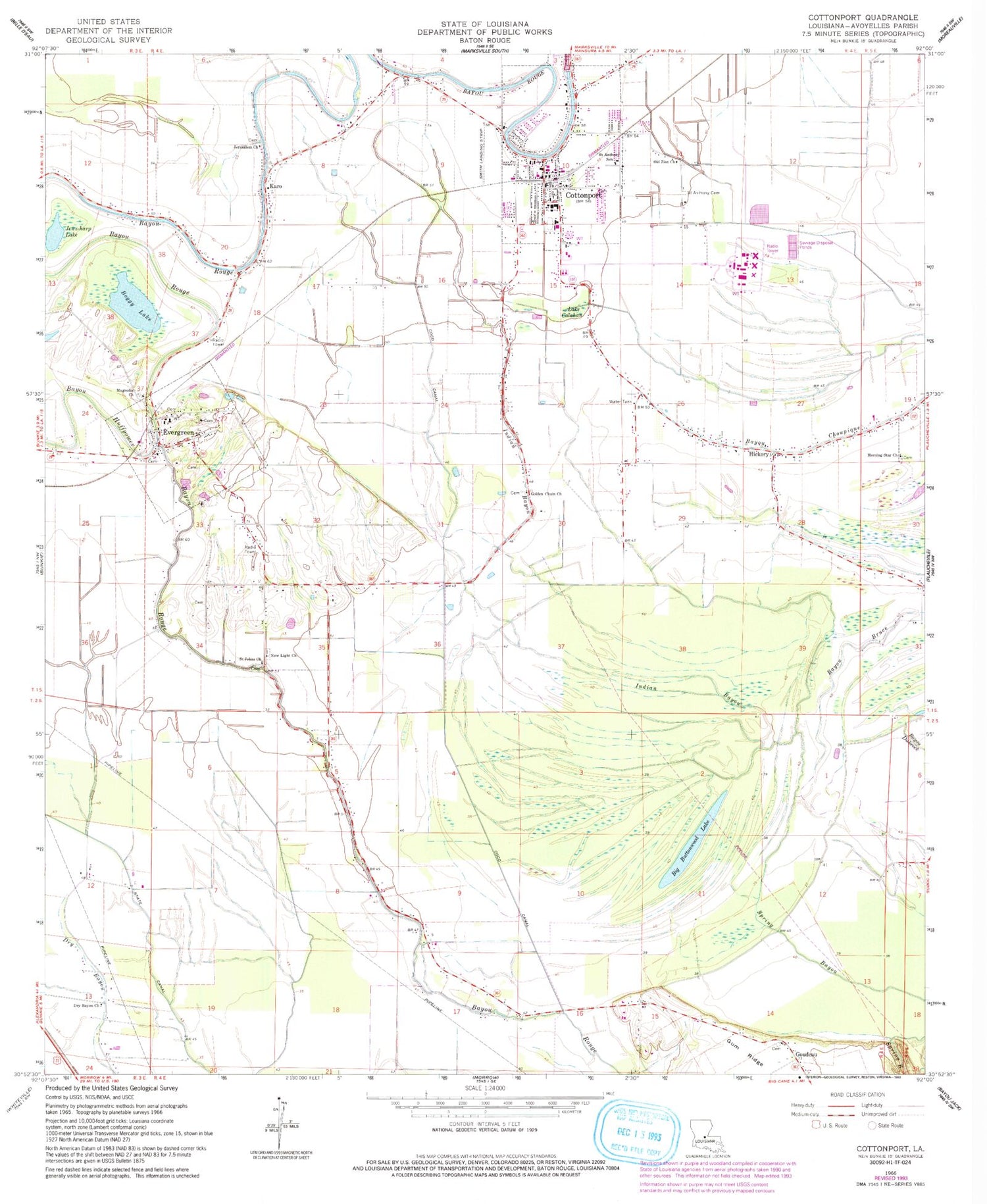
Classic USGS Cottonport Louisiana 7.5'x7.5' Topo Map
Couldn't load pickup availability
Historical USGS topographic quad map of Cottonport in the state of Louisiana. Map scale may vary for some years, but is generally around 1:24,000. Print size is approximately 24" x 27"
This quadrangle is in the following counties: Avoyelles.
The map contains contour lines, roads, rivers, towns, and lakes. Printed on high-quality waterproof paper with UV fade-resistant inks, and shipped rolled.
Contains the following named places: Avoyelles Parish Women's Correctional Center, Bayou Bruce, Bayou Huffpower, Big Buttonwood Lake, Big Cane Gas Field, Boggy Lake, Central Louisiana Technical Community College Ward H Nash Avoyelles Campus, Coco Canal, Cottonport, Cottonport Elementary School, Cottonport High School, Cottonport Police Department, Cottonport Post Office, Cottonport Volunteer Fire and Rescue, Deats, Dora, Dry Bayou Church, Enterprise, Evergreen, Evergreen High School, Evergreen Post Office, Evergreen Volunteer Fire Department, First Evening Star Baptist Church, Golden Chain Church, Hickory, Indian Bayou, Jerusalem Church, Jews-harp Lake, Karo, KRBG-FM (Bunkie), Magnolia Church, Max Airport, Morning Star Church, New Light Church, Old Zion Church, Parish Governing Authority District 11, Raymond Laborde Correctional Center, Raymond Laborde Correctional Center School, Saint Anthony Cemetery, Saint Anthony School, Saint Johns Church, Saint Mary's Assumption School, Saint Marys Catholic Church, Town of Cottonport, Town of Evergreen, Ward Nine, ZIP Codes: 71327, 71333