MyTopo
Classic USGS Cottonwood Camp Texas 7.5'x7.5' Topo Map
Couldn't load pickup availability
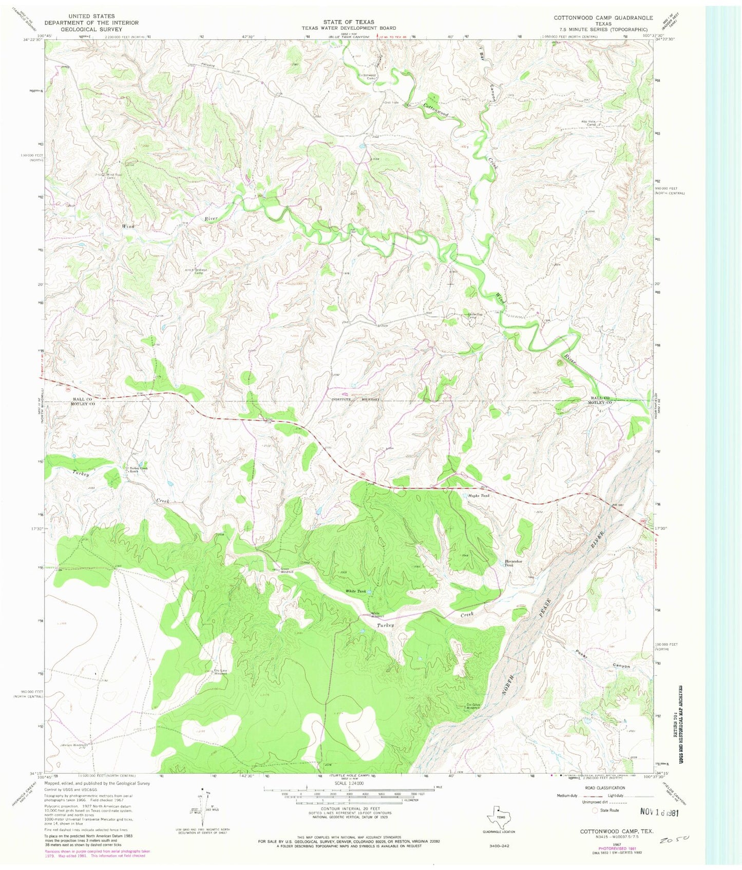
Historical USGS topographic quad map of Cottonwood Camp in the state of Texas. Map scale may vary for some years, but is generally around 1:24,000. Print size is approximately 24" x 27"
This quadrangle is in the following counties: Hall, Motley.
The map contains contour lines, roads, rivers, towns, and lakes. Printed on high-quality waterproof paper with UV fade-resistant inks, and shipped rolled.
Contains the following named places: Alto Vista Camp, Bridlebit Camp, Cedar Top Camp, Cid Gitus Windmill, Cottonwood Camp, Cottonwood Creek, Dry Lake Windmill, Green Windmill, Horseshoe Tank, Hughs Tank, Johnson Windmill, Poker Canyon, T Bar Canyon, Turkey Creek, Turkey Creek Ranch, White Tank, White Windmill, Wind River, Wind River Camp