MyTopo
Classic USGS Cottonwood Canyon Wyoming 7.5'x7.5' Topo Map
Regular price
$16.95
Regular price
Sale price
$16.95
Unit price
per
Couldn't load pickup availability
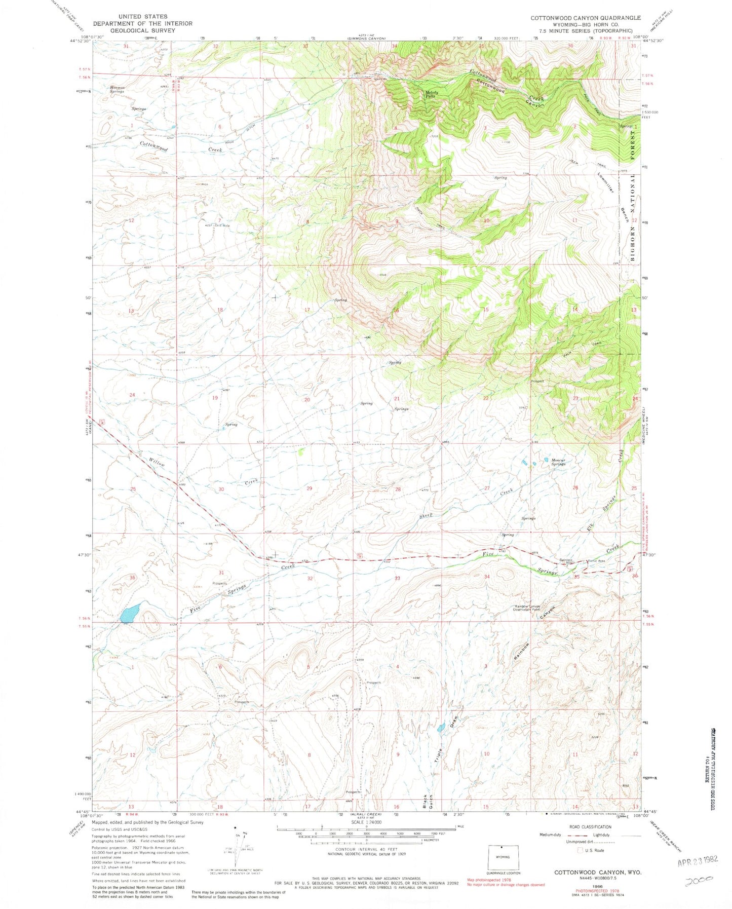
Historical USGS topographic quad map of Cottonwood Canyon in the state of Wyoming. Map scale may vary for some years, but is generally around 1:24,000. Print size is approximately 24" x 27"
This quadrangle is in the following counties: Big Horn.
The map contains contour lines, roads, rivers, towns, and lakes. Printed on high-quality waterproof paper with UV fade-resistant inks, and shipped rolled.
Contains the following named places: Cottonwood Canyon, Elk Springs Creek, Five Springs Number 1 Dam, Five Springs Number 1 Reservoir, Harmon Springs, High Ditch, Lowmiller Bench, Melody Falls, Moncur Springs, Rainbow Canyon, Rainbow Canyon Observation Point, Sheep Creek, Triple Draw