MyTopo
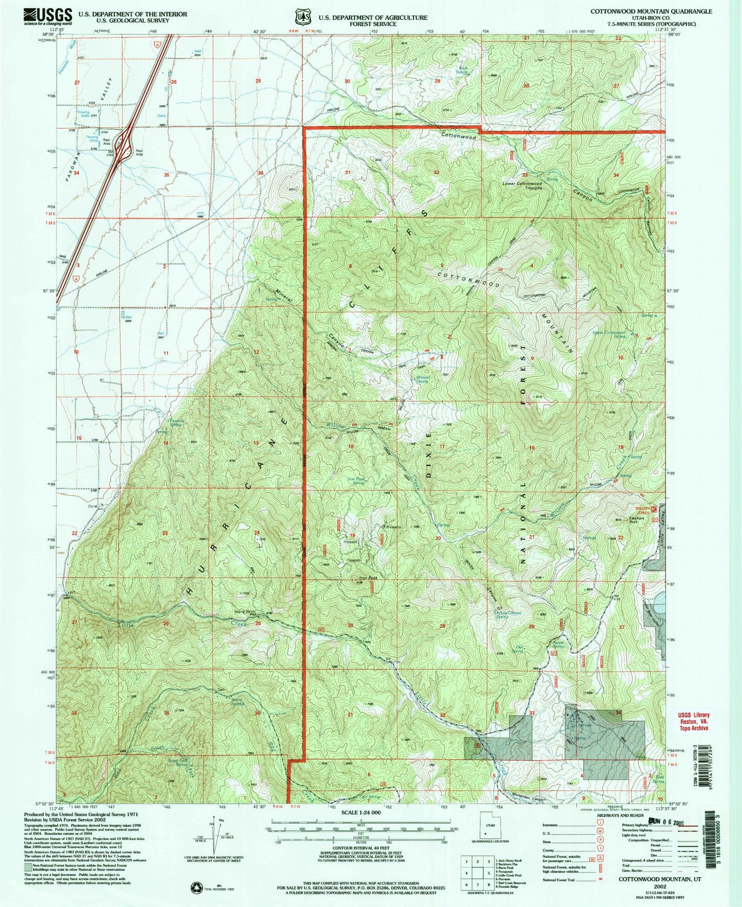
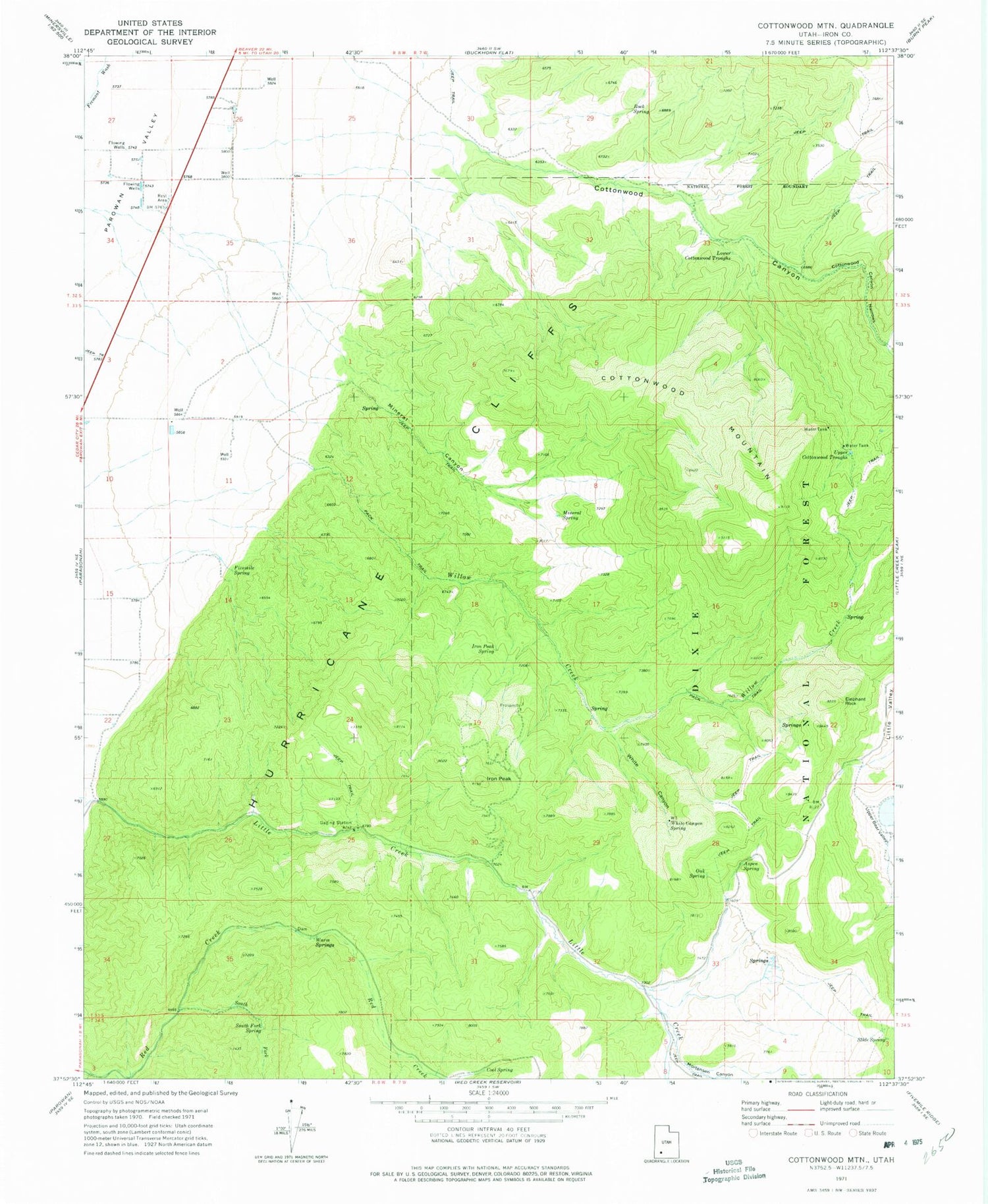
Classic USGS Cottonwood Mountain Utah 7.5'x7.5' Topo Map
Couldn't load pickup availability
Historical USGS topographic quad map of Cottonwood Mountain in the state of Utah. Map scale may vary for some years, but is generally around 1:24,000. Print size is approximately 24" x 27"
This quadrangle is in the following counties: Iron.
The map contains contour lines, roads, rivers, towns, and lakes. Printed on high-quality waterproof paper with UV fade-resistant inks, and shipped rolled.
Contains the following named places: Aspen Spring, Cool Spring, Cottonwood Canyon, Cottonwood Canyon Narrows, Cottonwood Mountain, Elephant Rock, Fivemile Spring, Iron Peak, Iron Peak Spring, Lower Cottonwood Troughs, Mineral Canyon, Mineral Spring, Mortensen Canyon, Oak Spring, Rock Spring, Slide Spring, South Fork Red Creek, South Fork Spring, Upper Cottonwood Troughs, Warm Springs, White Canyon, White Canyon Spring, Willow Creek, ZIP Code: 84760