MyTopo
Classic USGS Cottonwood Point Missouri 7.5'x7.5' Topo Map
Couldn't load pickup availability
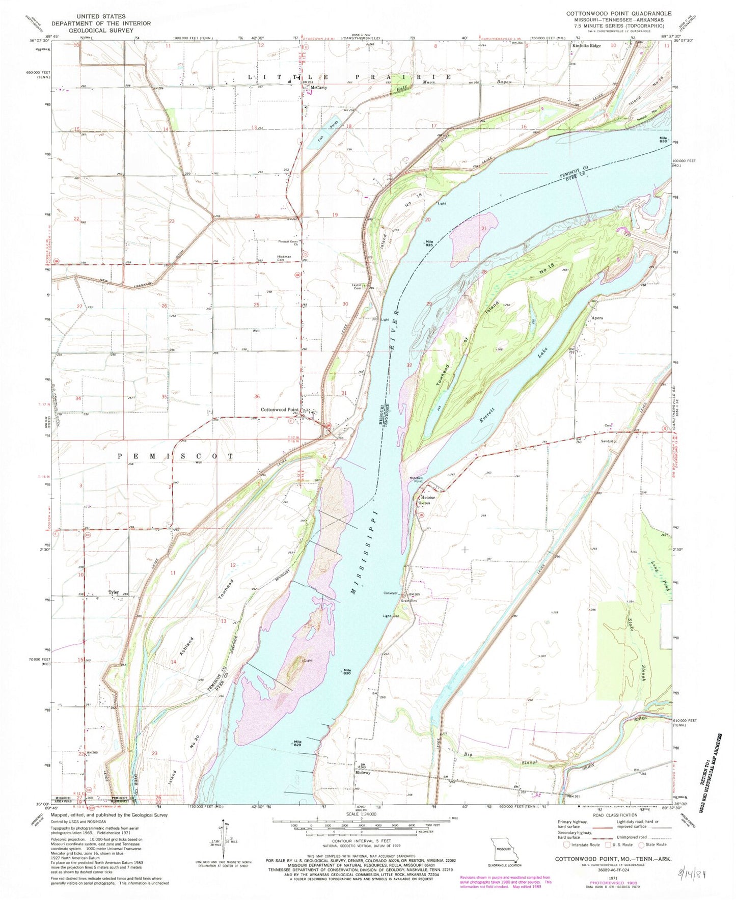
Historical USGS topographic quad map of Cottonwood Point in the states of Missouri, Tennessee. Map scale may vary for some years, but is generally around 1:24,000. Print size is approximately 24" x 27"
This quadrangle is in the following counties: Dyer, Mississippi, Pemiscot.
The map contains contour lines, roads, rivers, towns, and lakes. Printed on high-quality waterproof paper with UV fade-resistant inks, and shipped rolled.
Contains the following named places: Ashland Towhead, Ayers, Ayers Landing, Bader Bar, Big Slough, Bradleytown, Cottonwood Point, Cottonwood Point Census Designated Place, Cottonwood Point Dikes, Cottonwood Point Eagle Bar, Cottonwood Point Ferry, Cottonwood Point Landing, Everett Lake, Flag Lake School, Half Moon Bayou, Half-Moon Lake, Half-Moon Lake Dam, Head of Island Number Twentyone Dikes, Heloise, Heloise Landing, Heloise Revetment, Hickman Cemetery, Hunter School, Island Number 18, Island Number Twenty, Island Number Twenty Bar, Kinfolks Ridge, Long Pond, McCarty, McCarty School, Midway, Midway Crevasse, Mitchell Point, Needmore School, Pleasant Grove Church, Riverside Church, Skullbone, Skullbone Bar, Stake Slough, Taylor Cemetery, Towhead of Island Number Eighteen, Township of Pemiscot, Tyler