MyTopo
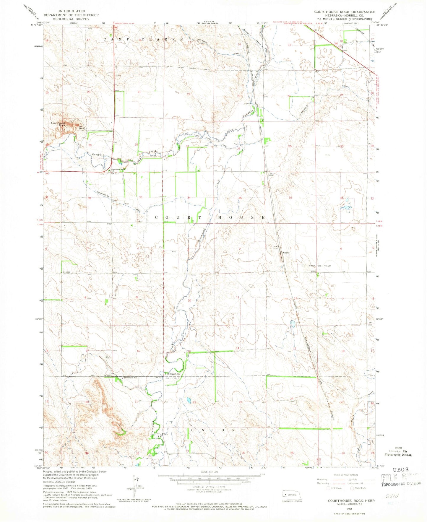
Classic USGS Courthouse Rock Nebraska 7.5'x7.5' Topo Map
Couldn't load pickup availability
Historical USGS topographic quad map of Courthouse Rock in the state of Nebraska. Map scale may vary for some years, but is generally around 1:24,000. Print size is approximately 24" x 27"
This quadrangle is in the following counties: Morrill.
The map contains contour lines, roads, rivers, towns, and lakes. Printed on high-quality waterproof paper with UV fade-resistant inks, and shipped rolled.
Contains the following named places: Alden, Courthouse and Jail Rock Golf Course, Courthouse Rock, Courthouse Rock Canal, Courthouse Rock School, East Camp Clarke Election Precinct, Greenwood Creek, Greenwood Oil Field, Greenwood School, Harless-Ogard Dam, Harless-Ogard Reservoir, Hart Oil Field, Jail Rock, Last Chance Canal, Meredith Ammer Canal