MyTopo
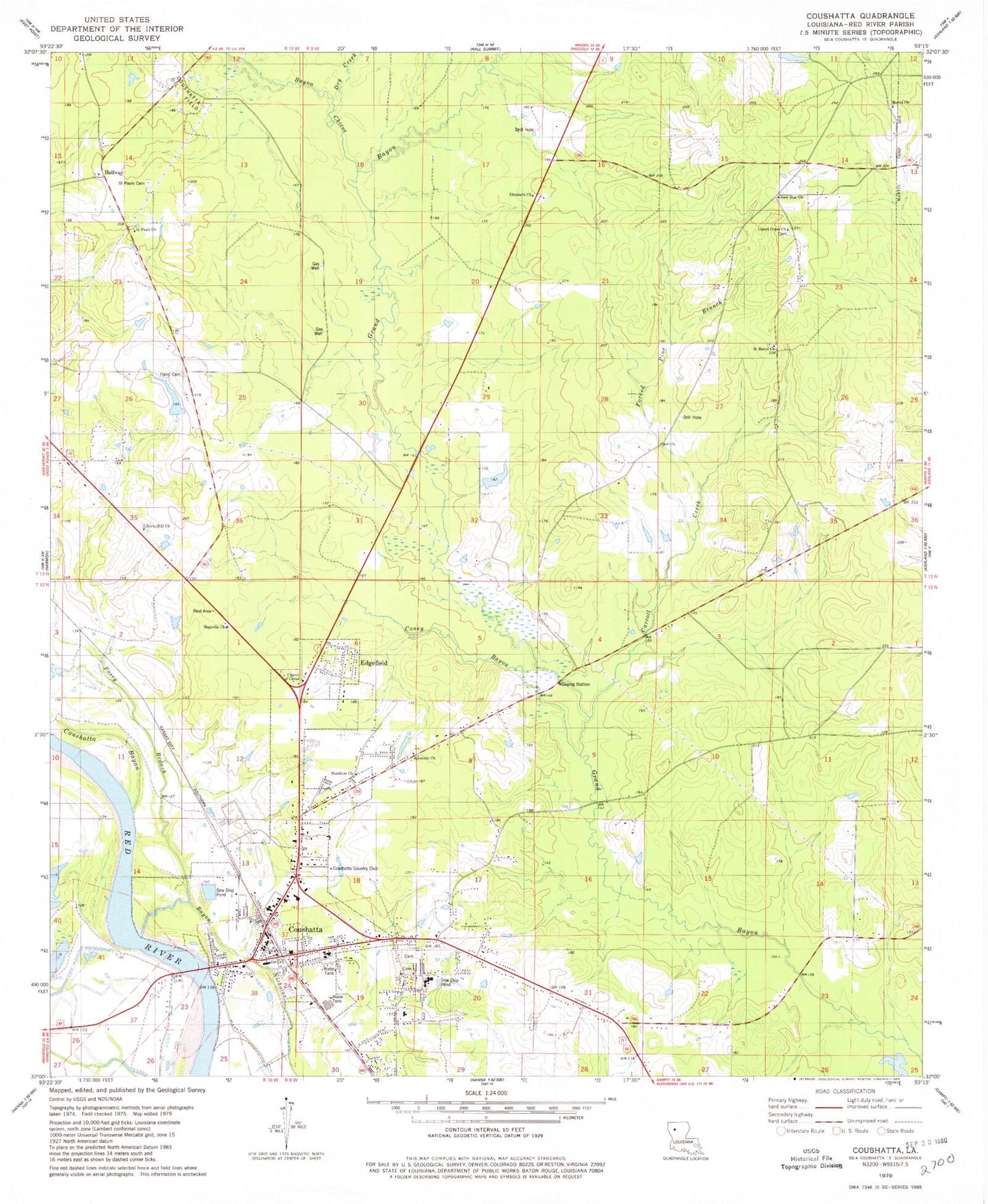
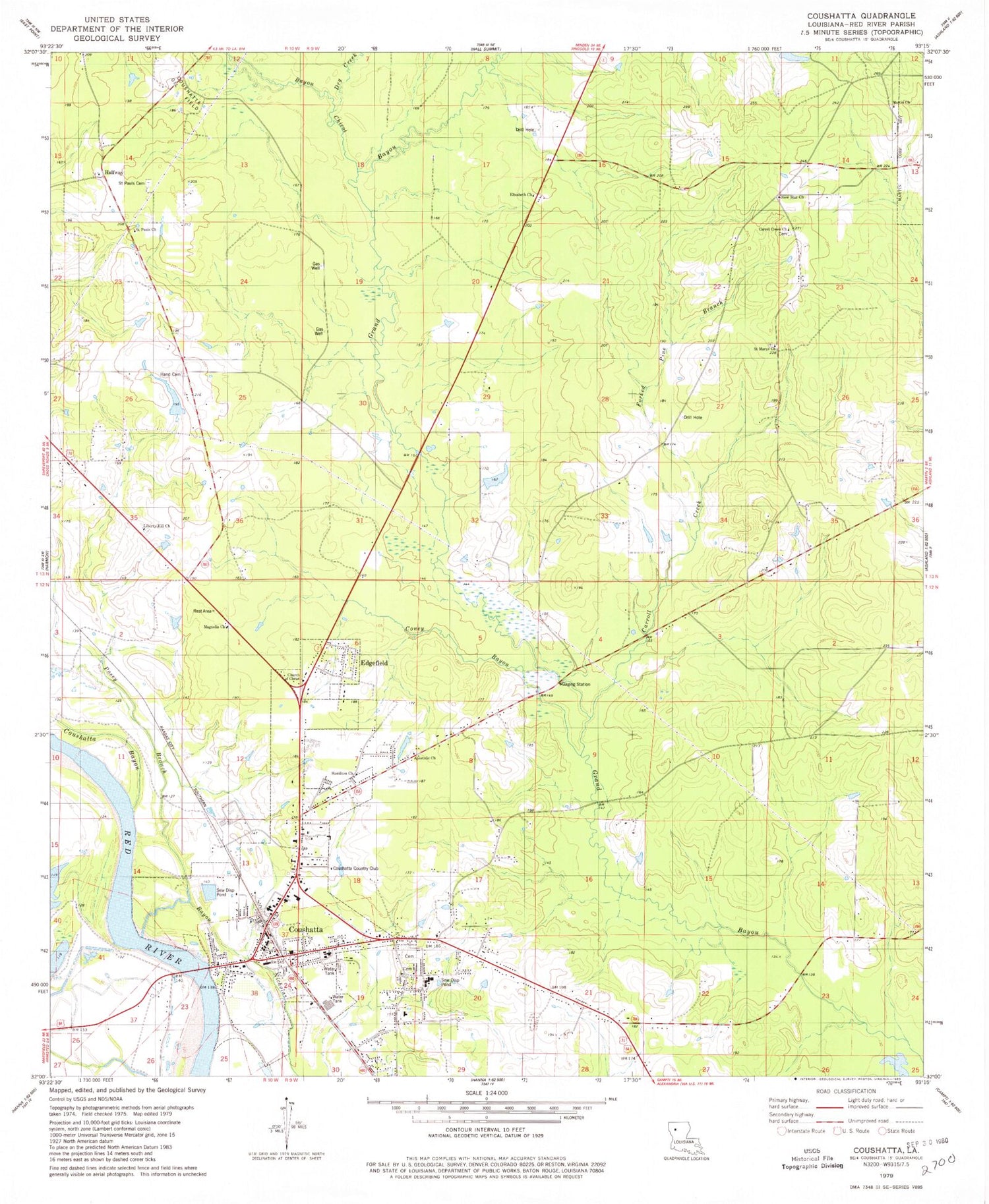
Classic USGS Coushatta Louisiana 7.5'x7.5' Topo Map
Couldn't load pickup availability
Historical USGS topographic quad map of Coushatta in the state of Louisiana. Map scale may vary for some years, but is generally around 1:24,000. Print size is approximately 24" x 27"
This quadrangle is in the following counties: Red River.
The map contains contour lines, roads, rivers, towns, and lakes. Printed on high-quality waterproof paper with UV fade-resistant inks, and shipped rolled.
Contains the following named places: Adcock Pond Dam, Apostolic Church, Bayou Chicot, Beacon Church, Carrol Creek Church, Carroll Creek, Christus Coushatta Health Care Center, Church of Christ, Coney Bayou, Coushatta, Coushatta Country Club, Coushatta Elementary School, Coushatta Oil Field, Dry Creek, Edgefield, Elizabeth Church, Forked Pine Branch, Grover Lane Church, Halfway, Hamilton Church, Hammell, Hand Cemetery, Hand Pond Dam, Jerusalem Church, Liberty Hill Church, Magnolia Church, Martin Church, New Star Cemetery, New Star Church, Parish Governing Authority District 7, Posey Branch, Red River Elementary School, Red River Fire Protection District, Red River High School, Red River Junior High School, Red River Parish, Red River Parish Courthouse, Red River Parish Sheriff's Office, Saint Marys Church, Saint Pauls Cemetery, Saint Pauls Church, Specialty Rehabilitation Hospital, Springville Cemetery, Springville Educational Center School, Stevens Plantation, Town of Coushatta, Village of Edgefield, Ward Eight, Ward Seven, Ward Six, Ward Two, Wesley Chapel Cemetery, Wesleyan Church, ZIP Code: 71019