MyTopo
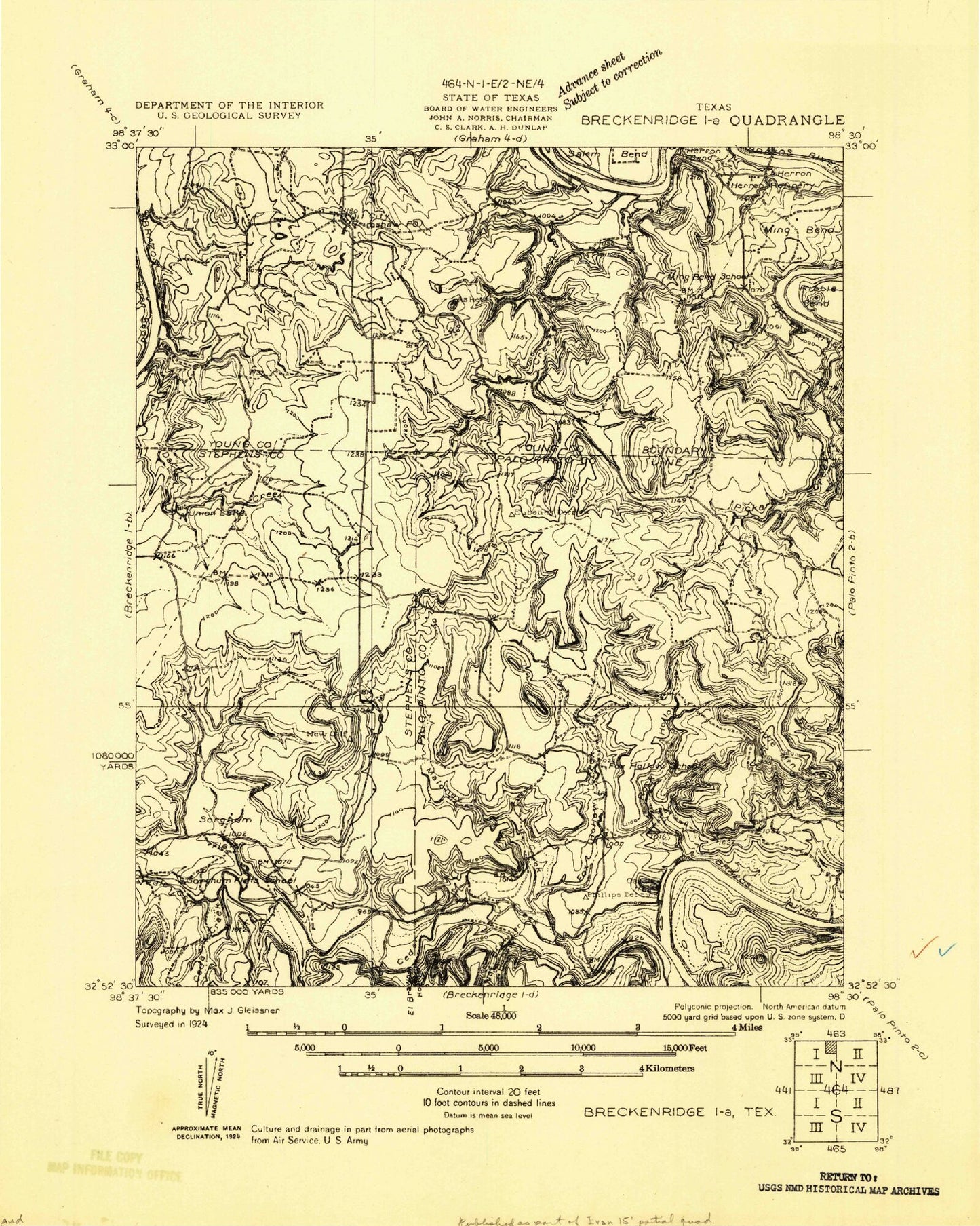
Classic USGS Cove Creek Texas 7.5'x7.5' Topo Map
Couldn't load pickup availability
Historical USGS topographic quad map of Cove Creek in the state of Texas. Map scale may vary for some years, but is generally around 1:24,000. Print size is approximately 24" x 27"
This quadrangle is in the following counties: Palo Pinto, Stephens, Young.
The map contains contour lines, roads, rivers, towns, and lakes. Printed on high-quality waterproof paper with UV fade-resistant inks, and shipped rolled.
Contains the following named places: Broadway Channel, Caudill Mountain, Cedar Creek, Cove Creek, Davis Creek, Fox Hollow Creek, Long Bend, Maloney Creek, Ming Bend Cemetery, Mountain Home Cemetery, Pickard Creek, Poor Bend, Possum Kingdom West Side Volunteer Fire Department, Possum Kingdom Westlake Volunteer Emergency Medical Service, Salem Bend, Sandy Beach, Union Lake, Union Lake Dam, Veale Creek