MyTopo
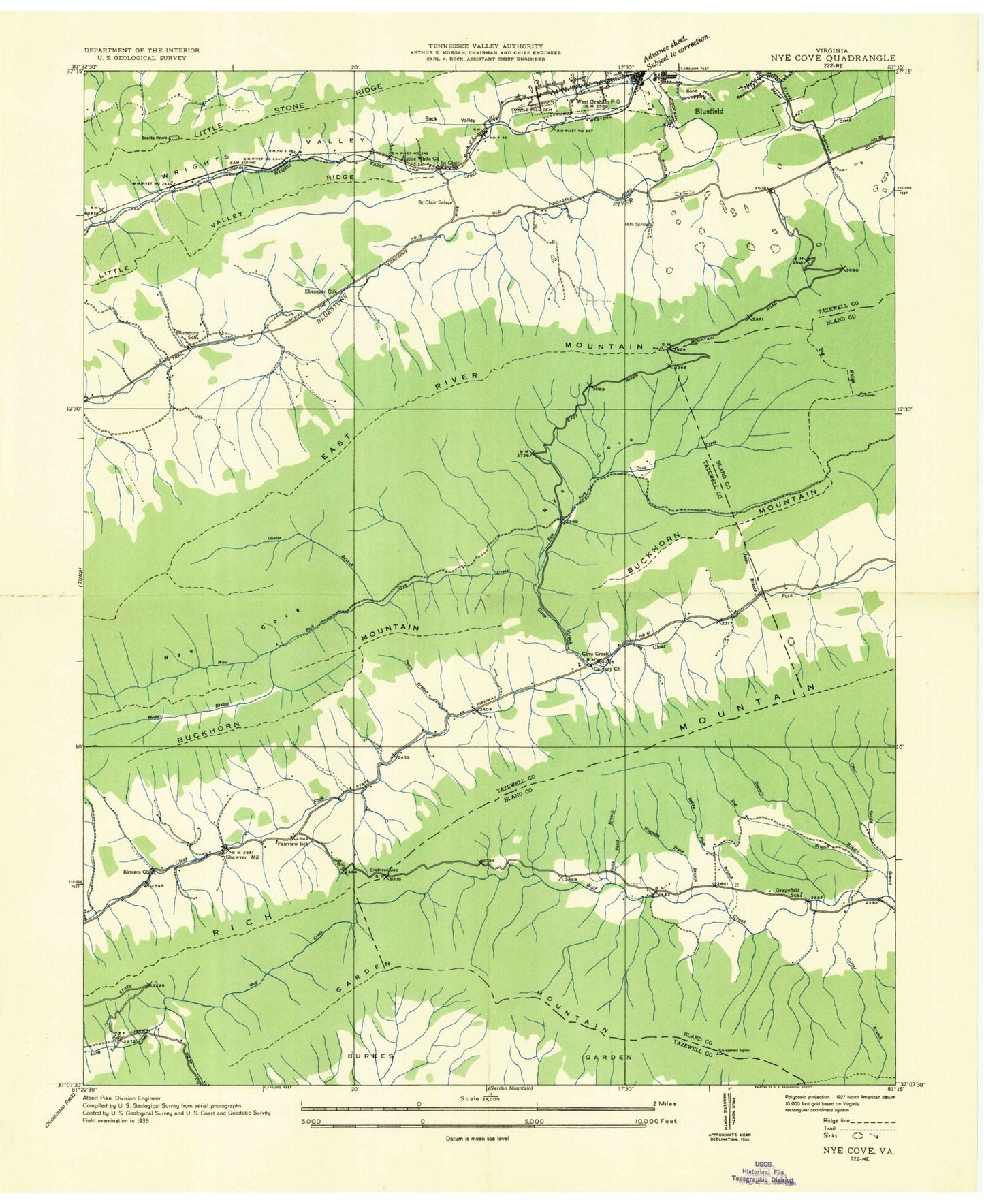
Classic USGS Cove Creek Virginia 7.5'x7.5' Topo Map
Couldn't load pickup availability
Historical USGS topographic quad map of Cove Creek in the state of Virginia. Map scale may vary for some years, but is generally around 1:24,000. Print size is approximately 24" x 27"
This quadrangle is in the following counties: Bland, Tazewell.
The map contains contour lines, roads, rivers, towns, and lakes. Printed on high-quality waterproof paper with UV fade-resistant inks, and shipped rolled.
Contains the following named places: Big Ridge, Bluefield Industrial Park, Bluefield Police Department, Bluestone School, Burkes Garden Creek, Calvary Church, Camp Joy, Carter Branch, Chestnut Grove Church, Chestnut Ridge, Clear Spring Branch, Clearfork Volunteer Fire Department, College Plaza Shopping Center, Cove Creek, Crabtree Gap, Deavers Branch, Dills Spring, Doe Hollow Gap, Dudley Primary School, East Fork Cove Creek, Eastern District, Ebenezer Church, Fairview School, Fincastle Country Club, First Assembly Christian School, Gose Knob, Gose Mill, Gose Mill Dam, Gospel Hall, Gospel Mission, Graham High School, Graham Middle School, Grandview Memory Gardens, Hemppatch Branch, Indianfield Branch, Kidd Branch, Kinzers Church, Little Creek, Maple Hill Cemetery, Mudley Branch, Nye Cove, Oneida Branch, Parkview Church, Perry Branch, Richwood Golf Club, Saint Clair, Saint Clair School, Saint Lukes Cemetery, Sam, Scott Knob, Shannandale, Shawver Mill, The Gap, Town of Bluefield, Twin City Shopping Center, Valley Vista Cemetery, Virginia Avenue United Methodist Church, Wagner Trace Branch, West Fork Cove Creek, West Graham, Wrights Valley, Wrights Valley Church, Wrights Valley Creek