MyTopo
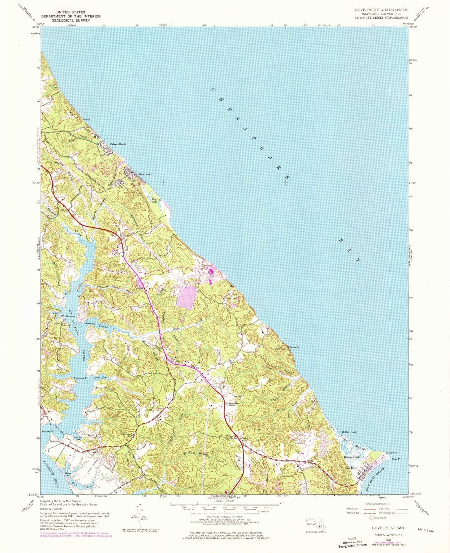
Classic USGS Cove Point Maryland 7.5'x7.5' Topo Map
Couldn't load pickup availability
Historical USGS topographic quad map of Cove Point in the state of Maryland. Typical map scale is 1:24,000, but may vary for certain years, if available. Print size: 24" x 27"
This quadrangle is in the following counties: Calvert, Dorchester.
The map contains contour lines, roads, rivers, towns, and lakes. Printed on high-quality waterproof paper with UV fade-resistant inks, and shipped rolled.
Contains the following named places: Breedens Point, Calvert Beach Run, Camp Conoy, Cove Point, Cove Point Hollow, Cove Point Marsh, Egypt Cove, Flag Ponds, Goldstein Branch, Grays Creek, Grover Creek, Grovers Creek, Johns Creek, Kings Creek, Laveel Branch, Mears Cove, Mears Creek, Middleham Chapel, Mosley Branch, Perrin Branch, Planters Wharf Creek, Quakers Swamp, Rodney Point, Rollins Cove, Saint Johns Church, Saint Leonard Creek, Saint Paul Branch, Saint Pauls Church, Saw Pit Cove, Thomas Branch, Webster Ponds, Wilbur Pond, Woodland Branch, Rocky Point, Planters Wharf, Cove Camp, Bertha, Calvert Beach, Cove Point, Long Beach, Lusby, Sollers, Columbia Lng Secondary Dam, Clng Cove Point Heliport, Appeal School, Bay Breeze Girl Scout Camp, Brianwood, Brooms Island, Calvert Beach Estates, Calvert Beach Park, Calvert Cliffs Nuclear Powerplant, Calvert Cliffs State Park, Calvary Bible Church, Cape Leonard, Chesapeake Country Club, Chesapeake Cove Estates, Cove of Calvert, Cove Point Park, Cove Point Woods, Cove Point Beach, Cove Point Lighthouse, Flag Harbor, Flag Ponds Park, Fort Hill, Grapevine Cove, Lusby Post Office, Middleham Cemetery, Mosley Acres, Norris Cove Camp, Nutts Cliffs, Papas, Planters Wharf (historical), Saint Johns Methodist Cemetery, Saint Leonard (historical), Saint Leonard Shores, Saint Paul United Methodist Cemetery, Southern School, Walnut Cove, Western Shore Estates, White Sands, District 1 Solomons Island, Flag Ponds Nature Park, Richardsons Pond, Todds Pond, Duncans Pond, Solomons Volunteer Rescue Squad and Fire Department Company 3 Substation, Patuxent Elementary School, Middleham and Saint Peters Episcopal Day School, Saint Leonard Elementary School, Calvert Beach-Long Beach Census Designated Place (historical), Saint Leonard Census Designated Place, Calvert County Public Library Library - Southern Branch, Cheasapeake Hills Golf Club, Calvert Beach Census Designated Place, Long Beach Census Designated Place, Osborn Cove