MyTopo
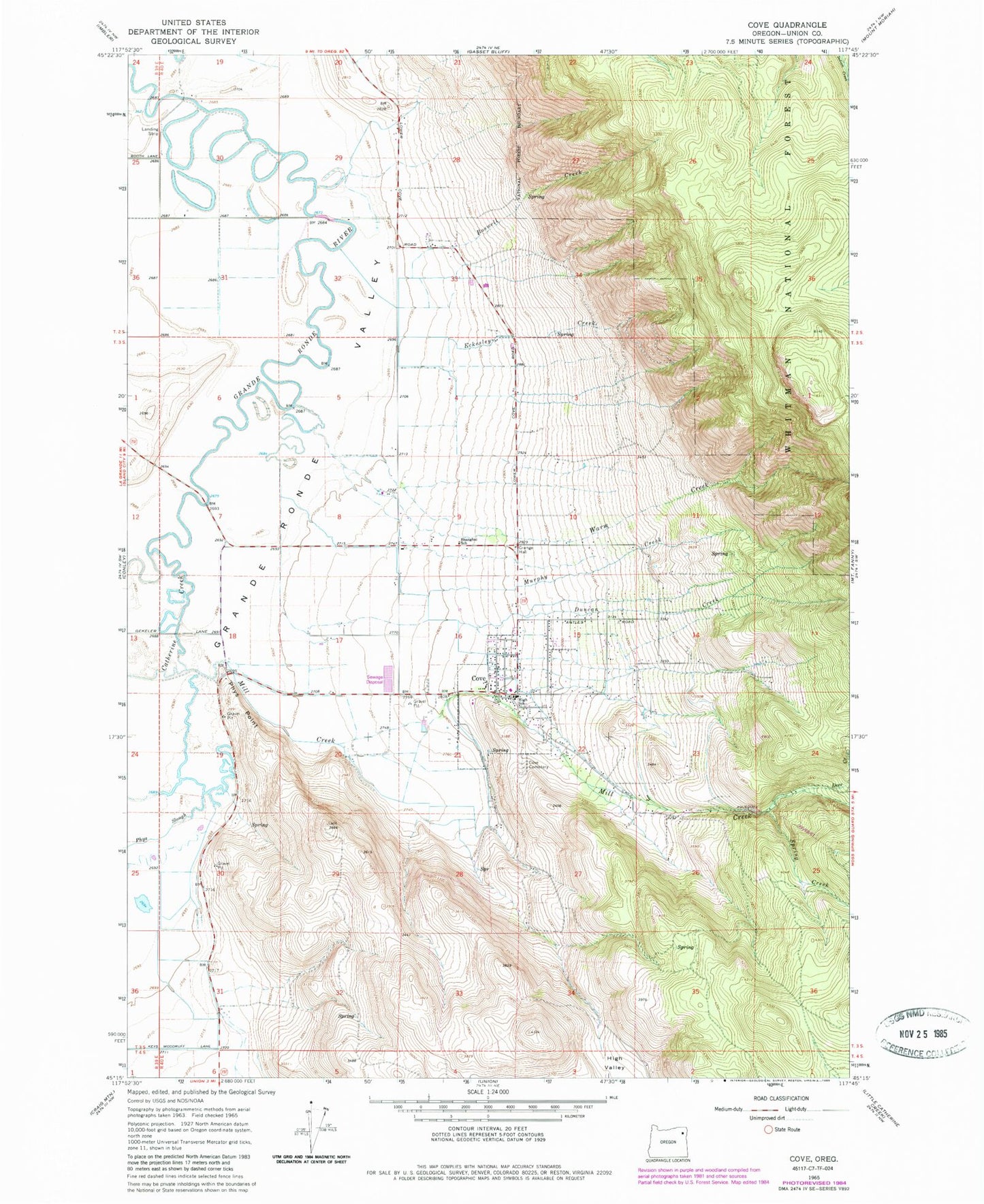
Classic USGS Cove Oregon 7.5'x7.5' Topo Map
Couldn't load pickup availability
Historical USGS topographic quad map of Cove in the state of Oregon. Typical map scale is 1:24,000, but may vary for certain years, if available. Print size: 24" x 27"
This quadrangle is in the following counties: Union.
The map contains contour lines, roads, rivers, towns, and lakes. Printed on high-quality waterproof paper with UV fade-resistant inks, and shipped rolled.
Contains the following named places: Boswell Creek, Catherine Creek, Cove Cemetery, Deer Creek, Duncan Creek, Eckesley Creek, Mill Creek, Murphy Creek, Phys Point, Phys Slough, Shanghai School (historical), Spring Creek, Warm Creek, Bobington Branch, Millard Branch, Hulick Branch, Cove Hot Springs, Elmers Reservoir 1, Elmers Reservoir 2, Elmers Reservoir 3, Hohstadt Reservoir, Elmer Dam Number Three, Elmer Dam Number Four, Elmers Reservoir 4, Cove, Wagner Springs, Cove Post Office, City of Cove, Cove School, Cove Rural Fire Protection District, Cove Side Ranch Port Airport, Cove Sewer Treatment Plant, Cove City Hall, Cove Public Library