MyTopo
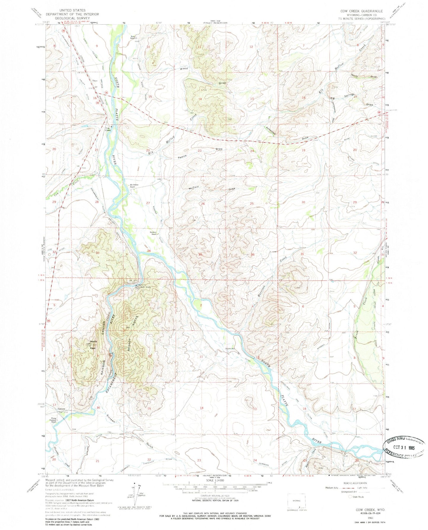
Classic USGS Cow Creek Wyoming 7.5'x7.5' Topo Map
Couldn't load pickup availability
Historical USGS topographic quad map of Cow Creek in the state of Wyoming. Map scale may vary for some years, but is generally around 1:24,000. Print size is approximately 24" x 27"
This quadrangle is in the following counties: Carbon.
The map contains contour lines, roads, rivers, towns, and lakes. Printed on high-quality waterproof paper with UV fade-resistant inks, and shipped rolled.
Contains the following named places: Adams Ditch, Antelope Draw, Baggot Rocks, Beaver Creek, Big Springs Draw, Brush Creek Supply Ditch, Canyon, Cherokee Creek, Cornerstone Draw, Cow Creek, Cyclops Ditch, Days, Donzelman and Tilton Ditch, Elk Hollow Creek, Elk Hollow Ditch, Elk Hollow Ranch, Encampment Platte Valley Ditch, Encampment River, Flying Diamond Ranch, Harrison Creek, Hopkins Number 1 Ditch, Loski Ditch, McCold Draw, Needle Peak, North Draw, Paine Deposit, Pearce Draw, Rainbow Canyon, Rainbow Ranch, Reynolds Run, Ridding Number 1 Ditch, Ryan Ranch, Sixteen Gulch, Windall Ditch, Wood Draw, Wyco Club