MyTopo
Classic USGS Cow Face Hill Montana 7.5'x7.5' Topo Map
Couldn't load pickup availability
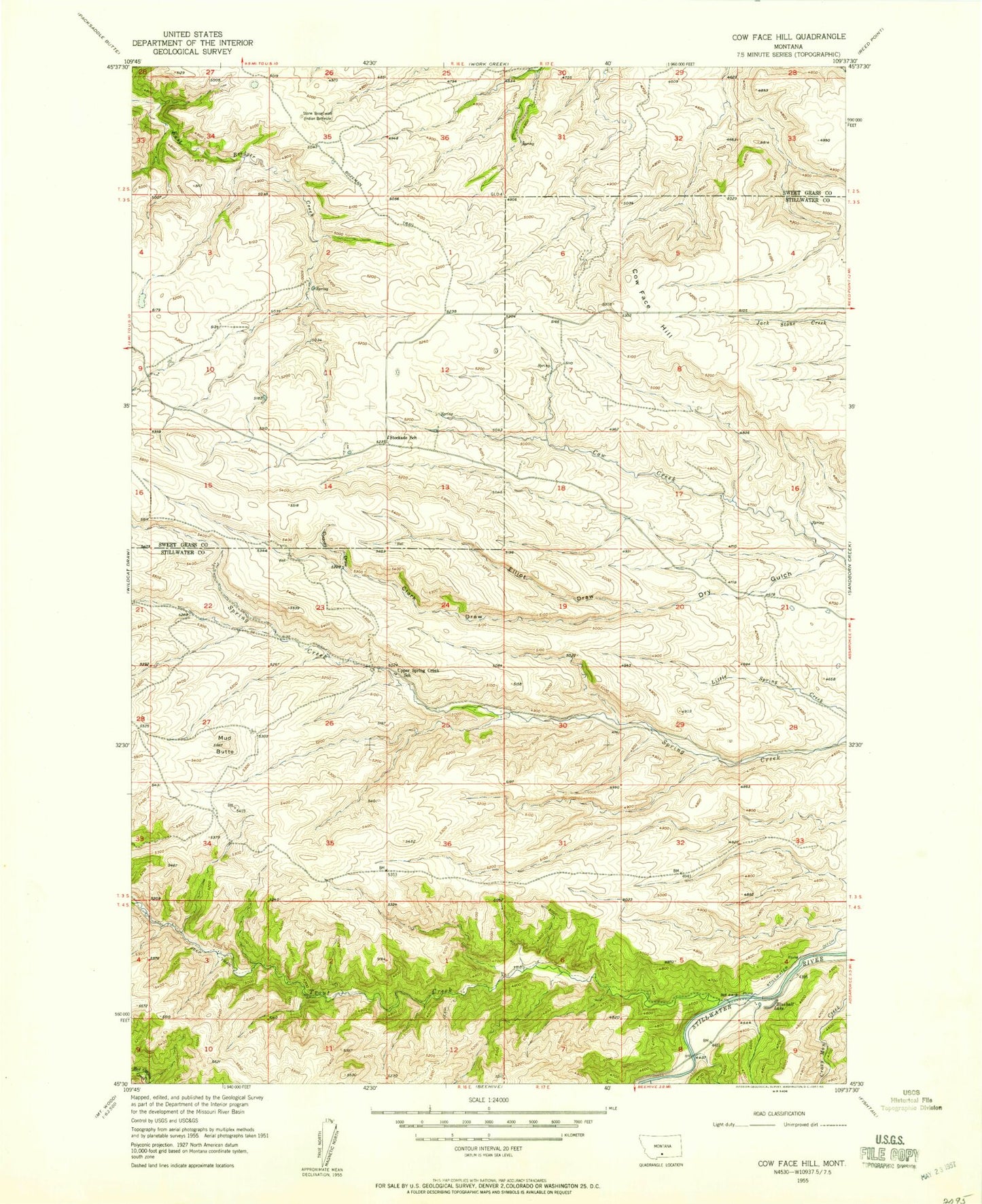
Historical USGS topographic quad map of Cow Face Hill in the state of Montana. Map scale may vary for some years, but is generally around 1:24,000. Print size is approximately 24" x 27"
This quadrangle is in the following counties: Stillwater, Sweet Grass.
The map contains contour lines, roads, rivers, towns, and lakes. Printed on high-quality waterproof paper with UV fade-resistant inks, and shipped rolled.
Contains the following named places: 04S17E08BDDA01 Well, Blueball Lake, Clark Draw, Cliff Swallow Fishing Access Site, Cow Face Hill, Crazy Man Creek, Cudney Draw, Dry Gulch, Elliot Draw, Mud Butte, Springcreek Post Office, Stockade Post Office, Stockade School, Stone Breastwork Indian Battlesite, Trout Creek, Upper Spring Creek School