MyTopo
Classic USGS Coweta Oklahoma 7.5'x7.5' Topo Map
Couldn't load pickup availability
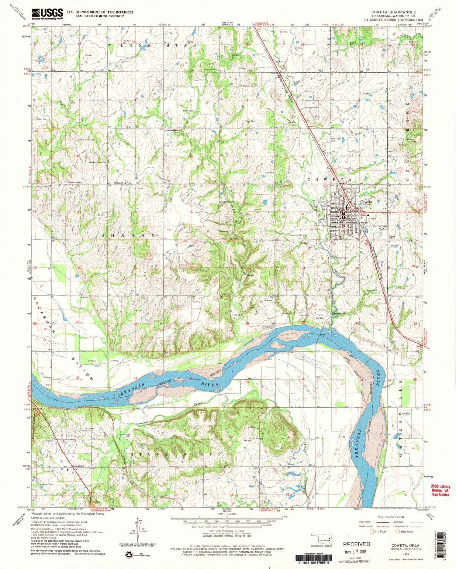
Historical USGS topographic quad map of Coweta in the state of Oklahoma. Map scale may vary for some years, but is generally around 1:24,000. Print size is approximately 24" x 27"
This quadrangle is in the following counties: Wagoner.
The map contains contour lines, roads, rivers, towns, and lakes. Printed on high-quality waterproof paper with UV fade-resistant inks, and shipped rolled.
Contains the following named places: Anderson Cemetery, Atkins Cemetery, Broken Arrow Church, Bruner Cemetery, Cedar Creek, Cedar Creek Church, Central Elementary School, Christian Church, Church of Christ, Church of God of Prophesy, City of Coweta, Coweta, Coweta Baptist Church, Coweta Creek, Coweta Fire Department, Coweta High School, Coweta Intermediate Elementary School, Coweta Police Department, Coweta Post Office, First Baptist Church, Gipson Cemetery, IOOF Cemetery, Jackson Cemetery, Jackson Grove Cemetery, Jackson Grove Church, Kadashan Bottom, Kadashan Bottom Site 2 Dam, Kadashan Bottom Site 2 Reservoir, Kadashan Bottom Site 3 Dam, Kadashan Bottom Site 3 Reservoir, Kadashan Bottom Site 4 Dam, Kadashan Bottom Site 4 Reservoir, Kadashan Bottom Site 5 Dam, Kadashan Bottom Site 5 Reservoir, Kadashan Bottom Site 6 Dam, Kadashan Bottom Site 6 Reservoir, Kelley Cemetery, Kelly Lake, Memorial Park Cemetery, Miller Cemetery, Northwest Elementary School, Potter Cemetery, Prairie Glade School, Saint Vincent De Paul Church, Shahan Cemetery, Shahan Church, Southside Elementary School, Stone Bluff Volunteer Fire Department, Stonebluff, Tiger Cemetery, Tom Kelly Lake Dam, Township of Coweta, Township of Shahan, Township of Stone Bluff, Vernon Cemetery, Wilson Chapel, ZIP Code: 74429


