MyTopo
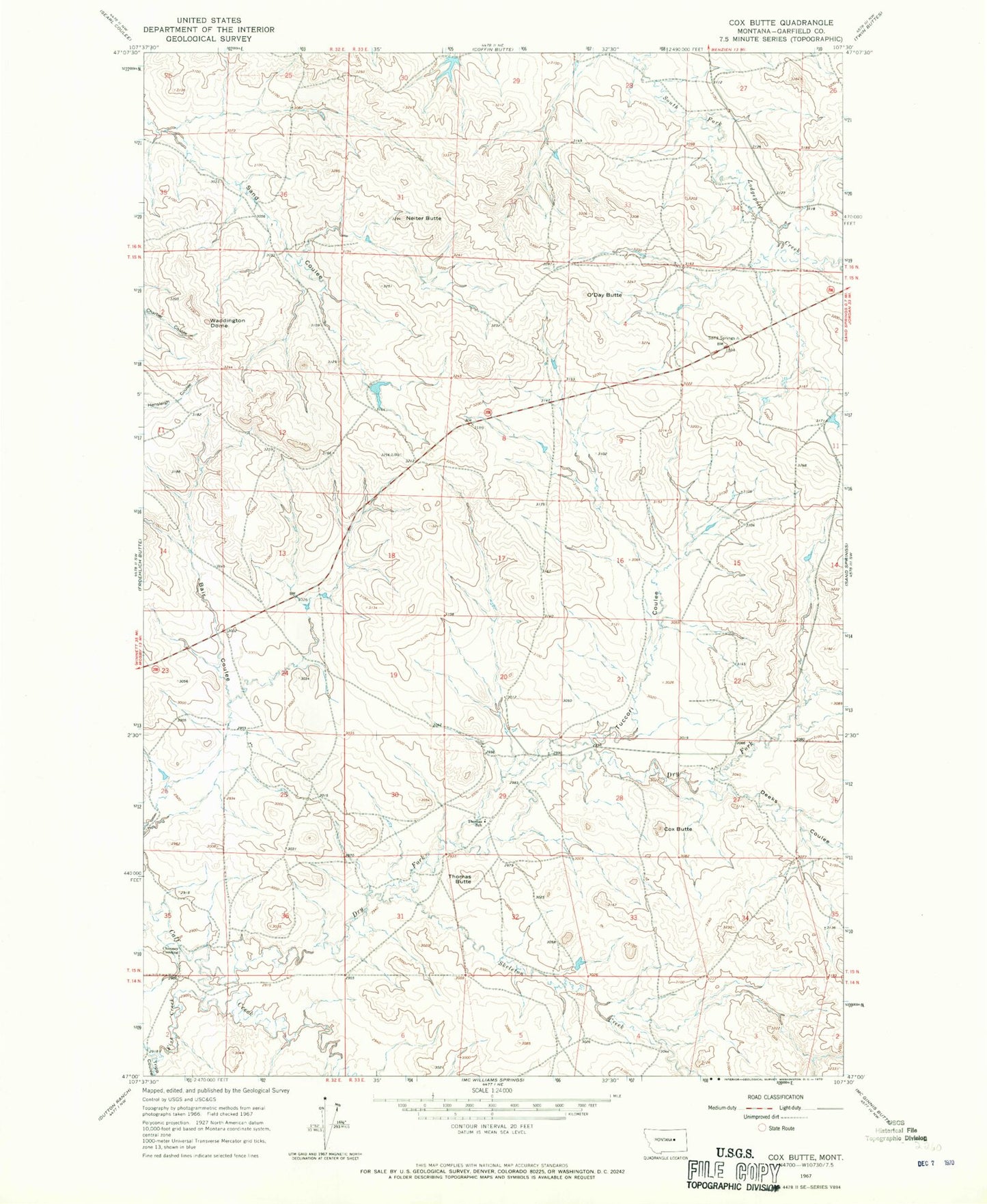
Classic USGS Cox Butte Montana 7.5'x7.5' Topo Map
Regular price
$16.95
Regular price
Sale price
$16.95
Unit price
per
Couldn't load pickup availability
Historical USGS topographic quad map of Cox Butte in the state of Montana. Map scale may vary for some years, but is generally around 1:24,000. Print size is approximately 24" x 27"
This quadrangle is in the following counties: Garfield.
The map contains contour lines, roads, rivers, towns, and lakes. Printed on high-quality waterproof paper with UV fade-resistant inks, and shipped rolled.
Contains the following named places: Brown Number 3 Dam, Chimney Crossing, Cox Butte, Deeks Coulee, Dry Fork Calf Creek, Fish Creek, Neiter Butte, O'Day Butte, Sand Springs Strip, Skeleton Creek, Thomas Butte, Thomas School, Tripp Coulee, Tuccori Coulee, Waddington Dome