
MyTopo
Classic USGS Coy Alabama 7.5'x7.5' Topo Map
Couldn't load pickup availability
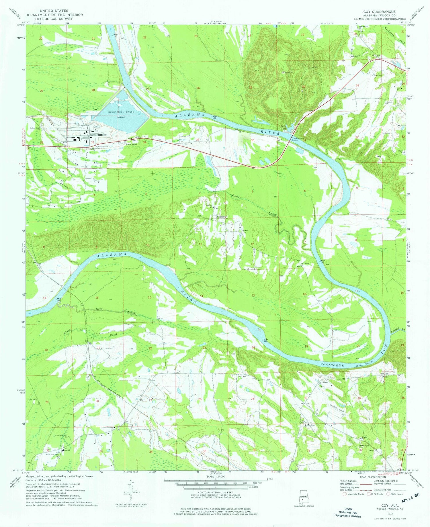
Historical USGS topographic quad map of Coy in the state of Alabama. Map scale may vary for some years, but is generally around 1:24,000. Print size is approximately 24" x 27"
This quadrangle is in the following counties: Wilcox.
The map contains contour lines, roads, rivers, towns, and lakes. Printed on high-quality waterproof paper with UV fade-resistant inks, and shipped rolled.
Contains the following named places: Barbars Landing, Beauford Landing, Bethel Church, Black Bluff, Black Bluff Landing, Blacks Bluff, Brox Mcintosh Dam, Brox Mcintosh Lake, Burford Cemetery, Coal Bluff, Coal Bluff Landing, Cook Cemetery, Coy, Coy Normal School, Coy Post Office, Coy School, Coy Volunteer Fire Department, Deers Wood Yard Landing, Dunns Creek, Ead Ferry Landing, Evans Lower Bar, Evans Upper Bar, Frank Dobson Bridge, Grey Creek, Gullett Bluff, Gullettes Bluff Landing, Gulletts Bluff Park, H. S. Evans Landing, Hobbs Island, Hobbs Landing, Holleys Ferry Access Point Park, Holly Ferry, Lake Glen, Little Zion Number 1 Church, Little Zion Number 2 Church, MacMillan Bloedel Incorporated Waste Pond, Matthews Bar, McNeils Bar, McNeils Landing, McPherson Cemetery, Mount Gillard Church, Mount Pleasant Church, Nellie, New Providence Church, Pursley Creek, Reeves Bar, Ross Landing, Ryals Lake, S E Ryals Dam, Saint Emanuel Church, Saint Louis Church, Sheppard, Spiritual Power Church, Tait Bar, Tait Cemetery, Tait Island, Taits Middle Landing, Tate Bar Landing, Tate Junior High School, Tates Chapel, Town of Yellow Bluff, Unity Church, Uxapita, Walnut Bluff, Wilcox Bar, Yellow Bluff, Yellow Bluff Church, Yellow Jacket Bar


