MyTopo
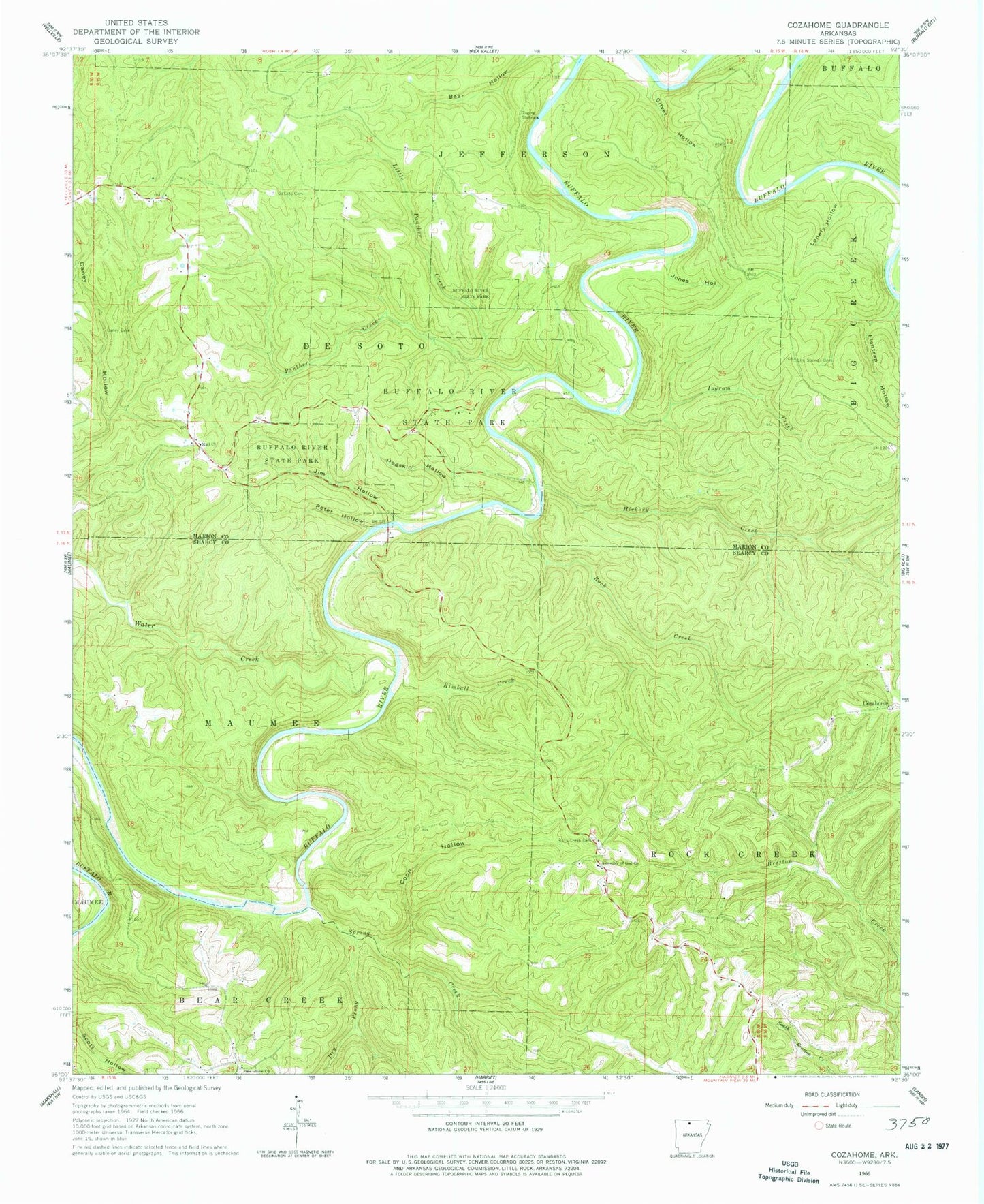
Classic USGS Cozahome Arkansas 7.5'x7.5' Topo Map
Couldn't load pickup availability
Historical USGS topographic quad map of Cozahome in the state of Arkansas. Typical map scale is 1:24,000, but may vary for certain years, if available. Print size: 24" x 27"
This quadrangle is in the following counties: Marion, Searcy.
The map contains contour lines, roads, rivers, towns, and lakes. Printed on high-quality waterproof paper with UV fade-resistant inks, and shipped rolled.
Contains the following named places: Buffalo River State Park, Coon Hollow, DeSoto Cemetery, Dry Prong Spring Creek, Elm Springs Cemetery, Hogskin Hollow, Ingram Creek, Jim Hollow, Jones Hollow, Kimball Creek, Little Panther Creek, Lonely Hollow, Panther Creek, Peter Hollow, Pine Grove Church, Rock Creek, Rock Creek Cemetery, Rush Creek, Silver Hollow, Spring Creek, Water Creek, Cozahome, Mull, Sylvia (historical), Panther Hollow, Keystone (historical), Township of Maumee (historical), Township of De Soto (historical), Township of Jefferson (historical), Assembly of God Church, Evening Star, Brantley Ford, Dog Leg Chute, Petits Chute, Roaring Rock, Silver Hollow Shoal, Weast Ford, Fishtrap Hollow, Hickory Creek, Mull Church of Christ, Mull School (historical), Harriet - Rock Creek Cosey Home Fire Station, Ralph - Caney Rural Fire Protection, Indian Rockhouse, Brantley Cemetery, Shipman Cemetery