MyTopo
Classic USGS Crabtree Oregon 7.5'x7.5' Topo Map
Couldn't load pickup availability
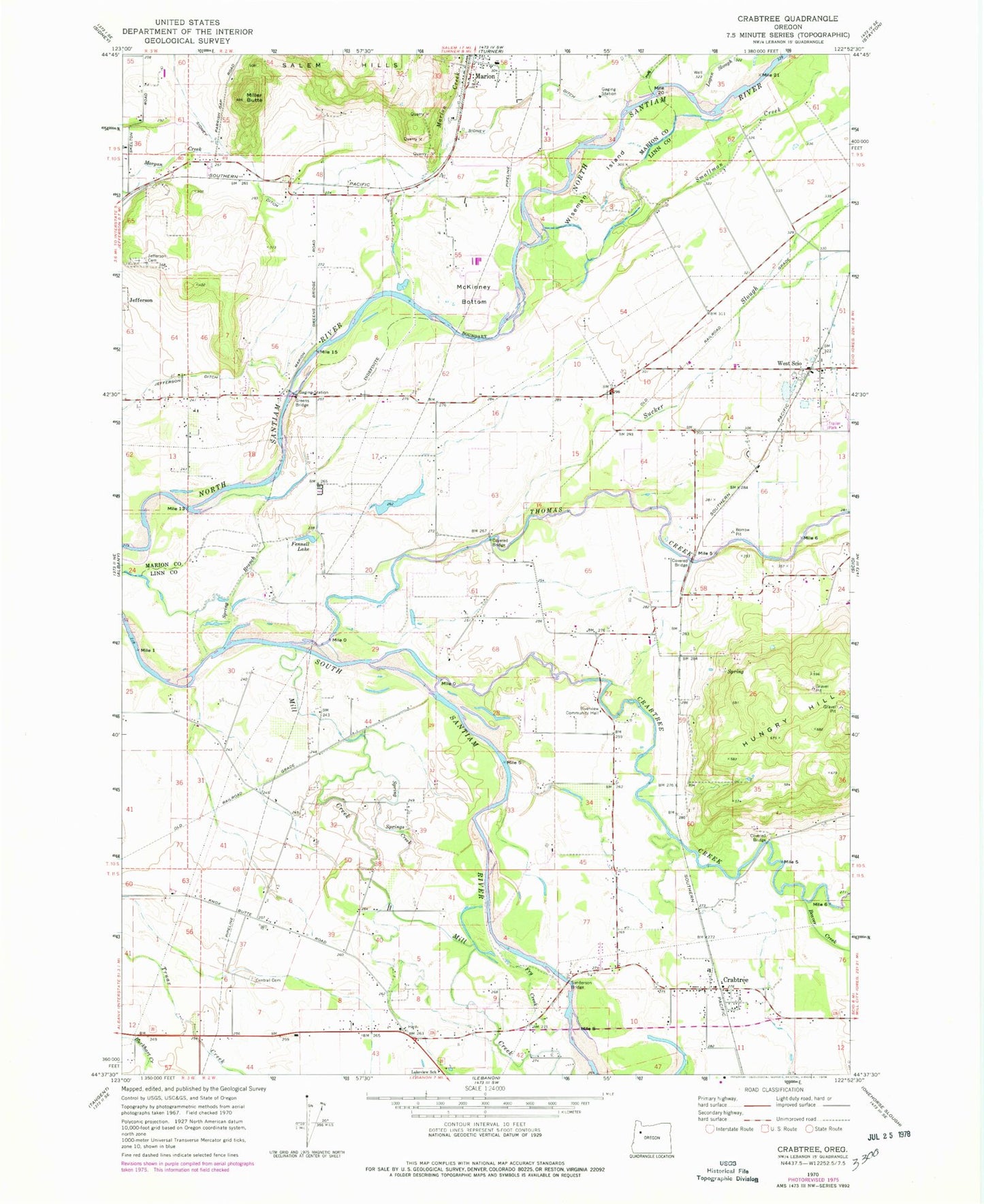
Historical USGS topographic quad map of Crabtree in the state of Oregon. Map scale may vary for some years, but is generally around 1:24,000. Print size is approximately 24" x 27"
This quadrangle is in the following counties: Linn, Marion.
The map contains contour lines, roads, rivers, towns, and lakes. Printed on high-quality waterproof paper with UV fade-resistant inks, and shipped rolled.
Contains the following named places: Beaver Creek, Bryant, Bussard, Central, Central Cemetery, Central Post Office, Cold Creek, Coxs Crossing, Crabtree, Crabtree Census Designated Place, Crabtree Creek, Crabtree Post Office, Crabtree School, Davidson Ranch Airstrip, Edgar Slough, Fennell Lake, Fir Ridge Holstein Farm, Folsom Pond, Fry Creek, Gaines, Gilkey, Greens Bridge, Greens Bridge Boat Ramp, Helms Dam, Helms Reservoir, Hungry Hill, Independence Prairie, Jefferson Cemetery, Jefferson Ditch, Keech, Kirkpatrick Reservoir, Kleinschmidt Airport, Lakeview School, Lakeview Slough, Linn-Benton Community College, Logan Slough, Marion, Marion Creek, Marion Elementary School, Marion Post Office, Marion School, Maxwell, McKinney Bottom, Mill Creek, Miller Butte, Munkers, Munkers Post Office, Novak Slough, Oakview Community Church of God, Renner, Riverview Community Hall, Sanderson Bridge, Sanderson Bridge Boat Ramp, Santyam Forks Post Office, Scio Rural Fire Protection District Station 92, Sidney Ditch, Smallman Creek, South Santiam, Spring Branch, Spring Creek, Stud Horse Creek, Sucker Slough, Thomas, Thomas Creek, Thomas Post Office, West Scio, West Scio Census Designated Place, Wil-Lyn Reservoir, Wiseman Island