MyTopo
Classic USGS Craftsbury Vermont 7.5'x7.5' Topo Map
Couldn't load pickup availability
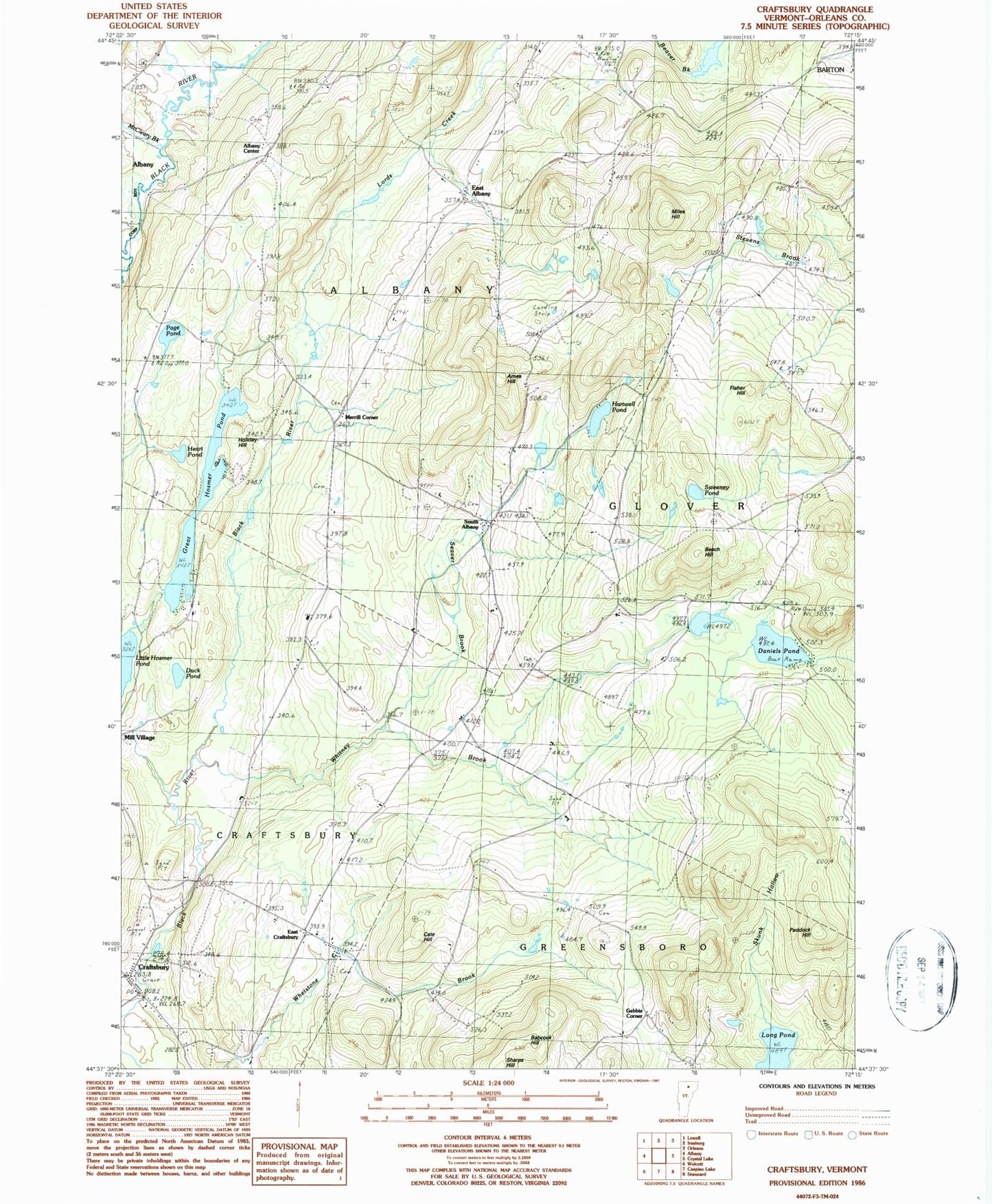
Historical USGS topographic quad map of Craftsbury in the state of Vermont. Typical map scale is 1:24,000, but may vary for certain years, if available. Print size: 24" x 27"
This quadrangle is in the following counties: Orleans.
The map contains contour lines, roads, rivers, towns, and lakes. Printed on high-quality waterproof paper with UV fade-resistant inks, and shipped rolled.
Contains the following named places: Ames Hill, Babcock Hill, Beach Hill, Cate Hill, Craftsbury, Daniels Pond, Duck Pond, East Albany, East Craftsbury, Fisher Hill, Great Hosmer Pond, Hartwell Pond, Hazen Road School, Heart Pond, Holiday Hill, Lamphean Brook, Long Pond, McCleary Brook, Miles Hill, Paddock Hill, Page Pond, Seaver Brook, Skunk Hollow, South Albany, Sweeney Pond, Whitney Brook, Wright School, Albany Center, Gebbie Corner, Merrill Corner, Town of Albany, Catholic Cemetery, Craftsbury Nordic Center, Craftsbury Post Office, Craftsbury School (historical), East Craftsbury Cemetery, East Craftsbury Presbyterian Church, Holiday Hill Camp, John Woodruff Simpson Memorial Library, Mitchell - McLaren Cemetery, Old Covenanter Church (historical), Rowell Cemetery, South Albany Cemetery, Albany Center Cemetery, Andersonville Cemetery, Craftsbury Fire Department