
MyTopo
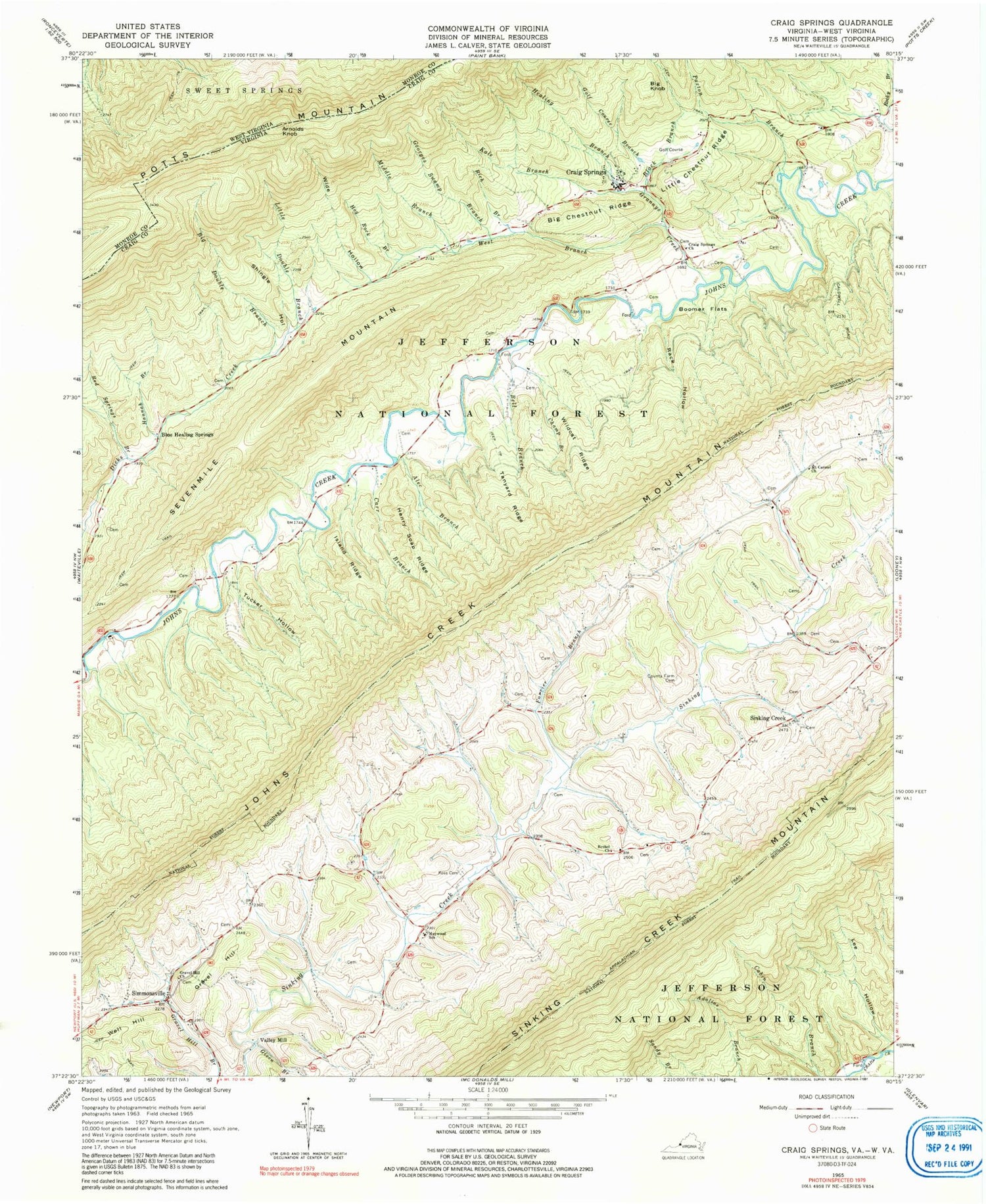
Classic USGS Craig Springs Virginia 7.5'x7.5' Topo Map
Couldn't load pickup availability
Historical USGS topographic quad map of Craig Springs in the states of Virginia, West Virginia. Typical map scale is 1:24,000, but may vary for certain years, if available. Print size: 24" x 27"
This quadrangle is in the following counties: Craig, Monroe.
The map contains contour lines, roads, rivers, towns, and lakes. Printed on high-quality waterproof paper with UV fade-resistant inks, and shipped rolled.
Contains the following named places: Alec Branch, Bell Branch, Bethel Church, Big Chestnut Ridge, Black Branch, Blue Healing Springs, Boomer Flats, Carr Branch, Champ Branch, County Farm Cemetery, Craig Springs Church, Dickey Farm Branch, Double Branch, Farrier Branch, Georges Swamp Branch, Given Branch, Golf Course Branch, Grannys Creek, Gravel Hill Church, Hannah Branch, Healing Branch, Henry Soap Ridge, Hog Rock Branch, Island Ridge, Kale Branch, Little Chestnut Ridge, Little Double Branch, Maywood School, Mount Carmel Church, Paxton Branch, Rack Hollow, Red Springs Branch, Rich Branch, Ross Cemetery, Middle Branch, West Branch Grannys Creek, Shingle Hollow, Simmonsville, Tanyard Ridge, Tucker Hollow, Wide Hollow, Wildcat Ridge, Big Knob, Craig Springs, Gravel Hill, Sevenmile Mountain, Sinking Creek, Valley Mill, Well Hill, Blue Healing Springs Post Office (historical), Simmonsville District, Hardy Fire Department, Hardy Rescue Squad, Simmonsville Volunteer Fire Department, Arnolds Knob, Mottesheard Mountain


