MyTopo
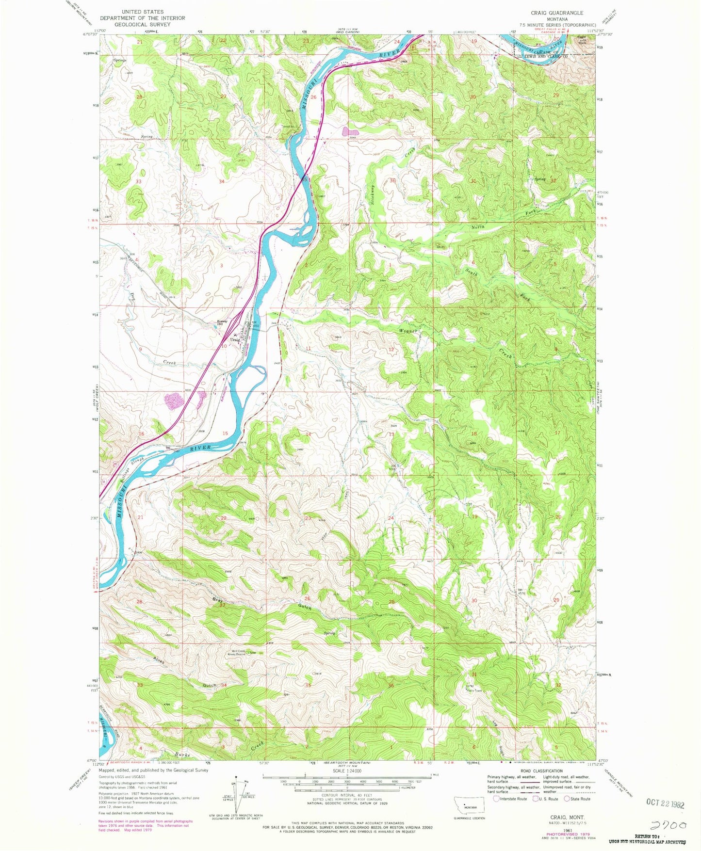
Classic USGS Craig Montana 7.5'x7.5' Topo Map
Couldn't load pickup availability
Historical USGS topographic quad map of Craig in the state of Montana. Map scale may vary for some years, but is generally around 1:24,000. Print size is approximately 24" x 27"
This quadrangle is in the following counties: Cascade, Lewis and Clark.
The map contains contour lines, roads, rivers, towns, and lakes. Printed on high-quality waterproof paper with UV fade-resistant inks, and shipped rolled.
Contains the following named places: Billings Slough, Bray Gulch, Brewer Hill, Craig, Craig Bridge, Craig Cemetery, Craig Census Designated Place, Craig Elementary School, Craig Fishing Access Site, Craig Post Office, Dearborn, Dog Creek, Eagle Rock, Missouri River Ranch Airport, North Fork Stickney Creek, South Fork Stickney Creek, Spite Hill Fishing Access Site, Stickney Creek, Stickney Creek Fishing Access Site, Tunnel Number 3, Wegner Creek, Wegner Creek Bridge, Wolf Creek - Craig Fire Department Station 1